


For 7000 ft. to 8000 ft.
| Saturday | Saturday Night | Sunday | |
|---|---|---|---|
| Weather: | Partly cloudy. Isolated snow showers in the afternoon. Snow levels below 7000 feet. Chance of precipitation is 20%. | Partly cloudy then becoming clear. Isolated snow showers in the evening. Snow levels below 7000 feet. Chance of precipitation is 15%. | Sunny then becoming partly cloudy. Slight chance of snow in the afternoon. Snow levels below 7000 feet. Chance of precipitation is 20%. |
| Temperatures: | 35 to 41. deg. F. | 19 to 25. deg. F. | 39 to 44. deg. F. |
| Mid Slope Winds: | Light winds. | Light winds. | Light winds. |
| Expected snowfall: | 20% probability up to 1 inch. 80% probability no accumulation. | SWE = less than 0.10 inch. | No accumulation. | SWE = trace amounts. | 20% probability up to 1 inch. 80% probability no accumulation. | SWE = less than 0.10 inch. |
For 8000 ft. to 9000 ft.
| Saturday | Saturday Night | Sunday | |
|---|---|---|---|
| Weather: | Mostly cloudy. Scattered snow showers in the afternoon. Snow levels below 7000 feet. Chance of precipitation is 25%. | Partly cloudy then becoming clear. Isolated snow showers in the evening. Snow levels below 7000 feet. Chance of precipitation is 15%. | Sunny then becoming partly cloudy. Slight chance of snow in the afternoon. Snow levels below 7000 feet. Chance of precipitation is 20%. |
| Temperatures: | 29 to 35. deg. F. | 16 to 21. deg. F. | 33 to 39. deg. F. |
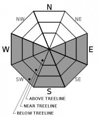
| Ridge Top Winds: | East around 15 mph with gusts to 25 mph. | Light winds becoming east around 15 mph with gusts to 25 mph after midnight. | Southeast around 15 mph with gusts to 30 mph in the morning becoming light. |
| Expected snowfall: | 20% probability up to 1 inch. 80% probability no accumulation. | SWE = less than 0.10 inch. | No accumulation. | SWE = trace amounts. | 20% probability up to 1 inch. 80% probability no accumulation. | SWE = less than 0.10 inch. |


