THIS AVALANCHE FORECAST EXPIRED ON November 22, 2020 @ 6:55 am
Avalanche Forecast published on November 21, 2020 @ 6:55 am
Issued by Andy Anderson - Tahoe National Forest - Sierra Avalanche Center

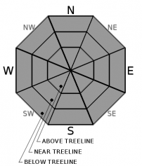
Shallow early season conditions with lots of exposed and barely covered obstacles to hit will represent today's main concern. Avalanche activity has become unlikely on a regional scale. Unlikely does not mean impossible and overhangs of snow along ridges or a patch of unstable snow on an isolated terrain feature could still cause trouble today. LOW avalanche danger exists at all elevations. 

1. Low

?

Above Treeline
Generally safe avalanche conditions. Watch for unstable snow on isolated terrain features.

1. Low

?

Near Treeline
Generally safe avalanche conditions. Watch for unstable snow on isolated terrain features.

1. Low

?

Below Treeline
Generally safe avalanche conditions. Watch for unstable snow on isolated terrain features.
    Generally safe avalanche conditions. Watch for unstable snow on isolated terrain features.
Avalanche Problem 1: Normal Caution
  • Type ?
  • Aspect/Elevation ?
  • Likelihood ?
    Certain
    Very Likely
    Likely
    Possible
    Unlikely
  • Size ?
    Historic
    Very Large
    Large
    Small

Data and observations seem to indicate that the thin snowpack has gained enough strength to support itself and triggering an avalanche has become unlikely in the majority of the forecast area. The caveat to this is that instability like fragile overhangs of snow along ridgelines (cornices) or a small area unstable of snow on some isolated terrain feature may still exist. A thin snowpack and numerous exposed and barely covered rocks, stumps, logs, bushes, and other obstacles more than makeup for the decreased instability. 

It pays to be conservative when traveling in a thin snowpack since collisions with hard immovable objects tend to damage people and equipment. Sometimes these things stick up out of the snow. Sometimes they lurk just below the surface. Moving on low angle slopes at slower speeds and maintaining constant vigilance can help. Early season also represents a great time to practice avalanche rescue skills, route finding, and terrain identification. Start the season off by practicing safe travel strategies and make them a habit for the rest of the year.

recent observations

Yesterday, snowpit data and observations from Relay Peak targeting the old weak snow near the base of the snowpack showed definite improvement over observations in the same area on 11/18. Yesterday that weak layer exhibited no signs of instability and none of the snowpit tests produced unstable results. Other observations from Tamarack Peak and in the Donner Summit area also did not find any lingering signs of instability associated with this layer. These observations continue a trend evidenced by data gathered on 11/19 and 11/20 at a variety of locations showing that the old weak snow is gaining strength and seems able to support the more recent snow above it now. This layer will continue to change and continued monitoring will tell if it starts to weaken again. 

Observations on Relay Ridge yesterday and Meiss Ridge and Donner Summit on 11/19 did not find any signs of wind slab instability. 

Other observations in the Mt. Rose backcountry and on Donner Summit found soft cold snow and surface hoar on more northerly aspects and warmer, sometimes wet and sticky sometimes crusty snow on sunny easterly and southerly aspects.

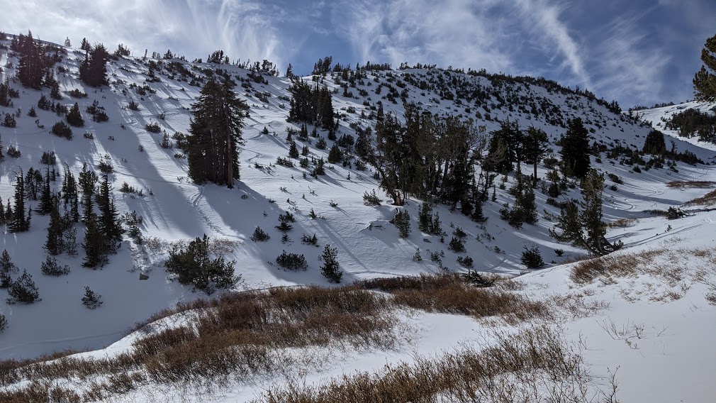
The snowpack remains thin with numerous things to hit. The best coverage exists above 7800’ along the Sierra Crest and above 8600’ in the Mt. Rose area.

Bushes and rocks poking out of the snowpack on Relay Peak at about 9500 ft.

Weather and CURRENT CONDITIONS
weather summary

Calm clear weather allowed cold air to settle into the valleys overnight. This morning temperatures at the lower elevations remain ~10 degrees lower than those at the upper elevations. As the day warms up, this inversion should lift. Expect another nice sunny day today. A weak low pressure should start to influence the weather tonight. Since the bulk of this anemic system should remain north of the region, it should only bring some increased SW winds and a few overnight clouds to this area. The forecast calls for the increased SW winds to remain through tomorrow with slightly warmer weather.

CONDITIONS ALONG THE SIERRA CREST BETWEEN 8200 FT. AND 9200 FT. IN THE LAST 24 HOURS
6am temperature: 29 to 36 deg. F.
Max. temperature: 34 to 45 deg. F.
Average ridgetop wind direction: Variable
Average ridgetop wind speed: 5 to 15 mph
Maximum ridgetop wind gust: 28 mph
New snowfall: 0 inches
Total snow depth: 16 to 22 inches
Two-Day Mountain Weather Forecast Produced in partnership with the Reno NWS
For 7000 ft. to 8000 ft.
Saturday Saturday Night Sunday
Weather: Sunny. Snow levels below 7000 feet increasing to 7000 feet in the afternoon. Chance of precipitation is 0%. Partly cloudy. Snow levels below 7000 feet. Chance of precipitation is 0%. Sunny. Snow levels below 7000 feet. Chance of precipitation is 0%.
Temperatures: 38 to 43 deg. F. 22 to 28 deg. F. 42 to 47 deg. F.
Mid Slope Winds: Light winds. Light winds. Light winds.
Expected snowfall: No accumulation. | SWE = none. No accumulation. | SWE = none. No accumulation. | SWE = none.
For 8000 ft. to 9000 ft.
Saturday Saturday Night Sunday
Weather: Sunny. Snow levels below 7000 feet increasing to 7000 feet in the afternoon. Chance of precipitation is 0%. Partly cloudy. Snow levels 7000 feet. Chance of precipitation is 0%. Sunny. Snow levels below 7000 feet. Chance of precipitation is 0%.
Temperatures: 36 to 42 deg. F. 22 to 28 deg. F. 38 to 44 deg. F.
Ridge Top Winds: Light winds. Light winds becoming southwest around 15 mph with gusts to 35 mph after midnight. Southwest around 15 mph with gusts to 35 mph.
Expected snowfall: No accumulation. | SWE = none. No accumulation. | SWE = none. No accumulation. | SWE = none.
Disclaimer

This avalanche forecast is provided through a partnership between the Tahoe National Forest and the Sierra Avalanche Center. This forecast covers the Central Sierra Nevada Mountains between Yuba Pass on the north and Ebbetts Pass on the south. Click here for a map of the forecast area. This forecast applies only to backcountry areas outside established ski area boundaries. This forecast describes general avalanche conditions and local variations always occur. This forecast expires 24 hours after the posted time unless otherwise noted. The information in this forecast is provided by the USDA Forest Service who is solely responsible for its content.

For a recorded version of the avalanche forecast call (530) 587-3558 x258