THIS AVALANCHE FORECAST EXPIRED ON November 27, 2020 @ 6:50 am
Avalanche Forecast published on November 25, 2020 @ 6:50 am
Issued by Steve Reynaud - Tahoe National Forest

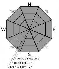
Early season conditions exist with limited terrain available for over the snow recreation.  LOW avalanche danger continues throughout the forecast region, normal caution is advised.  This forecast is valid for 2 days and will be updated on Friday November 27 by 7am.

1. Low

?

Above Treeline
Generally safe avalanche conditions. Watch for unstable snow on isolated terrain features.

1. Low

?

Near Treeline
Generally safe avalanche conditions. Watch for unstable snow on isolated terrain features.

1. Low

?

Below Treeline
Generally safe avalanche conditions. Watch for unstable snow on isolated terrain features.
    Generally safe avalanche conditions. Watch for unstable snow on isolated terrain features.
Avalanche Problem 1: Normal Caution
  • Type ?
  • Aspect/Elevation ?
  • Likelihood ?
    Certain
    Very Likely
    Likely
    Possible
    Unlikely
  • Size ?
    Historic
    Very Large
    Large
    Small

Early season conditions with a thin snowpack remains the greatest hazard for backcountry users.  The snowpack is mostly supportable which provides useable conditions and helps to avoid many of the obstacles that exist by staying on top of the snow.  Caution should still be used as there are many rocks, bushes, ground, tree stumps, etc, that could prematurely end your season.  Strong winds today are only expected to move light amounts of snow with limited snow available for transport.  Our snowpack continues to settle and gain strength with no present reactive weak layers.  

Use normal caution by coming up with a travel plan with your group, regrouping out of avalanche terrain, and carrying avalanche rescue gear.  This is a great time to get all of your winter gear organized and get out and practice avalanche rescue skills with your partners.     

recent observations

A shallow, but mostly supportable, snowpack exists throughout the forecast region.  1-2 feet of snow is on northerly aspects above 8600' in the Mt. Rose area and above 7800' along the Sierra Crest.  More snow exists in the northerly portion of the forecast region at this point.  Snow melt and loss has occurred on all southerly aspects with bare ground showing in many locations.  The previously problematic Nov 13 facet layer has gained strength, started to round, and is no longer reactive.  Several things are occurring on the snow surface which could present future concerns.  Surface faceting is underway with our cold nights and clear skies.  Surface hoar has also formed along with large graupel that fell with the dusting of snow we received on Sunday night.  These are potential future issues and do not pose a concern until we get our next storm and potentially bury these layers.

Weather and CURRENT CONDITIONS
weather summary

A cold front will move through our area today bringing increasing winds, cooler temperatures, and a chance for a dusting of snow.  SW winds will increase throughout today into the strong to gale force range.  After the front moves through later tonight, winds will shift to the NE and keep conditions cold through Thanksgiving day and into Friday.  Snowfall should be very limited with up to an inch in most areas.  High pressure moves back in for the weekend with mostly clear skies, lighter winds, and warmer temperatures.    

CONDITIONS ALONG THE SIERRA CREST BETWEEN 8200 FT. AND 9200 FT. IN THE LAST 24 HOURS
6am temperature: 24 to 25 deg. F.
Max. temperature: 41 to 49 deg. F.
Average ridgetop wind direction: NE shifting to SW
Average ridgetop wind speed: 30 to 50 mph
Maximum ridgetop wind gust: 62 mph
New snowfall: 0 inches
Total snow depth: 15 to 20 inches
Two-Day Mountain Weather Forecast Produced in partnership with the Reno NWS
For 7000 ft. to 8000 ft.
Wednesday Wednesday Night Thursday
Weather: Sunny. Snow levels below 7000'. Chance of precipitation is 10% Partly cloudy then becoming mostly cloudy. Slight chance of snow in the evening. Snow levels below 7000'. Chance of precipitation is 10% Mostly cloudy then becoming sunny. Snow levels below 7000'. Chance of precipitation is 5%.
Temperatures: 33 to 39 deg. F. 15 to 21 deg. F. 25 to 30 deg. F.
Mid Slope Winds: West 15 to 25mph with gusts to 50mph. Light winds East winds 15 to 20mph with gusts to 40mph.
Expected snowfall: Up to 1 inch.| SWE =.10 Up to 1 inch. | SWE =.10 No accumulation. | SWE =none
For 8000 ft. to 9000 ft.
Wednesday Wednesday Night Thursday
Weather: Sunny. Snow levels below 7000'. Chance of precipitation is 10%. Partly cloudy then becoming mostly cloudy. Slight chance of snow in the evening. Snow levels below 7000'. Chance of precipitation is 10%. Mostly cloudy then becoming sunny. Snow levels below 7000'. Chance of precipitation is 5%.
Temperatures: 29 to 35 deg. F. 12 to 18 deg. F. 20 to 25 deg. F.
Ridge Top Winds: Southwest 20 to 35mph with gusts to 75mph. North around 15mph with gusts to 30mph. East 20 to 35mph with gusts to 75mph.
Expected snowfall: Up to 1 inch.| SWE =.10" Up to 1 inch.| SWE = .10" No accumulation. | SWE =none.
Disclaimer

This avalanche forecast is provided through a partnership between the Tahoe National Forest and the Sierra Avalanche Center. This forecast covers the Central Sierra Nevada Mountains between Yuba Pass on the north and Ebbetts Pass on the south. Click here for a map of the forecast area. This forecast applies only to backcountry areas outside established ski area boundaries. This forecast describes general avalanche conditions and local variations always occur. This forecast expires 24 hours after the posted time unless otherwise noted. The information in this forecast is provided by the USDA Forest Service who is solely responsible for its content.

For a recorded version of the avalanche forecast call (530) 587-3558 x258