In partnership with: 
|
January 29, 2009 at 8:00 am |
|
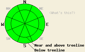
The avalanche danger is LOW for all elevations and aspects. Use normal caution when travelling in the backcountry. |
|
|
|
A high pressure ridge over the west coast should bring warmer temperatures, clear skies, and continued easterly winds to the forecast area. Today, high temperatures should reach into the low 40's at all elevations. The forecast calls for continued high pressure and springlike weather into next week.
Yesterday, observations and layer-bonding tests from Highland Peak (near Ebbetts Pass), Bear Valley, and Mt. Judah (near Donner Pass) indicated a mostly stable snowpack. Both the bonds within the recent snow and between the older snow surfaces and the recent snow are gaining strength. The easterly winds continued to transport small amounts of snow over the ridgelines. Observations across the forecast area revealed that wind slabs formed by these east winds have remained small and inconsequential. A sun crust formed over the last two days on southerly aspects below 8000'. Several inches of soft, unconsolidated snow exists on protected NW-N-NE-E aspects.
The limited amount of wind-transported snow should prevent large, dangerous wind slabs from forming today. Gradual warming since Monday, cool easterly winds, below freezing temperatures overnight, and the weak January sun should limit wet snow instabilities to pinwheels and small, point-release sluffs on sun exposed southerly aspects steeper than 35 degrees. These warming instabilities could occur naturally or be triggered by a person on the slope. Even though these instabilities should not entrain enough snow to bury a person, they could be large enough to knock a person off-balance. Getting knocked over in the wrong place (the top of a cliff for instance) could have dangerous consequences. Be aware of the surroundings. Use caution and safe travel to minimize risks. Slab avalanche activity will remain unlikely but not impossible today.
The avalanche danger is LOW for all elevations and aspects. Use normal caution when travelling in the backcountry.
| 0600 temperature: | 22 deg. F. |
| Max. temperature in the last 24 hours: | 31 deg. F. |
| Average wind direction during the last 24 hours: | East northeast |
| Average wind speed during the last 24 hours: | 32 mph |
| Maximum wind gust in the last 24 hours: | 52 mph |
| New snowfall in the last 24 hours: | O inches |
| Total snow depth: | 72 inches |
For 7000-8000 ft: |
|||
| Thursday: | Thursday Night: | Friday: | |
| Weather: | Sunny | Clear | Sunny |
| Temperatures: | 36-45 deg. F. | 20-30 deg. F. | 42-49 deg. F. |
| Wind direction: | East | East | East |
| Wind speed: | 10-15 mph with gusts to 25 mph | 10-15 mph | 10-15 mph with gusts to 30 mph becoming light in the afternoon |
| Expected snowfall: | O in. | O in. | O in. |
For 8000-9000 ft: |
|||
| Thursday: | Thursday Night: | Friday: | |
| Weather: | Sunny | Clear | Sunny |
| Temperatures: | 38-44 deg. F. | 26-32 deg. F. | 43-49 deg. F. |
| Wind direction: | East | East | East |
| Wind speed: | 20-30 mph with gusts to 45 mph | 15-25 mph with gusts to 35 mph increasing to gusts to 45 mph after midnight | 15-25 mph with gusts to 45 mph decreasing to 10-15 mph in the afternoon |
| Expected snowfall: | O in. | O in. | O in. |


This website is owned and maintained by the non-profit arm of the Sierra Avalanche Center. Some of the content is updated by the USDA avalanche forecasters including the forecasts and some observational data. The USDA is not responsible for any advertising, fund-raising events/information, or sponsorship information, or other content not related to the forecasts and the data pertaining to the forecasts.

