In partnership with: 
|
February 10, 2009 at 8:00 am |
|
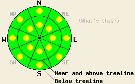
The avalanche danger is LOW with pockets of MODERATE danger in open areas, 37 degrees and steeper for all elevations and aspects. |
|
|
|
The forecast calls for a short break in the weather today with slightly warmer temperatures and clearer skies. Another in a series of winter storms should start to impact the forecast area tonight. Over the last 24 hours the winds have shifted between southwest and northeast. These winds should start to shift back to the southwest and increase ahead of this next storm system. This system should have less moisture associated with it but could still deposit another 6 inches of snow in the Sierra by tomorrow afternoon. The pattern of brief periods of calmer weather between winter storms should continue through this week.
Yesterday observations indicated that most of the weakest layers in the storm snow had failed naturally during the night on Sunday. Observers reported no natural avalanche activity during the day yesterday. Layer bonding tests, test slopes, and general observations on Hidden Peak (the West Shore area) and Carpenter Peak (north of Castle Peak) showed that the 12-17 inches of new snow had started to form bonds within itself and with the old snow surfaces by mid morning. Some weaknesses still remained in the storm snow and failed due to moderate force during the layer bonding tests. The interface between the old crusts / wind scoured surfaces and the snow above them also failed due to moderate force in these tests. Observers reported some shooting cracks and thick wind slabs on the steeper more wind loaded slopes near treeline on Hidden Peak. In the Carpenter Peak area wind slabs were much smaller and less reactive. Only a few very small isolated soft slabs reacted to a skier's weight. Observers reported wind transport of the storm snow onto a variety of aspects yesterday.
Wind slabs formed by the shifting winds will be the primary avalanche concern today. These wind slabs could exist on almost any aspect due to the variety of wind directions over the last 24 hours. These wind slabs may not have formed bonds strong enough to eliminate the possibility of human-triggering yet. The winds have transported the snow that will form these wind slabs multiple times during this storm. The more transport the snow undergoes, the more stiff and more likely to propagate fractures the newly formed wind slabs will be. These characteristics will make these wind slabs more likely to break as slab avalanches if they do fail today. If the new snow and the new wind slabs gain strength and form new bonds faster than expected, these instabilities may not be as much of an issue today. Use clues like blowing snow, drifts, ripples, cornices, and other signs of wind loading to help determine where these pockets of wind slabs exist and use even more caution around them.
The avalanche danger is LOW with pockets of MODERATE danger in open areas, 37 degrees and steeper for all elevations and aspects.
| 0600 temperature: | 8-13 deg. F. |
| Max. temperature in the last 24 hours: | 14-20 deg. F. |
| Average wind direction during the last 24 hours: | Variable between southwest and northeast |
| Average wind speed during the last 24 hours: | 22 mph |
| Maximum wind gust in the last 24 hours: | 58 mph |
| New snowfall in the last 24 hours: | Trace inches |
| Total snow depth: | 81 inches |
For 7000-8000 ft: |
|||
| Tuesday: | Tuesday Night: | Wednesday: | |
| Weather: | Partly cloudy this morning becoming mostly cloudy this afternoon | Chance of snow showers in the evening with snow likely after midnight | Snow showers in the morning becoming more widespread and intense in the afternoon |
| Temperatures: | 22-29 deg. F. | 13-20 deg. F. | 19-26 deg. F. |
| Wind direction: | Northwest shifting to the west | Southwest | Southwest |
| Wind speed: | Light increasing to 10-15 mph with gusts to 25 mph in the afternoon | 15-25 mph with gusts to 35 mph increasing to 45 mph after midnight | 15-25 mph with gusts to 35 mph |
| Expected snowfall: | O in. | up to 4 in. | up to 4 in. |
For 8000-9000 ft: |
|||
| Tuesday: | Tuesday Night: | Wednesday: | |
| Weather: | Partly cloudy this morning becoming mostly cloudy this afternoon | Chance of snow showers in the evening with snow likely after midnight | Snow showers in the morning becoming more widespread and intense in the afternoon |
| Temperatures: | 18-25 deg. F. | 10-17 deg. F. | 14-21 deg. F. |
| Wind direction: | Northwest shifting to the west | Southwest | Southwest |
| Wind speed: | 10 mph increasing to 20-30 mph with gusts to 50 mph | 30-45 mph with gusts to 70 mph increasing to 80 mph after midnight | 30-40 mph with gusts to 65 mph decreasing to 20-30 mph with gusts to 50 mph in the afternoon |
| Expected snowfall: | O in. | 1-4 in. | 3-5 in. |


This website is owned and maintained by the non-profit arm of the Sierra Avalanche Center. Some of the content is updated by the USDA avalanche forecasters including the forecasts and some observational data. The USDA is not responsible for any advertising, fund-raising events/information, or sponsorship information, or other content not related to the forecasts and the data pertaining to the forecasts.

