In partnership with: 
|
March 15, 2009 at 6:46 am |
|
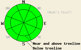
Avalanche danger is LOW for all elevations and aspects. Normal caution is advised. |
|
|
|
A weather system moved into the forecast area overnight. Precipitation associated with this system is expected to focus on the west side and directly along the spine of the Sierra Crest. Precipitation amounts are forecast to decrease drastically on the east side of the Sierra Crest. Any snowfall accumulation today is expected to be less than 2 inches. Precipitation intensity is expected to increase overnight into Monday. Snow levels are forecast to rise to 6,500' to 7,000' tonight as warmer air is pushed into the area. This morning, air temperatures are in the low to mid 20s in most locations. Air temperatures are forecast to rise into the mid 30s to mid 40s as the day progresses. Ridgetop winds became strong from the southwest mid day yesterday and remain moderate to strong in speed this morning.
Yesterday, observations made on Mt. Judah (Donner Summit area) and in the Mt. Watson/Sawtooth Ridge area (West of Northstar) indicated the presence of a stable snowpack. This matches well with other recent observations from around the forecast area. The existing snowpack is in good condition to handle new snow loading from this weather system. Areas of snowpack instability that form during the next 36 hours will be limited to the new snow.
Today, widespread stable snowpack conditions will exist in the vast majority of areas due to the western slope nature of this storm. Snow surface conditions will be a mix of frozen surfaces on southerly aspects and cold wind scoured surfaces above treeline on northerly aspects. Lingering areas of unconsolidated surface snow exist below treeline on north aspects. Other areas hold a variable crusty mix of snow surface conditions.
Late this afternoon or evening, some very small areas of instability may form along the spine of the Sierra Crest (western boundary of forecast area, click here to view mouse over map). This instability will be limited to the most heavily wind loaded areas, mainly on steep NE aspects above 7,500'. These small instabilities are not expected to become large enough to present a significant hazard to backcountry travelers during the day today. An increase in avalanche danger is expected to occur during the overnight hours.
| 0600 temperature: | 20 deg. F. |
| Max. temperature in the last 24 hours: | 29 to 32 deg. F. |
| Average wind direction during the last 24 hours: | Southwest |
| Average wind speed during the last 24 hours: | 45 mph |
| Maximum wind gust in the last 24 hours: | 69 mph |
| New snowfall in the last 24 hours: | Trace inches |
| Total snow depth: | 143 inches |
For 7000-8000 ft: |
|||
| Sunday: | Sunday Night: | Monday: | |
| Weather: | Cloudy skies with isolated snow showers in the morning. Scattered snow showers in the afternoon. | Cloudy skies with snow likely. | Cloudy skies with snow likely in the morning. Scattered snow showers in the afternoon. |
| Temperatures: | 40 to 46 deg. F. | 28 to 35 deg. F. | 38 to 45 deg. F. |
| Wind direction: | SW | SW | SW |
| Wind speed: | 20 to 30 mph with gusts to 55 mph. Gusts increasing to 65 mph in the afternoon. | 20 to 35 mph with gusts to 70 mph. | 25 to 35 mph with gusts to 75 mph. Increasing to 30 to 45 mph with gusts to 85 mph in the afternoon. |
| Expected snowfall: | Trace to 1 in. | Up to 2 in. | Up to 2 in. |
For 8000-9000 ft: |
|||
| Sunday: | Sunday Night: | Monday: | |
| Weather: | Cloudy skies with isolated snow showers in the morning. Scattered snow showers in the afternoon. | Cloudy skies with snow likely. | Cloudy skies with snow likely in the morning. Scattered snow showers in the afternoon. |
| Temperatures: | 35 to 41 deg. F. | 23 to 30 deg. F. | 32 to 39 deg. F. |
| Wind direction: | SW | SW | SW |
| Wind speed: | 30 to 45 mph with gusts to 80 mph. Increasing to 40 to 55 mph with gusts to 90 mph in the afternoon. | 40 to 55 mph decreasing to 30 to 50 mph after midnight. Gusts up to 90 mph. | 35 to 50 mph increasing to 40 to 60 mph in the afternoon. Gusts up to 100 mph. |
| Expected snowfall: | Trace to 2 in. | 2 to 4 in. | 2 to 4 in. |


This website is owned and maintained by the non-profit arm of the Sierra Avalanche Center. Some of the content is updated by the USDA avalanche forecasters including the forecasts and some observational data. The USDA is not responsible for any advertising, fund-raising events/information, or sponsorship information, or other content not related to the forecasts and the data pertaining to the forecasts.

