In partnership with: 
|
March 21, 2009 at 7:00 am |
|
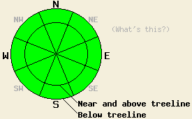
For today, avalanche danger is LOW for all elevations and aspects. Normal caution is advised. Avalanche danger is expected to increase significantly overnight with 1 to 3 feet of new snow and natural avalanche activity possible. |
|
|
|
A day of transitioning weather is forecast for today. Some sun and clouds this morning will give way to increasing cloud cover and light precipitation as the day progresses. Snow levels are expected to begin around 8,000' before quickly dropping to around 6,000' by this afternoon or evening. Up to 1 inch of new snowfall is expected during the day. Air temperatures this morning are ranging from 26 to 37 degrees with no air temperature inversion. Maximum daytime air temperatures are expected to occur this morning with cooling through the afternoon hours. Ridgetop winds this morning are moderate in speed out of the southwest and are expected to increase to strong in speed as the day progresses. Snow levels are expected to fall to near 2,000' overnight into Sunday. High intensity snowfall rates and 1 to 3 feet of new snow accumulation are expected between 11pm tonight and 11am Sunday.
Yesterday, observations made on Rose Knob Peak (Mount Rose area) revealed warm air temperatures at the upper elevations with help from an air temperature inversion. Significant wet snow and large skier triggered pinwheels occurred on E and SE aspects below 9,000' by 11 am. The snow surface was slower to melt on S and SW aspects making it possible to change aspects with warming to maintain good supportable corn skiing and minimize the possibility of human triggered wet snow avalanches. No new avalanche activity was reported from within the forecast area.
Last night, below freezing air temperatures at the upper elevations and periods of clear skies will have allowed for snowpack refreeze. Due to warmer air on the valley floors, only a fairly thin refreeze may have occurred at the lower elevations. Today, some melting of surface snow is expected to occur, especially during the morning hours below 8,500'. Significantly less overall melting and free water formation is expected today as compared to what was observed over the past 3 days. This afternoon, cooling air temperatures and snow showers are expected to slow melting rates significantly, keeping any wet snow instability to a minimum.
Tonight, high intensity snowfall with snowfall rates around 3 inches/hour and accumulations of 1 to 3 feet are expected. This will rapidly increase snowpack instability. Natural and human triggered avalanche activity will be possible during the overnight hours.
For today, avalanche danger is LOW for all elevations and aspects. Normal caution is advised. Avalanche danger is expected to increase significantly overnight with 1 to 3 feet of new snow and natural avalanche activity possible.
| 0600 temperature: | 28 to 30 deg. F. |
| Max. temperature in the last 24 hours: | 41 to 46 deg. F. |
| Average wind direction during the last 24 hours: | Southwest |
| Average wind speed during the last 24 hours: | 20 mph |
| Maximum wind gust in the last 24 hours: | 33 mph |
| New snowfall in the last 24 hours: | O inches |
| Total snow depth: | 141 inches |
For 7000-8000 ft: |
|||
| Saturday: | Saturday Night: | Sunday: | |
| Weather: | Mostly cloudy skies with scattered snow showers, increasing in the afternoon. | Cloudy skies with high intensity snowfall. | Cloudy skies with snow in the morning. Mostly cloudy skies with a chance of snow in the afternoon. |
| Temperatures: | Cooling in the afternoon with a high in the morning of 35 to 45 deg. F. | 15 to 23 deg. F. | 20 to 29 deg. F. |
| Wind direction: | SW | W | NW |
| Wind speed: | 15 to 25 mph with gusts to 40 mph. Increasing to 25 to 35 mph with gusts to 50 mph in the afternoon. | 25 to 35 mph with gusts to 50 mph. | 10 to 20 mph with gusts to 35 mph. |
| Expected snowfall: | Up to 1 in. | Up to 20 in. near the Sierra Crest, elsewhere 6 to 14 in. | 6 to 10 in. |
For 8000-9000 ft: |
|||
| Saturday: | Saturday Night: | Sunday: | |
| Weather: | Mostly cloudy skies with scattered snow showers, increasing in the afternoon. | Cloudy skies with high intensity snowfall. | Cloudy skies with snow in the morning. Mostly cloudy skies with a chance of snow in the afternoon. |
| Temperatures: | Cooling in the afternoon with a high in the morning of 28 to 38 deg. F. | 8 to 18 deg. F. | 10 to 20 deg. F. |
| Wind direction: | SW | SW shifting to W | NW |
| Wind speed: | 30 to 40 mph with gusts to 75 mph. Increasing to 40 to 60 mph with gusts to 90 mph in the afternoon. | 40 to 60 mph with gusts to 95 mph. Decreasing to 30 to 45 mph with gusts to 80 mph after midnight. | 20 to 30 mph with gusts to 50 mph. |
| Expected snowfall: | Up to 1 in. | Up to 20 in. near the Sierra Crest, elsewhere 6 to 14 in. | 6 to 10 in. |


This website is owned and maintained by the non-profit arm of the Sierra Avalanche Center. Some of the content is updated by the USDA avalanche forecasters including the forecasts and some observational data. The USDA is not responsible for any advertising, fund-raising events/information, or sponsorship information, or other content not related to the forecasts and the data pertaining to the forecasts.

