In partnership with: 
|
April 14, 2009 at 6:50 am |
|
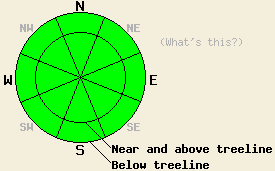
Avalanche danger is LOW for all elevations and aspects. Normal caution is advised. |
|
|
|
A cold front is moving through the forecast area today. Increasing cloud cover and a few isolated snow showers occurred overnight. A band a higher intensity snowfall is expected to move through the forecast area around mid day. This band is forecast to produce snowfall at rates of 1 to 2 inches per hour for 1 to 2 hours. New snow accumulation of 1 to 3 inches is expected. Air temperatures this morning are in the 20s in most locations, with low 30s at the mountain valley floors. Ridgetop winds increased from moderate to strong in speed overnight and shifted from southwest to west. Wind speeds are expected to remain strong through this evening.
Recent observations from around the forecast area indicate that new snow from last week has stabilized. On southerly aspects, the recent new snow has become corn snow. On northerly aspects, significant settlement has occurred, leaving a mix of shallow unconsolidated snow well bonded to a melt-freeze crust below. Some areas of breakable crust have formed on the snow surface on northerly aspects below 7,500' to 8,000'. Overnight, air temperature below freezing have allowed areas where wet surface snow formed yesterday to refreeze.
Today, below freezing air temperature and cloud cover are expected to keep snow surface melting to a minimum. Many areas on southerly aspects are expected to remain frozen all day. The expected short period of snowfall may create some isolated pockets of wind loading in lee areas near and above treeline. These pockets will generally be found below existing cornice features. Due to limited new snow amounts, any areas of instability that form are expected to remain very small, not posing a significant threat to backcountry travelers.
| 0600 temperature: | 24 deg. F. |
| Max. temperature in the last 24 hours: | 39 to 42 deg. F. |
| Average wind direction during the last 24 hours: | Southwest shifting to west. |
| Average wind speed during the last 24 hours: | 30 mph |
| Maximum wind gust in the last 24 hours: | 66 mph |
| New snowfall in the last 24 hours: | 0 to trace inches |
| Total snow depth: | 136 inches |
For 7000-8000 ft: |
|||
| Tuesday: | Tuesday Night: | Wednesday: | |
| Weather: | Mostly cloudy to cloudy skies. Scattered snow showers in the morning then numerous snow showers in the afternoon. | Cloudy skies with numerous snow showers in the evening, becoming scattered after midnight. | Mostly cloudy skies with a slight chance of snow showers. |
| Temperatures: | 27 to 33 deg. F. | 6 to 13 deg. F. | 26 to 33 deg. F. |
| Wind direction: | W | N | N |
| Wind speed: | 20 to 30 mph with gusts to 45 mph. | 15 to 25 mph with gusts to 45 mph. Gusts decreasing to 35 mph after midnight. | 10 to 20 mph with gusts to 30 mph. Increasing to 20 to 30 mph with gusts to 45 mph in the afternoon. |
| Expected snowfall: | 1 to 3 in. | 1 to 3 in. | 0 to trace in. |
For 8000-9000 ft: |
|||
| Tuesday: | Tuesday Night: | Wednesday: | |
| Weather: | Mostly cloudy to cloudy skies. Scattered snow showers in the morning then numerous snow showers in the afternoon. | Cloudy skies with numerous snow showers in the evening, becoming scattered after midnight. | Mostly cloudy skies with a slight chance of snow showers. |
| Temperatures: | 21 to 27 deg. F. | 6 to 12 deg. F. | 22 to 30 deg. F. |
| Wind direction: | W | N | N |
| Wind speed: | 20 to 35 mph with gusts to 65 mph. | 20 to 30 mph with gusts to 60 mph. Gusts decreasing to 35 mph after midnight. | 15 to 20 mph with gusts to 30 mph. Increasing to 20 to 30 mph with gusts to 55 mph in the afternoon. |
| Expected snowfall: | 1 to 3 in. | 1 to 3 in. | 0 to trace in. |


This website is owned and maintained by the non-profit arm of the Sierra Avalanche Center. Some of the content is updated by the USDA avalanche forecasters including the forecasts and some observational data. The USDA is not responsible for any advertising, fund-raising events/information, or sponsorship information, or other content not related to the forecasts and the data pertaining to the forecasts.

