In partnership with: 
|
January 4, 2010 at 7:53 am |
|
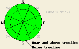
Avalanche danger is LOW for all elevations and aspects. Avalanche activity is unlikely but not impossible. Normal caution is advised. |
|
|
|
High pressure is in place over the forecast area. A few weak systems will pass north of the forecast area over the next few days. The first system will bring increasing clouds to the area this afternoon, but no precipitation is expected. An air temperature inversion is allowing for above freezing air temperatures this morning at the upper elevations. Most remote sensors above 7,000' are reporting air temperatures in the mid 30s to low 40s. Ridgetop winds switched from east to southwest yesterday and increased from light to moderate in speed over the past 24 hours.
Observations made yesterday on Rose Knob Peak (Mount Rose area) indicated the presence of a stable snowpack on NE-E-SE-S aspects both above and below treeline between 7,400' and 9,500' (pit profile). Melt freeze conditions were observed on S-SE aspects up to 9,500' and in all sun exposed areas below 8,500'. Observations made on Pickett Peak (Luther Pass area) below treeline in a shallow snowpack at 8,300' on a NW aspect 25 degree slope indicated a strengthening snowpack compared to observations made in the same location on Dec 17. Some lingering weakness of the Oct 19 basal facet layer was observed. Despite continued evidence of likely fracture propagation on this layer, the crystals were noted as undergoing the rounding process, indicating continued strengthening over time (pit profile, photo, and videos). Along the Sierra Crest between Mt. Lincoln and Anderson Peak (Donner Summit area) natural cracking behind cornice features and wind features next to rock outcrops was reported. This seems to describe the typical activity seen in this area when significant warming occurs post storm cycle in December or January.
Avalanche concerns:
Avalanche concerns for today are few. Above freezing air temperatures may allow for some continued cornice collapse, but avalanche activity occurring on the slopes below remains unlikely at this time. In the vast majority of below treeline areas on NW-N-NE aspects above 7,700 where the Oct 19 facet layer once existed, this layer has rounded and the snowpack has become very stable, especially in areas where the snowpack is over 3 feet deep. Human triggered deep slab avalanche activity remains unlikely but is not impossible in very isolated areas where the snowpack is less than 2.5 feet deep. In these areas, the Oct 19 layer retains more of its weaker faceted properties. Stability tests and fracture propagation tests performed in these areas have not completely ruled out failure of this layer if one were to find the perfect trigger point. Very strong snow in the middle and upper portions of the snowpack has kept avalanche activity from occurring on this layer for the past few weeks.
Avalanche danger is LOW for all elevations and aspects. Avalanche activity is unlikely but not impossible. Normal caution is advised.
| 0600 temperature: | 32 to 41 deg. F. |
| Max. temperature in the last 24 hours: | 34 to 43 deg. F. |
| Average wind direction during the last 24 hours: | E shifting to SW |
| Average wind speed during the last 24 hours: | 20 mph |
| Maximum wind gust in the last 24 hours: | 36 mph |
| New snowfall in the last 24 hours: | O inches |
| Total snow depth: | 35 to 64 inches |
For 7000-8000 ft: |
|||
| Monday: | Monday Night: | Tuesday: | |
| Weather: | Partly cloudy skies in the morning, becoming mostly cloudy. | Partly cloudy skies. | Partly cloudy skies. |
| Temperatures: | 41 to 46 deg. F. | 25 to 35 deg. F. | 39 to 44 deg. F. |
| Wind direction: | SW | Variable | NW |
| Wind speed: | Up to 10 mph. | Light winds | Up to 10 mph. |
| Expected snowfall: | O in. | O in. | O in. |
For 8000-9000 ft: |
|||
| Monday: | Monday Night: | Tuesday: | |
| Weather: | Partly cloudy skies in the morning, becoming mostly cloudy. | Partly cloudy skies. | Partly cloudy skies. |
| Temperatures: | 38 to 44 deg. F. | 24 to 33 deg. F. | 38 to 44 deg. F. |
| Wind direction: | SW | W | NW |
| Wind speed: | 10 to 20 mph. Gusts up to 35 mph decreasing to 25 mph in the afternoon. | 10 to 20 mph with gusts to 35 mph. | 10 to 15 mph with gusts to 25 mph. |
| Expected snowfall: | O in. | O in. | O in. |


This website is owned and maintained by the non-profit arm of the Sierra Avalanche Center. Some of the content is updated by the USDA avalanche forecasters including the forecasts and some observational data. The USDA is not responsible for any advertising, fund-raising events/information, or sponsorship information, or other content not related to the forecasts and the data pertaining to the forecasts.

