In partnership with: 
|
January 5, 2010 at 7:40 am |
|
Avalanche danger is LOW for all elevations and aspects. Avalanche activity is unlikely but not impossible. Normal caution is advised. |
|
|
|
Another day of sunshine, warms air temperatures, and light to moderate winds is expected today. A weak weather system is forecast to move through the area Wednesday afternoon and Thursday, bringing a chance of light precipitation. The vast majority of remote sensors are reporting air temperatures above 7,000' in the mid to low 30s this morning. Ridgetop winds were moderate in speed out of the southwest yesterday, becoming light and shifting to the west overnight. Winds are forecast to increase to moderate in speed and shift to the northwest today.
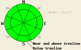
Observations made yesterday on Dick's Peak and Janine's Ridge (Desolation Wilderness area) revealed that snow surface conditions were a mix of crusts or wind pressed snow on S-SE aspects below 8500'. N-NE-E aspects between 8,000' and 9,500' had some unconsolidated snow in more protected areas with most locations having some sort of wind effect on the snow surface. SW winds were were noted to move a little snow, causing some wind loading to occur in very isolated areas on N-NE-E aspects near and above treeline. Informal observations noted good snowpack stability on all aspects in the area both above and below treeline. Observations made Sunday on Pickett Peak (Luther Pass area) below treeline in a shallow snowpack at 8,300' on a NW aspect 25 degree slope indicated a strengthening snowpack compared to observations made in the same location on Dec 17. Some lingering weakness of the Oct 19 basal facet layer was observed. Despite continued evidence of likely fracture propagation on this layer, the crystals were noted as undergoing the rounding process, indicating continued strengthening over time (pit profile, photo, and videos).
Avalanche concerns:
A few small and very isolated unstable slabs may exist near and above treeline on N-NE-E aspects where some very isolated areas of wind loading occurred yesterday. As winds shift to the NW, some small and very isolated unstable slabs may form today on E-SE aspects. In the vast majority of below treeline areas on NW-N-NE aspects above 7,700 where the Oct 19 facet layer once existed, this layer has rounded and the snowpack has become very stable, especially in areas where the snowpack is over 3 feet deep. Human triggered deep slab avalanche activity remains unlikely but is not impossible in very isolated areas where the snowpack is less than 2.5 feet deep. In these areas, the Oct 19 layer retains more of its weaker faceted properties. Stability tests and fracture propagation tests performed in these areas have not completely ruled out failure of this layer if one were to find the perfect trigger point. Very strong snow in the middle and upper portions of the snowpack has kept avalanche activity from occurring on this layer for the past few weeks.
Avalanche danger is LOW for all elevations and aspects. Avalanche activity is unlikely but not impossible. Normal caution is advised.
| 0600 temperature: | 28 to 36 deg. F. |
| Max. temperature in the last 24 hours: | 39 to 45 deg. F. |
| Average wind direction during the last 24 hours: | Southwest |
| Average wind speed during the last 24 hours: | 18 mph |
| Maximum wind gust in the last 24 hours: | 37 mph |
| New snowfall in the last 24 hours: | O inches |
| Total snow depth: | 34 to 63 inches |
For 7000-8000 ft: |
|||
| Tuesday: | Tuesday Night: | Wednesday: | |
| Weather: | Partly cloudy skies. | Partly cloudy skies in the evening, becoming mostly cloudy. | Mostly cloudy skies in the morning. Cloudy skies with a chance of light snow in the afternoon. |
| Temperatures: | 41 to 46 deg. F. | 30 to 35 deg. F. | 38 to 44 deg. F. |
| Wind direction: | NW | NW | Variable |
| Wind speed: | Around 10 mph. | Up to 10 mph. | Light winds |
| Expected snowfall: | O in. | O in. | Trace to 1 in. |
For 8000-9000 ft: |
|||
| Tuesday: | Tuesday Night: | Wednesday: | |
| Weather: | Partly cloudy skies. | Partly cloudy skies in the evening, becoming mostly cloudy. | Mostly cloudy skies in the morning. Cloudy skies with a chance of light snow in the afternoon. |
| Temperatures: | 37 to 42 deg. F. | 24 to 32 deg. F. | 35 to 41 deg. F. |
| Wind direction: | NW | NW shifting to N | Variable |
| Wind speed: | 15 to 20 mph with gust to 35 mph. | 15 to 25 mph with gusts to 35 mph. Winds decreasing to 10 to 20 mph overnight. | 5 to 15 mph |
| Expected snowfall: | O in. | O in. | Trace to 1 in. |


This website is owned and maintained by the non-profit arm of the Sierra Avalanche Center. Some of the content is updated by the USDA avalanche forecasters including the forecasts and some observational data. The USDA is not responsible for any advertising, fund-raising events/information, or sponsorship information, or other content not related to the forecasts and the data pertaining to the forecasts.

