In partnership with: 
|
January 16, 2010 at 7:51 am |
|
Avalanche danger is LOW all elevations and aspects. Normal caution is advised. |
|
|
|
One more day of dry weather is expected today before a series of well advertised storm systems begin to impact the area Sunday. Mostly cloudy skies, moderate south to southwest ridgetop winds, and above freezing air temperatures are forecast for today. Southwest winds over the past 24 hours have mixed out the air temperature inversion that has occurred over the past several days. More information on the approaching storm systems, are available in this video briefing from the National Weather Service in Reno (click here).
No new avalanche activity has been observed or reported to have occurred since Wednesday. Observations made yesterday on Talking Mountain (Echo Summit area) on a N aspect at 8,730', on Waterhouse Peak (Luther Pass area) below treeline on a N aspect at 9,360', and in the Blue Zone (Outside the Bear Valley Ski Area boundary) below treeline on a NW aspect at 8,160' all indicated the presence of a stable snowpack (photos and pit profiles). Continued bonding and settlement of the recent storm snow has stabilized the storm snow instability that occurred on Wednesday. Views of the surrounding peaks revealed isolated wind transport occurring above treeline in the Carson Pass and Echo Summit areas, but minimal to no wind loading or new slab formation was observed yesterday in lee areas.
Avalanche concerns:
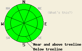
Wind transport that was observed yesterday from increasing SW winds continued overnight and may have caused sufficient wind loading to create a few small unstable slabs in isolated areas. If these slabs exist at all today, they will be found above treeline on N-NE-E aspects. For the most part, any areas of instability in the snowpack today will be few and far between. Use good travel habits to minimize the impact of any surprises.
| 0600 temperature: | 26 to 31 deg. F. |
| Max. temperature in the last 24 hours: | 31 to 41 deg. F. |
| Average wind direction during the last 24 hours: | Southwest |
| Average wind speed during the last 24 hours: | 41 mph |
| Maximum wind gust in the last 24 hours: | 64 mph |
| New snowfall in the last 24 hours: | O inches |
| Total snow depth: | 46 to 69 inches |
For 7000-8000 ft: |
|||
| Saturday: | Saturday Night: | Sunday: | |
| Weather: | Mostly cloudy skies. | Mostly cloudy skies with a slight chance of snow after midnight. | Cloudy skies with a slight chance of snow in the morning. Snow in the afternoon. |
| Temperatures: | 35 to 42 deg. F. | 21 to 28 deg. F. | 30 to 37 deg. F. |
| Wind direction: | S to SW | S | S |
| Wind speed: | 15 to 25 mph with gusts to 40 mph. | 15 to 25 mph with gusts to 35 mph. | 15 to 20 mph with gusts to 35 mph. |
| Expected snowfall: | O in. | O in. | Up to 2 in. |
For 8000-9000 ft: |
|||
| Saturday: | Saturday Night: | Sunday: | |
| Weather: | Mostly cloudy skies. | Mostly cloudy skies with a slight chance of snow after midnight. | Cloudy skies with a slight chance of snow in the morning. Snow in the afternoon. |
| Temperatures: | 34 to 40 deg. F. | 19 to 26 deg. F. | 27 to 34 deg. F. |
| Wind direction: | S to SW | SW | SW |
| Wind speed: | 25 to 35 mph with gusts to 60 mph. | 25 to 40 mph with gusts to 60 mph. | 30 to 45 mph with gusts to 65 mph. Gusts increasing to 80 mph in the afternoon. |
| Expected snowfall: | O in. | O in. | Up to 2 in. |


This website is owned and maintained by the non-profit arm of the Sierra Avalanche Center. Some of the content is updated by the USDA avalanche forecasters including the forecasts and some observational data. The USDA is not responsible for any advertising, fund-raising events/information, or sponsorship information, or other content not related to the forecasts and the data pertaining to the forecasts.

