In partnership with: 
|
February 11, 2010 at 7:41 am |
|
Avalanche danger is LOW for all elevations and aspects. Human triggered avalanches are unlikely but not impossible. Normal caution is advised. |
|
|
|
Mostly cloudy skies, moderate southwest winds, and near freezing air temperatures at the 8,000' level are expected for today. Some very light snow flurries may continue this morning with just a trace of accumulation. Ridgetop winds shifted to the southwest late yesterday morning and increased to moderate in speed. Moderate west winds are forecast to continue today. The storm track has shifted to the north of the forecast area, keeping west winds and minimal snowfall in the forecast through Friday.
Observations made yesterday on Becker and Flagpole Peaks (Echo Summit area), Mt. Tallac (Desolation Wilderness area), and on Lincoln Ridge (Yuba Pass area) all showed no significant evidence of instability. Snowpit data taken from S-SW aspects and N-NE aspects between 7,600 and 8,500' further supported a lack of instability (pit profiles, more info). Recent NE winds had moved some snow onto S-SW aspects, but slab formation was minimal and travel on skies in these areas produced no significant cracking of these small and shallow slabs. Late morning cloud cover was thicker than expected, reducing the incoming solar radiation and keeping areas of wet snow instability from forming on southerly aspects.
Avalanche Concerns:
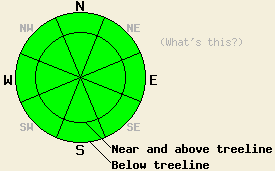
Avalanche concerns for today are few. Human triggered avalanches are unlikely but not impossible in very isolated areas. Increasing west winds may cause some light wind loading in isolated areas. Small and shallow slabs may linger in near and above treeline areas where recent wind loading has occurred. Air temperatures will warm today, but significant cloud cover is expected to keep wet snow instability from occurring. Use good travel techniques to minimize the impacts of any surprises.
Avalanche danger is LOW for all elevations and aspects. Human triggered avalanches are unlikely but not impossible. Normal caution is advised.
| 0600 temperature: | 24 to 29 deg. F. |
| Max. temperature in the last 24 hours: | 27 to 40 deg. F. |
| Average wind direction during the last 24 hours: | Southwest |
| Average wind speed during the last 24 hours: | 25 mph |
| Maximum wind gust in the last 24 hours: | 41 mph |
| New snowfall in the last 24 hours: | trace inches |
| Total snow depth: | 71 to 110 inches |
For 7000-8000 ft: |
|||
| Thursday: | Thursday Night: | Friday: | |
| Weather: | Mostly cloudy skies with a few snow flurries in the morning. | Mostly cloudy skies with a slight chance of snow. | Mostly cloudy skies with a slight chance of snow. |
| Temperatures: | 34 to 39 deg. F. | 22 to 27 deg. F. | 34 to 39 deg. F. |
| Wind direction: | W | SW | SW |
| Wind speed: | Around 10 mph. | 10 to 20 mph with gusts to 35 mph. | 10 to 20 mph with gusts to 35 mph. |
| Expected snowfall: | 0 to trace in. | 0 to trace in. | 0 to trace in. |
For 8000-9000 ft: |
|||
| Thursday: | Thursday Night: | Friday: | |
| Weather: | Mostly cloudy skies with a few snow flurries in the morning. | Mostly cloudy skies with a slight chance of snow. | Mostly cloudy skies with a slight chance of snow. |
| Temperatures: | 29 to 34 deg. F. | 20 to 25 deg. F. | 29 to 34 deg. F. |
| Wind direction: | W | W | W |
| Wind speed: | 15 to 25 mph with gusts to 45 mph. | 20 to 30 mph with gusts to 50 mph. | 20 to 35 mph with gusts to 60 mph. |
| Expected snowfall: | 0 to trace in. | 0 to trace in. | 0 to trace in. |


This website is owned and maintained by the non-profit arm of the Sierra Avalanche Center. Some of the content is updated by the USDA avalanche forecasters including the forecasts and some observational data. The USDA is not responsible for any advertising, fund-raising events/information, or sponsorship information, or other content not related to the forecasts and the data pertaining to the forecasts.

