In partnership with: 
|
February 25, 2010 at 8:01 am |
|
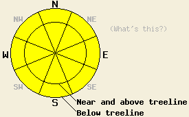
MODERATE avalanche danger exists on all slopes steeper than 35 degrees. Careful snowpack evaluation and terrain choices are a must for today due to variability in the snowpack. |
|
|
|
A slight inversion exists below 7000' across the forecast area this morning. This inversion should lift as a high-pressure ridge moves over the forecast area. This high-pressure should bring mostly sunny, mild, calm weather to the region today. By tonight, the clouds and winds should start to increase again as a strong Pacific storm approaches the forecast area. The forecast calls for precipitation to start on Friday as this storm reaches the Sierra. Warm air associated with this storm should keep snow levels between 7000' and 7500' during the heaviest period of precipitation. Above 7500', up to 6 inches of heavy, wet snow could accumulate during the day tomorrow. By early Saturday morning the snow levels should fall to Lake Level and below.
Below treeline, human-triggered whumphing, snowpack collapse, and shooting cracks occurred on Jake's Peak, in the Mt. Rose backcountry, on Silver Peak, and in Huckleberry Canyon (near Echo Summit) yesterday. Steep (35-38 degree), below-treeline test slopes in the Silver Peak (photos and snowpit) area and in the Mt. Rose backcountry produced small slab fractures when weighted by skiers. Shooting cracks and human-triggered avalanches also occurred in near and above treeline terrain on Silver Peak (photos and video). A motorist on Donner Pass Road reported avalanche debris visible near the train shed on Donner Peak; however, we did not receive any other details concerning this slide. On Silver Peak and in Huckleberry Canyon the interface where heavy, new snow sat on top of lighter, new snow served as the initial failure layer. The human-triggered avalanches that occurred on N-NE-facing, 35-38-degree, wind-loaded slopes on Silver Peak quickly stepped from this layer down to just below the thin, Feb 19th crust layer resulting in crowns of 1.5 to 2 ft deep. These avalanches propagated along this crust for long distances.
Variability in the strength and distribution of weak layers at the base of the new snow means more variability in the snowpack stability from area to area and slope to slope. Careful snowpack evaluation and terrain choices are a must for today.
Avalanche Concern #1:
Avalanche activity due to poor bonding between the old weak layers and the new snow will comprise the primary avalanche concern today. These old weak layers range from thin crusts with weak sugary snow underneath them on northerly aspects to hard refrozen crusts on southerly aspects and low elevation northerly aspects to isolated areas of surface hoar to old unconsolidated snow. Near and above treeline thick, heavy wind slabs sit on top of these layers on the wind-loaded slopes. Below treeline 8-12 inches of heavy new snow sits on top of these layers. Adding a person to the snowpack could overload the older weak layers mentioned above on both wind-loaded and non-wind-loaded slopes resulting in avalanche activity. Some of these avalanches may still start in the storm snow weaknesses then step down the older weak layers. These avalanches can propagate long distances on along some of those weak layers resulting in large dangerous avalanches. The location, strength, and distribution of these weak layers varies greatly across the forecast area. Digging quick hand pits down to the older snow and testing the bonding between the older snow surfaces and the more recent snow can help determine where these weaknesses exist.
Avalanche Concern #2:
As the sun comes out and warms up the new snow today, some wet-snow instabilities like roller-balls and point release slide may occur. These wet snow instabilities should remain limited to the sun exposed southerly aspects steeper than 35 degrees.
MODERATE avalanche danger exists on all slopes steeper than 35 degrees. Careful snowpack evaluation and terrain choices are a must for today due to variability in the snowpack.
| 0600 temperature: | 20 deg. F. |
| Max. temperature in the last 24 hours: | 31 deg. F. |
| Average wind direction during the last 24 hours: | Southwest shifting to the northwest after midnight |
| Average wind speed during the last 24 hours: | Southwest: 25-35 mph | Northwest: 5 mph |
| Maximum wind gust in the last 24 hours: | 67 mph |
| New snowfall in the last 24 hours: | 2-4 inches |
| Total snow depth: | 78-116 inches |
For 7000-8000 ft: |
|||
| Thursday: | Thursday Night: | Friday: | |
| Weather: | Mostly sunny | Cloudy with a 30% chance of snow. | Cloudy with rain and snow showers likely. Snow levels between 7000 ft and 7500 ft. |
| Temperatures: | 34-41 deg. F. | 21-28 deg. F. | 33-40 deg. F. |
| Wind direction: | Southwest | South | South |
| Wind speed: | 10-15 mph decreasing to less than 10 mph | 10-15 mph with gusts to 30 mph | 20-30 mph with gusts to 50 mph increasing to 65 mph in the afternoon |
| Expected snowfall: | O in. | trace in. | above 7500 ft up to 6 in. |
For 8000-9000 ft: |
|||
| Thursday: | Thursday Night: | Friday: | |
| Weather: | Mostly sunny | Cloudy with a 30% chance of snow. | Snow becoming heavier and more widespread in the afternoon. |
| Temperatures: | 31-38 deg. F. | 19-26 deg. F. | 30-37 deg. F. |
| Wind direction: | Southwest | South | South |
| Wind speed: | 15-25 mph with gusts to 35 mph decreasing to 10 mph with gusts to 25 mph | 15-25 mph with gusts to 35 mph increasing to 50 mph | 25-40 mph with gusts to 60 mph increasing to 80 mph in the afternoon |
| Expected snowfall: | O in. | trace in. | 3-6 in. |


This website is owned and maintained by the non-profit arm of the Sierra Avalanche Center. Some of the content is updated by the USDA avalanche forecasters including the forecasts and some observational data. The USDA is not responsible for any advertising, fund-raising events/information, or sponsorship information, or other content not related to the forecasts and the data pertaining to the forecasts.

