In partnership with: 
|
January 4, 2011 at 8:00 am |
|
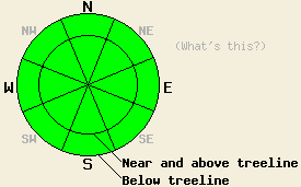
LOW avalanche danger exists at all elevations and on all aspects today. LOW danger does not mean no danger. Even though dangerous avalanche activity should remain unlikely it is not impossible. Continue to use normal caution when traveling in the backcountry. |
|
|
|
A high pressure ridge should bring clear skies to the forecast area. Light east winds should also continue through tonight as this ridge establishes itself. By tomorrow the winds should calm down. This morning an inversion exists below 7000 ft with temperatures in the teens. Above 7000 ft temperatures have already climbed into the 20's. Calm, clear weather should allow these inversions to continue. Above 7000 ft the forecast calls for gradual warming temperatures over the next few days.
Mostly stable snowpack conditions existed on Mt. Tallac, Flagpole Peak, and in the Deep Creek Drainage yesterday. The east and northeast winds did not reach forecasted speeds for very long in these areas, and they did not transport enough snow to form dangerous wind slabs on the leeward aspects. Snowpits, hand pits, and layer bonding tests in these areas showed significant settlement and consolidation in the upper snowpack. Near the ridgelines on Tallac and on Flagpole, the east and northeast winds had lightly scoured the high-elevation, exposed N-NE-E aspects leaving behind patches of firm, wind-affected surface snow (video). Skiers could cause minor cracking in this firm wind board in isolated areas where just the right amount of wind scouring had occurred: too much and the wind crust was to stiff to break, too little and it was too soft to break. When it did crack, it only cracked 1-4 inches deep in very small, isolated areas (photo). Ski cuts on 38-39 degree, N-NE facing slopes between 8000 and 9000 ft on Mt. Tallac occasionally produced small inconsequential sluffs 1-3 inches deep. Soft, unconsolidated snow remained on all aspects near and below treeline on Mt. Tallac yesterday.
Avalanche Concerns:
Due to recent settlement and consolidation in the snowpack, calm winds, and mild weather, avalanche activity should remain unlikely today. Unlikely does not mean impossible. Some isolated pockets of unstable snow could still lurk on isolated terrain features like very steep couliors or steep unsupported snowfields. Very large triggers like very large cornices could still break the snowpack if applied in the right place. Continue to travel with caution and evaluate slopes carefully.
Some roller balls and wet, loose snow sluffs may start to occur today as the sun comes out and the temperatures start to warm up. Gradual warming, low sun angles, and short days should keep these instabilities too small to entrain enough snow to bury a person or pose much of a threat to people. They should also remain limited to southerly sun-exposed aspects.
LOW avalanche danger exists at all elevations and on all aspects today. LOW danger does not mean no danger. Even though dangerous avalanche activity should remain unlikely it is not impossible. Continue to use normal caution when traveling in the backcountry.
| 0600 temperature: | 17-28 deg. F. |
| Max. temperature in the last 24 hours: | 25-29 deg. F. |
| Average wind direction during the last 24 hours: | East and northeast |
| Average wind speed during the last 24 hours: | 15 mph |
| Maximum wind gust in the last 24 hours: | 37 mph |
| New snowfall in the last 24 hours: | O inches |
| Total snow depth: | 76-104 inches |
For 7000-8000 ft: |
|||
| Tuesday: | Tuesday Night: | Wednesday: | |
| Weather: | Sunny | Clear | Sunny |
| Temperatures: | 25-32 deg. F. | 10-20 deg. F. | 28-35 deg. F. |
| Wind direction: | Northeast | East | Variable |
| Wind speed: | up to 10 mph | Light | Light |
| Expected snowfall: | O in. | O in. | O in. |
For 8000-9000 ft: |
|||
| Tuesday: | Tuesday Night: | Wednesday: | |
| Weather: | Sunny | Clear | Sunny |
| Temperatures: | 24-31 deg. F. | 14-24 deg. F. | 30-37 deg. F. |
| Wind direction: | Northeast | Northeast | Variable |
| Wind speed: | 10-15 mph with gusts to 25 mph | 10-15 mph | Light |
| Expected snowfall: | O in. | O in. | O in. |


This website is owned and maintained by the non-profit arm of the Sierra Avalanche Center. Some of the content is updated by the USDA avalanche forecasters including the forecasts and some observational data. The USDA is not responsible for any advertising, fund-raising events/information, or sponsorship information, or other content not related to the forecasts and the data pertaining to the forecasts.

