In partnership with: 
|
January 23, 2011 at 7:59 am |
|
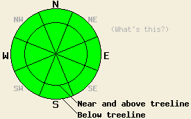
The avalanche danger should remain LOW for all elevations and aspects today. Continue to use normal caution when traveling in the backcountry. |
|
|
|
The forecast calls for another day of sunny, dry, and mild weather across the forecast area. The northerly winds should continue today but should decrease this afternoon. Temperatures should climb few degrees higher toady than yesterday. This strong high pressure ridge over the region should allow the spring-like weather to continue until it departs.
Yesterday, temperatures only climbed into the mid 30's and low 40's across the forecast area. They quickly fell back below freezing for most of the night with overnight lows in the mid 20's to low 30's at all elevations. This morning around 3 am some of the higher elevations started to warm back up and climbed above freezing. The lower elevations remained cold due to an inversion.
Across the forecast area, melt-freeze conditions that soften into good corn snow continue to exist on the sun-exposed southerly aspects. Firm, frozen crusts remain on most northerly aspects. By 2pm yesterday, 1-4 inches of soft, wet snow had formed on top of a supportable frozen layer on the sunny SE-S-SW slopes on Fireplug (Mt. Rose backcountry) (video). By 2:30 pm some of these slopes had already started to refreeze. Ski cuts and other quick stability tests did not reveal any signs of dangerous wet snow instabilities. General observations in the area did not find any new signs of wet snow sluffs or roller balls.
Avalanche Concerns:
Less melting occurred during the day yesterday due to the moderate northerly winds and the cooler daytime temperatures. These cooler conditions combined with overnight temperatures below freezing and a clear night sky that allowed the snowpack to radiate heat out into space should have allowed a very strong overnight refreeze to occur across most of the forecast area. This refreeze, low sun angles, and well established drainage channels in the snowpack will work together to keep any dangerous wet snow instabilities unlikely today. Like yesterday, the melting that occurs today should soften the top few inches of the snow surface on sun-exposed southerly aspects. This softening should occur slightly sooner than it did yesterday due to the lack of morning clouds, decreased northerly winds, and increased temperatures. Some small, isolated, shallow, wet, loose sluffs are not impossible on the most sun-exposed slopes especially if the temperatures climb higher than forecasted. Most northerly aspects should remain frozen today.
The avalanche danger should remain LOW for all elevations and aspects today. Continue to use normal caution when traveling in the backcountry.
| 0600 temperature: | 31-35 deg. F. |
| Max. temperature in the last 24 hours: | 35-43 deg. F. |
| Average wind direction during the last 24 hours: | Northeast |
| Average wind speed during the last 24 hours: | 30 mph |
| Maximum wind gust in the last 24 hours: | 67 mph |
| New snowfall in the last 24 hours: | O inches |
| Total snow depth: | 60-89 inches |
For 7000-8000 ft: |
|||
| Sunday: | Sunday Night: | Monday: | |
| Weather: | Sunny | Clear | Partly cloudy |
| Temperatures: | 40-47 deg. F. | 28-34 deg. F. | 42-49 deg. F. |
| Wind direction: | Northeast shifting to the Northwest | East | Northeast |
| Wind speed: | 10-20 mph becoming light in the afternoon | around 10 mph after midnight | 10-15 mph with gusts to 30 mph in the morning decreasing in the afternoon |
| Expected snowfall: | O in. | O in. | O in. |
For 8000-9000 ft: |
|||
| Sunday: | Sunday Night: | Monday: | |
| Weather: | Sunny | Clear | Partly cloudy |
| Temperatures: | 38-43 deg. F. | 24-31 deg. F. | 40-45 deg. F. |
| Wind direction: | Northeast shifting to the Northwest | Northwest shifting to the Northeast | Northeast shifting to the Northwest |
| Wind speed: | 15-25 mph with gusts to 40 mph in the morning decreasing to 10-15 mph with gusts to 25 mph in the afternoon | 10-20 mph | 10-20 mph with gusts to 30 mph in the morning decreasing to 10-15 mph with gusts to 25 mph in the afternoon |
| Expected snowfall: | O in. | O in. | O in. |


This website is owned and maintained by the non-profit arm of the Sierra Avalanche Center. Some of the content is updated by the USDA avalanche forecasters including the forecasts and some observational data. The USDA is not responsible for any advertising, fund-raising events/information, or sponsorship information, or other content not related to the forecasts and the data pertaining to the forecasts.

