In partnership with: 
|
February 5, 2011 at 7:53 am |
|
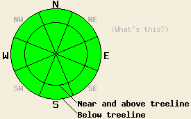
LOW avalanche danger exists on all aspects and elevations. Use normal caution when traveling in the backcountry. |
|
|
|
The high pressure ridge over the region should keep dry weather in place until it moves away from the area. Some cloud cover should develop over the forecast area due to a low pressure east of here. The forecast also calls for the northerly winds to increase today and remain strong through tomorrow. Temperatures should again reach into the mid to upper 40's above 7000 ft today. By tomorrow they could even climb back into the low 50's.
The recent snow continues to settle and consolidate. Stability tests and observations on Hidden Peak yesterday showed a mostly stable snowpack. These tests also showed the that the crust beneath the new snow continues to weaken. Depending on when the next snowfall occurs, this layer could become a problem. Near and above treeline in this area the NE wind had scoured the N-NE aspects leaving a mix of drifts and wind scoured surfaces. On the sheltered northerly aspects above 7200 ft, 6-10 inches of soft snow still remained above a deteriorating crust. Below 7200 on these aspects, the 3-4 inches of snow on top of the crust became wet and sticky by mid afternoon.
Avalanche Concerns:
Dangerous avalanche activity will remain unlikely today. The recent northerly and easterly winds have stripped most of the wind slabs away from the N-NE-E starting zones. The new wind slabs that they deposited on the W-SW-S-SE aspects seem to have bonded well on those aspects. Observations have shown some signs of sensitive wind slabs remaining on the NW-N aspects over the last few days due to the slabs gaining strength faster than the bonds holding them to the snow below. However, these slabs have been too discontinuous and small to cause problems. For these types of instabilities to become a problem requires so many conditions to be just right that dangerous avalanche activity resulting from them will remain unlikely. "Unlikely" does not mean that avalanche activity is impossible.
LOW avalanche danger exists on all aspects and elevations. Use normal caution when traveling in the backcountry.
| 0600 temperature: | 27-32 deg. F. |
| Max. temperature in the last 24 hours: | 40-45 deg. F. |
| Average wind direction during the last 24 hours: | North and Northeast |
| Average wind speed during the last 24 hours: | 20-30 mph |
| Maximum wind gust in the last 24 hours: | 48 mph |
| New snowfall in the last 24 hours: | O inches |
| Total snow depth: | 60-88 inches |
For 7000-8000 ft: |
|||
| Saturday: | Saturday Night: | Sunday: | |
| Weather: | Partly cloudy | Partly cloudy | Partly cloudy |
| Temperatures: | 43-49 deg. F. | 24-30 deg. F. | 48-54 deg. F. |
| Wind direction: | North | Northeast | Northeast |
| Wind speed: | 15-30 mph with gusts to 45 mph increasing to 70 mph in the afternoon | 20-30 mph with gusts to 70 mph decreasing to 60 mph after midnight | 15-25 mph with gusts to 50 mph decreasing to 35 mph in the afternoon |
| Expected snowfall: | O in. | O in. | O in. |
For 8000-9000 ft: |
|||
| Saturday: | Saturday Night: | Sunday: | |
| Weather: | Partly cloudy | Partly cloudy | Partly cloudy |
| Temperatures: | 31-38 deg. F. | 20-27 deg. F. | 42-52 deg. F. |
| Wind direction: | North | North shifting to the Northeast after midnight | Northeast |
| Wind speed: | 30-40 mph with gusts to 55 mph increasing to 35-50 mph with gusts to 75 mph | 40-55 mph with gusts to 75 mph decreasing to 30-45 mph with gusts to 60 mph | 20-35 mph with gusts to 50 mph decreasing to 40 mph |
| Expected snowfall: | O in. | O in. | O in. |


This website is owned and maintained by the non-profit arm of the Sierra Avalanche Center. Some of the content is updated by the USDA avalanche forecasters including the forecasts and some observational data. The USDA is not responsible for any advertising, fund-raising events/information, or sponsorship information, or other content not related to the forecasts and the data pertaining to the forecasts.

