In partnership with: 
|
February 6, 2011 at 7:46 am |
|
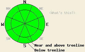
Avalanche danger is LOW for all elevations and aspects. Normal caution is advised. |
|
|
|
Partly cloudy skies with variable amounts of high cloud cover and east winds are forecast for today. A period of strong ridgetop winds occurred last night and are decreasing this morning. Winds are forecast to remain out of the east to northeast today and become moderate in speed. Air temperatures above 8,000' are expected to warm well into the 40s, about 10 degrees warmer than yesterday. Increasing west winds and late day cold front passage are expected for Monday.
Observations made yesterday on Powderhouse Peak (Luther Pass area) revealed conditions very similar to what was observed Friday on the West shore of Lake Tahoe. On northerly aspects, several inches of cold unconsolidated snow lingers at the surface in wind protected areas. Above treeline most E-NE aspects remain well scoured by recent east winds. On recently cross loaded NW-N aspects, wind slabs that formed over the past week are mostly stable with a few occasional outlying indications of possible instability. Snowpit data obtained from a 7' by 22' wind slab on the north side of the summit of Powderhouse Peak near treeline on a NW aspect revealed some indications that human triggered avalanches are not impossible. Fracture propagation tests indicated that fracture propagation was possible in this area, however skier loading all over the slab on this test slope failed to produce any cracking or other additional evidence of instability (pit profile, more info). Areas where these wind slabs remain reactive have become few and far between.
Primary avalanche concern: Wind slabs
On a regional scale, unstable wind slabs remain unlikely. On a local scale, an isolated unstable wind slab is not impossible. Cross loaded NW-N aspects where the bonds between the slab and the snow below have been slower to stabilize remain the areas of concern. In the vast majority of locations observed, these slabs were too small and disconnected to provide a significant hazard to backcountry travelers. In very isolated areas, a larger wind slab capable of contributing to a more dangerous human triggered avalanche is certainly not impossible. Use good travel habits and conservative decision making to minimize risk in suspect areas.
Secondary avalanche concern: Wet snow
With fairly gradual warming over the past several days, wet snow instabilities are not expected below 8,000'. The higher elevation areas will see a more abrupt warming event today. Air temperatures above 8,000' are expected to receive a 10 degree jump in warming which may allow for some small human triggered wet snow instabilities. The most likely area for this to occur is on open SE-S-SW aspects. Wet snow instabilities today will most likely take the form of human triggered roller balls or possibly an isolated wet loose snow sluff in very steep terrain. Widespread dangerous wet snow avalanche conditions are unlikely today, but backcountry travelers should exercise caution above terrain traps and other secondary terrain hazards on steep southerly aspects during the afternoon hours.
| 0600 temperature: | 25 to 30 deg. F. |
| Max. temperature in the last 24 hours: | 35 to 41 deg. F. |
| Average wind direction during the last 24 hours: | East |
| Average wind speed during the last 24 hours: | 47 mph |
| Maximum wind gust in the last 24 hours: | 74 mph |
| New snowfall in the last 24 hours: | O inches |
| Total snow depth: | 59 to 87 inches |
For 7000-8000 ft: |
|||
| Sunday: | Sunday Night: | Monday: | |
| Weather: | Partly cloudy skies. | Clear skies. | Partly cloudy skies in the morning, becoming sunny. |
| Temperatures: | 44 to 51 deg. F. | 26 to 34 deg. F. | 42 to 49 deg. F. |
| Wind direction: | NE to E | E | W |
| Wind speed: | 15 to 25 mph with gusts to 50 mph. Gusts decreasing to 35 mph in the afternoon. | 10 to 15 mph with gusts to 30 mph. | 15 to 30 mph with gusts to 50 mph. |
| Expected snowfall: | O in. | O in. | O in. |
For 8000-9000 ft: |
|||
| Sunday: | Sunday Night: | Monday: | |
| Weather: | Partly cloudy skies. | Clear skies. | Partly cloudy skies in the morning, becoming sunny. |
| Temperatures: | 42 to 50 deg. F. | 27 to 33 deg. F. | 36 to 43 deg. F. |
| Wind direction: | NE to E | N | W |
| Wind speed: | 20 to 35 mph with gusts to 50 mph. Gusts decreasing to 40 mph in the afternoon. | 20 to 30 mph with gusts to 45 mph. | 30 to 45 mph with gusts to 55 mph. Gusts increasing to 65 mph in the afternoon. |
| Expected snowfall: | O in. | O in. | O in. |


This website is owned and maintained by the non-profit arm of the Sierra Avalanche Center. Some of the content is updated by the USDA avalanche forecasters including the forecasts and some observational data. The USDA is not responsible for any advertising, fund-raising events/information, or sponsorship information, or other content not related to the forecasts and the data pertaining to the forecasts.

