In partnership with: 
|
February 13, 2011 at 8:01 am |
|
Avalanche danger remains LOW on all elevations and aspects. Normal caution is advised. |
|
|
|
The weather system passing to the north of the forecast area and upcoming pattern change has kept ridgetop winds moderate to strong out of the southwest. As the well advertised storm system approaches for Monday, ridgetop winds will continue to increase tonight. Today will provide one more day of partly cloudy skies and warm air temperatures before a major weather pattern change occurs this week.
Observations made yesterday in Underwood Bowl (Bear Valley backcountry) (pit profile, more info) and in Deep Creek (Deep Creek area) (video, more info) matched well with previous observations from around the forecast area revealing a mostly stable snowpack. Snow surface conditions are a mix of melt-freeze surfaces, wind scoured surfaces, breakable crusts, and some isolated patches of softer snow. The vast majority of daily melt freeze is focused on sun-exposed SE-S-SW aspects. The exposed N-NE-E aspects near and above treeline hold firm, uneven, wind-scoured surfaces in nearly all areas. Isolated patches of softer snow remain only on the sheltered upper elevation N aspects below treeline. In some areas this layer is continuing to facet and will be worth monitoring during the upcoming storm cycle. Stability tests and hand pits continue to show a strengthening trend at all other heights within the snowpack.
Avalanche concerns:
Avalanche concerns for today are few. Moderate to strong SW winds will slow snow surface melting that occurs on southerly aspects in response to daytime warming. Sufficient snow surface melting will occur by the afternoon hours for enjoyable recreation, but dangerous wet snow instabilities are unlikely to form. On northerly aspects, widespread stable snowpack conditions exist with slab avalanche activity unlikely.
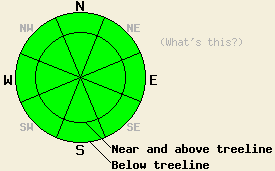
Avalanche danger remains LOW on all elevations and aspects. Normal caution is advised.
| 0600 temperature: | 30 to 34 deg. F. |
| Max. temperature in the last 24 hours: | 40 to 43 deg. F. |
| Average wind direction during the last 24 hours: | Southwest |
| Average wind speed during the last 24 hours: | 35 mph |
| Maximum wind gust in the last 24 hours: | 53 mph |
| New snowfall in the last 24 hours: | O inches |
| Total snow depth: | 58 to 84 inches |
For 7000-8000 ft: |
|||
| Sunday: | Sunday Night: | Monday: | |
| Weather: | Partly cloudy skies. | Mostly cloudy skies. | Cloudy with a chance of snow showers. |
| Temperatures: | 38 to 45 deg. F. | 28 to 34 deg. F. | 28 to 38 deg. F. |
| Wind direction: | SW | SW | S |
| Wind speed: | 25 to 35 mph with gusts to 55 mph. Gusts decreasing to 40 mph in the afternoon. | 15 to 25 mph with gusts to 35 mph. Gusts increasing to 55 mph after midnight. | 15 to 25 mph increasing to 30 to 45 mph in the afternoon. Gusts to 85 mph. |
| Expected snowfall: | O in. | O in. | 0 to trace in. |
For 8000-9000 ft: |
|||
| Sunday: | Sunday Night: | Monday: | |
| Weather: | Partly cloudy skies. | Mostly cloudy skies. | Cloudy with a chance of snow showers. |
| Temperatures: | 30 to 40 deg. F. | 22 to 30 deg. F. | 25 to 35 deg. F. |
| Wind direction: | SW | SW | SW |
| Wind speed: | 35 to 45 mph with gusts to 65 mph. Gusts decreasing to 50 mph in the afternoon. | 25 to 35 mph with gusts to 45 mph. Winds increasing to 40 to 50 mph with gusts to 75 mph after midnight. | 45 to 65 mph with gusts to 100 mph. |
| Expected snowfall: | O in. | O in. | 0 to trace in. |


This website is owned and maintained by the non-profit arm of the Sierra Avalanche Center. Some of the content is updated by the USDA avalanche forecasters including the forecasts and some observational data. The USDA is not responsible for any advertising, fund-raising events/information, or sponsorship information, or other content not related to the forecasts and the data pertaining to the forecasts.

