In partnership with: 
|
December 19, 2011 at 8:01 am |
|
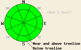
Avalanche danger remains LOW at all elevations and on all aspects. Use normal caution when traveling in the backcountry. |
|
|
|
The northeast winds increased late last night and should continue to gain strength today due to a low pressure system moving through the forecast area. These winds should remain strong through tonight before they begin to decrease again tomorrow. Some cloud cover should also remain over the region today. The combination of these clouds and the cold air associated with the northeast winds should keep daytime highs much colder today than yesterday. The forecast calls for temperatures in the mid 20's above 7000 ft today. As the clouds clear and the winds decrease tomorrow, expect the temperatures to climb slightly.
Observations across the region continue to show an anemic snowpack with lots of stumps, rocks, logs, and other anchors extending through the snowpack in most areas. Faceting has weakened all of the layers in the snowpack to the point that only weak snow remains without a slab on top of on the majority of the NW-N-NE-E aspects where snow exists. On a few of the more exposed slopes on these aspects, some isolated hard slabs still exist on top of the snowpack. A variety of weak snow consisting of facets and some depth hoar exists underneath these isolated hard slabs. Even in the areas where this combination of hard slab and facets remains, enough anchors usually poke all the way through the snowpack to hold everything in place. Most observations and data point to a mostly stable and shallow snowpack with a few occasional indications of very isolated areas of instability where those hard slabs exist on slopes without good anchors. Yesterday observations on the north side of the ridge connecting Castle Peak and Frog Lake Cliffs proved the exception. In this area a few patches of snow over 3ft deep existed on wind-loaded slopes. Snowpit data in one of these deeper patches indicated a strong and stable snowpack (more info, photo). Of course within 20 yards of this deeper patch, areas where the northeast winds had exposed bare ground and snow left over from last year existed. The SE-S-SW-W aspects remain snow free in most places.
Avalanche Concerns: Persistent slabs
Avalanche activity will remain unlikely again today. The lack of of slabs sitting on top of the persistent weak layer and anchors holding what slabs do exist in place in most areas accounts for this lack of avalanche activity. Even though the snowpack seems mostly stable, some slopes without many anchors where hard slabs exist on top of weak snow do exist. Steep northerly aspects hold the best potential for finding this worrisome combination. Careful observations and slope by slope evaluation can help determine where these very isolated patches of possible instability may remain. Pay close attention to any evidence of instability that is found and use it to heavily influence decision making in regards to route selection.
Avalanche danger remains LOW at all elevations and on all aspects. Use normal caution when traveling in the backcountry.
| 0600 temperature: | 19-24 deg. F. |
| Max. temperature in the last 24 hours: | 42-46 deg. F. |
| Average wind direction during the last 24 hours: | North to northeast |
| Average wind speed during the last 24 hours: | 10-20 mph |
| Maximum wind gust in the last 24 hours: | 52 mph |
| New snowfall in the last 24 hours: | O inches |
| Total snow depth: | 5-20 inches |
For 7000-8000 ft: |
|||
| Monday: | Monday Night: | Tuesday: | |
| Weather: | Partly cloudy | Clear | Sunny in the morning becoming partly cloudy in the afternoon |
| Temperatures: | 26-33 deg. F. | 20-26 deg. F. | 32-39 deg. F. |
| Wind direction: | Northeast | East | East |
| Wind speed: | 15-20 mph with gusts to 40 mph increasing to gusts to 50 mph in the afternoon | 15-25 mph with gusts to 50 mph decreasing to 10-20 mph with gusts to 40 mph after midnight | 10-15 mph with gusts to 35 mph |
| Expected snowfall: | O in. | O in. | O in. |
For 8000-9000 ft: |
|||
| Monday: | Monday Night: | Tuesday: | |
| Weather: | Partly cloudy | Clear | Sunny in the morning becoming partly cloudy in the afternoon |
| Temperatures: | 22-29 deg. F. | 19-26 deg. F. | 28-38 deg. F. |
| Wind direction: | Northeast | East | East shifting to the northeast |
| Wind speed: | 20-30 mph with gusts to 45 mph increasing to 30-45 mph with gusts to 60 mph in the afternoon | 30-45 mph with gusts to 65 mph | 20-30 mph with gusts to 50 mph decreasing to 10-20 mph with gusts to 40 mph in the afternoon |
| Expected snowfall: | O in. | O in. | O in. |


This website is owned and maintained by the non-profit arm of the Sierra Avalanche Center. Some of the content is updated by the USDA avalanche forecasters including the forecasts and some observational data. The USDA is not responsible for any advertising, fund-raising events/information, or sponsorship information, or other content not related to the forecasts and the data pertaining to the forecasts.

