In partnership with: 
|
January 28, 2012 at 7:47 am |
|
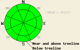
Avalanche danger is LOW for all elevations and aspects. Small wet loose snow avalanches are unlikely but not impossible beginning late morning on slopes 37 degrees and steeper. Normal caution is advised. |
|
|
|
High pressure is in place over the forecast area. Sunny skies, above freezing air temperatures, and light winds are forecast for today. Early this morning, an air temperature inversion is in place with temperatures along the ridges in the 30s while the mountain valley floors are in the teens. Air temperatures above 8,000' this morning are at their maximum for the past 24 hours. Maximum daytime air temperatures are expected to reach the mid 30s and mid 40s today for areas above 7,000'. Ridgetop winds remain out of the east this morning and have decreased to light in speed. Light winds are expected to continue through tonight. Tomorrow, winds are expected to shift to the southwest and increase to light to moderate in speed ahead of a weak weather system that is forecast to bring light precipitation to the northern half of the forecast area Sunday night.
Observations made yesterday on Rose Knob Peak (Mount Rose area) and in the Emerald Bay Chutes (Desolation Wilderness area) both revealed minimal warming instability. Well below freezing air temperatures above 9,000' kept the snow surface frozen in nearly all areas. Below 9,000', 1 to 2 inches of wet snow formed on the snow surface by late morning, with deeper areas of wet snow noted around exposed rocks, trees, and bushes. East winds created convective cooling that slowed snow surface melting in wind exposed areas, while more snow surface melting was observed in wind protected areas. One small and isolated wet loose snow avalanche was observed on the Emerald Bay road cut on a steep wind protected N aspect at around 6,800' (photo). No other evidence of instability was observed in either area on sun exposed SE-S-SW aspects during the late morning and early afternoon hours. Runnels have been noted on the snow surface in a variety of areas over the past couple of days, indicating that preferential channels for free water drainage from the snowpack have been established in these areas.
Recent observations from around the forecast area have shown a well defined trend of strengthening and stabilization of the snowpack since the end of that last storm cycle. The various density inversions that once existed within the storm snow have settled out and become stable. A rain crust exists at the base of the storm snow in areas below 9,500'. Very strong snow above this crust is expected to keep the snowpack stable and supportable above any remaining basal weak layers at this time. Above 9,500' all of the recent accumulated snow sits on the ground surface as these areas were heavily wind scoured and melted prior to the recent snowfall.
Avalanche Concerns:
Clearing skies combined with below freezing air temperatures overnight will have allowed for a good refreeze of wet surface snow that existed yesterday. Significant snow surface melting is expected to occur today at low elevations on all aspects and at the mid and upper elevations on SE-S-SW aspects. Most wet snow instability is expected to remain limited to human triggered roller ball activity and small isolated point release type wet loose snow avalanches on slopes 37 degrees and steeper. All recently collected and received snowpack data indicates that slab avalanche activity is unlikely at this time. The biggest hazard remains secondary terrain exposures where the push of a small wet loose snow avalanche could take a person over a cliff or into a gully.
Avalanche danger is LOW for all elevations and aspects. Small wet loose snow avalanches are unlikely but not impossible beginning late morning on slopes 37 degrees and steeper. Normal caution is advised.
| 0600 temperature: | 30 to 37 deg. F. |
| Max. temperature in the last 24 hours: | 30 to 37 deg. F. |
| Average wind direction during the last 24 hours: | East |
| Average wind speed during the last 24 hours: | 23 mph |
| Maximum wind gust in the last 24 hours: | 50 mph |
| New snowfall in the last 24 hours: | O inches |
| Total snow depth: | 19 to 38 inches |
For 7000-8000 ft: |
|||
| Saturday: | Saturday Night: | Sunday: | |
| Weather: | Sunny skies. | Partly cloudy skies. | Partly cloudy skies. |
| Temperatures: | 38 to 44 deg. F. | 30 to 38 deg. F. | 42 to 49 deg. F. |
| Wind direction: | E | Variable | SW |
| Wind speed: | 15 to 25 mph with gusts to 30 mph in the morning, becoming light. | Light winds. | Light winds increasing to 10 to 15 mph in the afternoon. |
| Expected snowfall: | O in. | O in. | O in. |
For 8000-9000 ft: |
|||
| Saturday: | Saturday Night: | Sunday: | |
| Weather: | Sunny skies. | Partly cloudy skies. | Partly cloudy skies. |
| Temperatures: | 35 to 42 deg. F. | 29 to 37 deg. F. | 37 to 43 deg. F. |
| Wind direction: | E | Variable | SW |
| Wind speed: | 20 to 25 mph with gusts to 35 mph in the morning, decreasing to 10 to 15 mph in the afternoon. | Light winds. | Light winds becoming 15 to 20 mph with gusts to 30 mph in the afternoon. |
| Expected snowfall: | O in. | O in. | O in. |


This website is owned and maintained by the non-profit arm of the Sierra Avalanche Center. Some of the content is updated by the USDA avalanche forecasters including the forecasts and some observational data. The USDA is not responsible for any advertising, fund-raising events/information, or sponsorship information, or other content not related to the forecasts and the data pertaining to the forecasts.

