In partnership with: 
|
April 3, 2012 at 6:42 am |
|
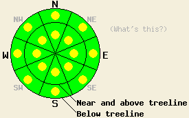
Both above and below treeline, avalanche danger is LOW with pockets of MODERATE danger on all aspects on slopes 35 degrees and steeper due to warming instability and persistent deep slab instability. |
|
|
|
Transitional weather will occur today as warm air moves into the forecast area ahead of a strong cold front that will reach the forecast area tonight. Ridgetop winds shifted from east to southwest overnight allowing an air temperature inversion to set up during the period of light winds at the shift. Ridgetop winds will steadily increase today, becoming gale force tonight. Remote sensors are reporting air temperatures this morning above 8,000' in the low to upper 30s. Daytime highs above 7,000' are forecast to reach the low 40s to mid 50s. Once the cold front arrives tonight, air temperatures will cool significantly. Cloud cover will increase as the day progresses, but sunshine is expected for much of today. Moisture associated with the cold front is limited with new snow amounts of 2 inches or less expected for most of the forecast area tonight. The northern tip of the forecast area could receive up to 4 inches.
Observations made yesterday on Relay Ridge (Mount Rose area) revealed isolated warming instability observed in the form of roller balls on E-SE aspects below cliff bands and rock outcrops on surrounding peaks during the late morning and afternoon hours. Snowpit tests performed just before noon in a recently wind loaded area on a SE aspect at 9,900' did not indicate likely propagation of slab failure within new snow, but 15 minutes later a ski cut above the pit released a small wet slab within the recent new snow that refilled the pit. The higher elevation of this area slowed warming through the morning hours, but warming accelerated significantly around noon (pit profile, more info). On Mt. Tallac (Desolation Wilderness area) more evidence of natural avalanche activity that occurred early Sunday morning was observed on N-NE aspects in wind loaded areas. Avalanche activity remain confined to the new snow and did not step down to deeper weak layers (photos, more info). Snowpit tests performed adjacent to the avalanches did not show ongoing instability within the recent storm snow. Roller balls were observed in areas of direct sun exposure.
Today's Primary Avalanche Concern: Warming Instability
After two days of above freezing air temperatures and April levels of incoming solar radiation, the snowpack has adjusted to the rapid change through avalanche activity and roller ball activity (photos, more info). Another round of significant rapid warming today will once again lead to areas of wet snow and warming instability in a variety of sun exposed areas. With an air temperature inversion warming the upper elevations above freezing last night, significant warming will occur much faster today at the mid and upper elevations than over the past two days. More roller ball and wet loose snow avalanche activity is expected in areas of significant warming.
Today's Secondary Avalanche Concern: Persistent Deep Slabs
At this time, triggering a deep slab avalanche is rather unlikely. However, given the potential size and consequences of a deep slab avalanche the issue cannot be ignored. There are one to two persistent weak layers buried in the snowpack in many areas on NW-N-NE aspects both above and below treeline. These weak layers of old crust and faceted snow crystals are buried anywhere from 4 to 8+ feet deep in the snowpack in most places. Due to the strength of the middle and upper portions of the snowpack these layers are difficult to trigger and cause snowpack failure. Recent snowpit tests continue to indicate that if either of these weak layers does collapse, the resulting fracture is likely to propagate along the layer and result in a large destructive deep slab avalanche. The areas of greatest concern remain focused on relativity shallow snowpack areas where these weak layers are closer to the snow surface such as near exposed rock outcrops, cliffs, steep unsupported slopes, and complex terrain features that create trigger points.
Both above and below treeline, avalanche danger is LOW with pockets of MODERATE danger on all aspects on slopes 35 degrees and steeper due to warming instability and persistent deep slab instability.
| 0600 temperature: | 32 to 39 deg. F. |
| Max. temperature in the last 24 hours: | 34 to 43 deg. F. |
| Average wind direction during the last 24 hours: | East shifting to Southwest |
| Average wind speed during the last 24 hours: | 20 mph |
| Maximum wind gust in the last 24 hours: | 31 mph |
| New snowfall in the last 24 hours: | O inches |
| Total snow depth: | 49 to 89 inches |
For 7000-8000 ft: |
|||
| Tuesday: | Tuesday Night: | Wednesday: | |
| Weather: | Mostly cloudy skies. | Mostly cloudy skies. Snow developing after midnight. | Partly cloudy skies, becoming mostly cloudy. Scattered snow showers in the afternoon. |
| Temperatures: | 47 to 55 deg. F. | 18 to 25 deg. F. | 30 to 38 deg. F. |
| Wind direction: | SW | SW | SW |
| Wind speed: | 15 to 20 mph with gusts to 35 mph, increasing to 20 to 30 mph with gusts to 45 mph in the afternoon. | 30 to 40 mph with gusts to 60 mph, increasing to 45 to 55 mph with gusts to 80 mph after midnight. | 20 to 30 mph with gusts to 45 mph. |
| Expected snowfall: | O in. | Up to 2 in. | 0 to trace in. |
For 8000-9000 ft: |
|||
| Tuesday: | Tuesday Night: | Wednesday: | |
| Weather: | Mostly cloudy skies. | Mostly cloudy skies. Snow developing after midnight. | Partly cloudy skies, becoming mostly cloudy. Scattered snow showers in the afternoon. |
| Temperatures: | 41 to 47 deg. F. | 19 to 25 deg. F. | 25 to 33 deg. F. |
| Wind direction: | SW | SW | SW |
| Wind speed: | 20 to 30 mph with gusts to 40 mph, increasing to 30 to 40 mph with gusts to 60 mph in the afternoon. | 40 to 50 mph with gusts to 80 mph, increasing to 55 to 65 mph with gusts to 100 mph after midnight. | 35 to 45 mph with gusts to 70 mph, decreasing to 25 to 35 mph with gusts to 55 mph in the afternoon. |
| Expected snowfall: | O in. | Up to 2 in. | 0 to trace in. |


This website is owned and maintained by the non-profit arm of the Sierra Avalanche Center. Some of the content is updated by the USDA avalanche forecasters including the forecasts and some observational data. The USDA is not responsible for any advertising, fund-raising events/information, or sponsorship information, or other content not related to the forecasts and the data pertaining to the forecasts.

