In partnership with: 
|
January 22, 2013 at 8:00 am |
|
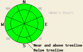
On a regional scale, the avalanche danger remains LOW for all elevations and aspects. Even though avalanche activity is unlikley, small pockets of unstable snow may still lurk on isolated terrain features. Continue to use normal caution when travelling in the backcountry. |
|
|
|
The high pressure ridge over the region should bring another warm, mostly sunny, and mostly calm day to the mountains. A low pressure headed towards the Pacific Northwest should begin to push some high clouds into the area today. The winds and clouds will increase tonight. The forecast calls for mostly cloudy skies and southwest winds around 50 mph above 8000 ft. by tomorrow. This low pressure should also cause temperatures to drop. Tomorrow's high's should only climb into the low to upper 30's above 7000 ft. The bulk of this system should remain north of the region, but some light showers may occur over the Sierra. These should not produce much more than a trace of accumulation.
Yesterday's observations on Mt. Judah (photos, more info), Mt. Lincoln (photos, more info), Hidden Peak (photos, more info), and in the Mt. Rose backcountry (snowpit, more info) all indicated a mostly stable snowpack with a wide variety of surface textures. Several inches of soft snow still resides on the sheltered below treeline N-NE aspects. Above treeline N-NE-E aspects remain wind scoured and firm. Yesterdays' sun and warm temperatures allowed about 2-4 inches of soft corn snow to form on the S aspects. On Mt. Judah ski cuts did trigger some small roller balls on steep test slopes around 7600 ft. Other less sun exposed aspects did not soften as much.
Avalanche Problems:
The snowpack has continued to settle and consolidate over the last several days. Some hard wind slabs may still linger in isolated pockets of terrain in near and above treeline areas. Triggering these slabs will remain unlikely due to their strength. Hard slabs tend to break well away from their triggers and often only break when the right trigger finds the right spot after several other people have already tracked out the slope. These hard slab characteristics mean that this avalanche issue still warrants caution even in its unlikely state. Other than those isolated and unlikely hard slabs, some wet loose snow avalanches could also occur today due to daytime warming. Due to slightly cooler temperatures and increased cloud cover, these should remain small and should only manifest as small roller balls, pinwheels and point releases. Very sun exposed southerly aspects near rocks or trees represent the most likely areas for these to form. They should not involve enough snow to bury a person, but they could change one's course of travel and push one into areas with other consequences.
On a regional scale, the avalanche danger remains LOW for all elevations and aspects. Even though avalanche activity is unlikley, small pockets of unstable snow may still lurk on isolated terrain features. Continue to use normal caution when travelling in the backcountry.
| 0600 temperature: | 39-45 deg. F. |
| Max. temperature in the last 24 hours: | 42-50 deg. F. |
| Average wind direction during the last 24 hours: | Southwest to Southeast |
| Average wind speed during the last 24 hours: | 10 mph |
| Maximum wind gust in the last 24 hours: | 38 mph |
| New snowfall in the last 24 hours: | O inches |
| Total snow depth: | 56-81 inches |
For 7000-8000 ft: |
|||
| Tuesday: | Tuesday Night: | Wednesday: | |
| Weather: | Partly cloudy | Partly cloudy | Mostly cloudy with a 30% chance of showers in the afternoon |
| Temperatures: | 45-51 deg. F. | 22-32 deg. F. | 36-43 deg. F. |
| Wind direction: | South | South | Southwest |
| Wind speed: | Around 10 mph in the morning becoming light in the afternoon | 10-15 mph with gusts to 25 mph | 20-30 mph with gusts to 45 mph |
| Expected snowfall: | O in. | O in. | O in. |
For 8000-9000 ft: |
|||
| Tuesday: | Tuesday Night: | Wednesday: | |
| Weather: | Partly cloudy | Partly cloudy | Mostly cloudy with a 30% chance of showers in the afternoon |
| Temperatures: | 39-46 deg. F. | 29-35 deg. F. | 32-39 deg. F. |
| Wind direction: | South | South | Southwest |
| Wind speed: | 10-20 mph with gusts to 30 mph | 20-30 mph with gusts to 35 mph increasing to gusts to 45 mph after midnight | 45-55 mph with gusts to 75 mph |
| Expected snowfall: | O in. | O in. | O in. |


This website is owned and maintained by the non-profit arm of the Sierra Avalanche Center. Some of the content is updated by the USDA avalanche forecasters including the forecasts and some observational data. The USDA is not responsible for any advertising, fund-raising events/information, or sponsorship information, or other content not related to the forecasts and the data pertaining to the forecasts.

