In partnership with: 
|
January 31, 2013 at 7:45 am |
|
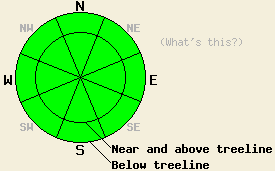
Avalanche danger is LOW for all elevations and aspects. Normal caution is advised. |
|
|
|
High pressure is in place over the forecast area. Sunny skies, light winds, and well above freezing maximum daytime air temperatures are forecast for the next few days. Ridgetop winds became light in speed yesterday and will remain light out of the east today. A short period of light southwest winds is expected tomorrow. Remote sensors are reporting air temperatures in the low to mid 30s this morning above 8,000'. Air temperatures are forecast to warm into the 40s today for most locations.
Observations made yesterday on Rose Knob Peak and on Tamarack Peak (Mount Rose area) revealed transitional snow surface conditions above 8,600'. In this area storm snow from late last week underwent the first significant post storm melt-freeze cycle yesterday on SE-S-SW aspects. Below 8,600', melt-freeze conditions were fairly well established due rain and recent warm air temperatures. On other aspects, the snow surface remained fairly cold with minimal melting on E and W aspects and no melting on NW-N-NE aspects. Shallow, small, stable wind slabs were observed near and along ridgelines above treeline in this area (photos, more info).
Observations made yesterday in the Deep Creek Drainage revealed that the snow surface was capped by a fairly supportable rain crust with less than 1 inch of recent new snow on top of the crust. Stable snowpack conditions with little to no warming were observed on northerly aspects in this area while southerly aspects were noted to hold very little snow (pit profile, photos, more info).
Avalanche Concerns:
Avalanche concerns for today are few. Wet surface snow will develop on SE-S-SW aspects in response to daytime warming. During the afternoon hours, small mostly inconsequential human triggered loose wet snow avalanches and roller balls may occur on SE-S-SW aspects on slopes 37 degrees and steeper. The small size of any loose wet snow avalanches is unlikely to pose a significant threat to backcountry travelers. Keep in mind that undesirable interaction with secondary terrain features such as cliffs, terrain traps, and trees can increase consequences significantly.
Small shallow wind slabs that formed on Sunday near and along ridgelines in above treeline areas have shown good stability over the past two days. Human triggering of a small shallow wind slab is unlikely today, but could theoretically occur. Above 8,600' in near or above treeline terrain on a SE-S-SW-W aspect, especially in an area of complex or extreme terrain is the most likely location. Maximum slab depth is unlikely to exceed 6 to 8 inches.
| 0600 temperature: | 30 to 37 deg. F. |
| Max. temperature in the last 24 hours: | 37 to 45 deg. F. |
| Average wind direction during the last 24 hours: | Northeast |
| Average wind speed during the last 24 hours: | 19 mph |
| Maximum wind gust in the last 24 hours: | 30 mph |
| New snowfall in the last 24 hours: | O inches |
| Total snow depth: | 57 to 83 inches |
For 7000-8000 ft: |
|||
| Thursday: | Thursday Night: | Friday: | |
| Weather: | Sunny skies. | Clear skies. | Sunny skies. |
| Temperatures: | 43 to 48 deg. F. | 24 to 31 deg. F. | 44 to 49 deg. F. |
| Wind direction: | E | Variable | Variable |
| Wind speed: | Around 10 mph in the morning, becoming light. | Light winds | Light winds |
| Expected snowfall: | O in. | O in. | O in. |
For 8000-9000 ft: |
|||
| Thursday: | Thursday Night: | Friday: | |
| Weather: | Sunny skies. | Clear skies. | Sunny skies. |
| Temperatures: | 38 to 43 deg. F. | 27 to 32 deg. F. | 39 to 44 deg. F. |
| Wind direction: | E | SW | Variable |
| Wind speed: | 10 to 15 mph. Gusts up to 25 mph in the morning. | 10 to 15 mph. | Light winds |
| Expected snowfall: | O in. | O in. | O in. |


This website is owned and maintained by the non-profit arm of the Sierra Avalanche Center. Some of the content is updated by the USDA avalanche forecasters including the forecasts and some observational data. The USDA is not responsible for any advertising, fund-raising events/information, or sponsorship information, or other content not related to the forecasts and the data pertaining to the forecasts.

