In partnership with: 
|
February 16, 2013 at 7:56 am |
|
The avalanche danger remains LOW for all elevations and aspects. Continue to use normal caution when traveling in the backcountry. |
|
|
|
The winds decreased and shifted to the southwest yesterday as the high pressure ridge moved father inland. These lighter southwest winds should continue through tomorrow. The skies should remain clear and temperatures should stay above normal with daytime highs in the upper 30's to upper 40's in the mountains above 7000 ft. The forecast calls for the sunny warm weather to continue through the weekend.
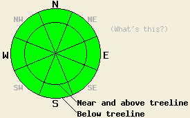
Yesterday observations form the Second and Third Creek drainages (photos, snowpit, more info) in the Mt. Rose area and the Underwood Bowl area (photos, snowpit, more info) near Bear Valley revealed 2-4 inches of wet corn snow had formed on the sun exposed SE-S-SW aspects by midday. This soft wet snow resided on top of a strong layer of still frozen melt-freeze snow. On the near and above treeline NW-N-NE aspects, recent winds have exposed firm frozen rain crusts on the surface. In areas sheltered from the recent E and NE winds, some soft snow still exists above a rain crust on these aspects. Below the rain crust on the northerly aspects, a layer of weak sugary snow exists in both areas. Tests on this weak layer from both locations indicated that even if it does break, the resulting fracture would not travel very far. On mid elevation NW-N facing slopes in the Second Creek drainage, a shallower snowpack composed mostly of alternating crust and facet layers similar to the snowpack stratigraphy noted on Porcupine Ridge exists (snowpit, more info).
Avalanche Concerns:
Avalanche activity will remain unlikely today. More warming should occur today due to plentiful sunshine, warm air temperatures, and less wind. This warming should should allow soft wet corn snow to form on most of the sun exposed SE-S-SW aspects today. Due to the prolonged melt-freeze cycle, the weakness of the Feb. sunshine, and the continued light winds, the melting that occurs today should not create substantial wet snow instabilities. Any wet snow instabilities that do form today, should remain limited to small roller balls and small isolated point releases.
The avalanche danger remains LOW for all elevations and aspects. Continue to use normal caution when traveling in the backcountry.
| 0600 temperature: | 26-36 deg. F. |
| Max. temperature in the last 24 hours: | 45-49 deg. F. |
| Average wind direction during the last 24 hours: | East shifting to the southwest yesterday afternoon |
| Average wind speed during the last 24 hours: | East: 15-25 mph | Southwest: 5-15 mph |
| Maximum wind gust in the last 24 hours: | 45 mph |
| New snowfall in the last 24 hours: | O inches |
| Total snow depth: | 53-80 inches |
For 7000-8000 ft: |
|||
| Saturday: | Saturday Night: | Sunday: | |
| Weather: | Sunny | Clear | Sunny |
| Temperatures: | 42-48 deg. F. | 25-31 deg. F. | 36-42 deg. F. |
| Wind direction: | Southwest | Southwest | Southwest |
| Wind speed: | Light in the morning increasing to 10-15 mph in the afternoon | 10-15 mph with gusts to 25 mph | 10-15 mph with gusts to 25 mph in the morning |
| Expected snowfall: | O in. | O in. | O in. |
For 8000-9000 ft: |
|||
| Saturday: | Saturday Night: | Sunday: | |
| Weather: | Sunny | Clear | Sunny |
| Temperatures: | 36-42 deg. F. | 21-29 deg. F. | 34-39 deg. F. |
| Wind direction: | Southwest | Southwest | West |
| Wind speed: | 15-25 mph with gusts to 35 mph | 25-35 mph with gusts to 55 mph | 25-35 mph with gusts to 50 mph decreasing to 40 mph in the afternoon |
| Expected snowfall: | O in. | O in. | O in. |


This website is owned and maintained by the non-profit arm of the Sierra Avalanche Center. Some of the content is updated by the USDA avalanche forecasters including the forecasts and some observational data. The USDA is not responsible for any advertising, fund-raising events/information, or sponsorship information, or other content not related to the forecasts and the data pertaining to the forecasts.

