In partnership with: 
|
February 17, 2013 at 7:49 am |
|
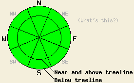
Avalanche danger remains LOW for all elevations and aspects. Continue to use normal caution while traveling in the backcountry. |
|
|
|
The large scale weather pattern over the region is beginning to change as high pressure continues to slowly shift to the east. Air temperatures are now on a day to day cooling trend. Ridgetop winds will remain out of the southwest to west today. Winds speeds will increase tomorrow out of the southwest after a brief period of light north winds tonight. Sunny skies today will give way to building high level cloud cover tomorrow. A chance of snowfall returns to the forecast area for Monday night through Wednesday.
Observations made yesterday on Jake's Peak (West Shore Tahoe area) revealed warming air temperatures and wet snow forming in the usual places on sun exposed SE-S-SW aspects. Up to 1 inch of wet surface snow was also noted below 7,800' on NE-E aspects and very low angle N aspects. Some very small and inconsequential skier triggered loose wet snow avalanches were noted yesterday afternoon at 7,400' on a NE aspect with 39 degree slope angle. This involved only the top 1 inch of the snowpack and was an indication of a changing snowpack rather than any significant or otherwise hazardous form of instability (photo, more info). This wet snow from yesterday on N-NE-E aspects is likely to have transitioned to breakable melt-freeze crust last night.
Snowpit data collected at 9,000' on a N aspect in near treeline terrain matched well with other recent observations from around the forecast area indicating a stable snowpack. Faceted snow layers are widespread on northerly aspects within the top 1 foot of the snowpack. For the most part these weak layers are in decent condition to handle new snow loading (pit profile, video, more info). With a few isolated exceptions of shallow snowpack areas in the Carson Range, propagation tests targeting these faceted weak layers have pointed to propagation as unlikely in the event of weak layer collapse under future snow loading conditions (pit profile, more info).
Avalanche Concerns:
Natural and human triggered avalanche activity remains unlikely today. Up to a few inches of wet snow will once again form today, mainly on SE-S-SW aspects. Minor amounts of wet surface snow may form on other aspects as well. Any amount of roller ball instability or loose wet snow avalanche activity that occurs today is expected to be very small and not present a hazard to backcountry travelers.
Avalanche danger remains LOW for all elevations and aspects. Continue to use normal caution while traveling in the backcountry.
| 0600 temperature: | 22 to 32 deg. F. |
| Max. temperature in the last 24 hours: | 40 to 46 deg. F. |
| Average wind direction during the last 24 hours: | Southwest |
| Average wind speed during the last 24 hours: | 21 mph |
| Maximum wind gust in the last 24 hours: | 34 mph |
| New snowfall in the last 24 hours: | O inches |
| Total snow depth: | 53 to 78 inches |
For 7000-8000 ft: |
|||
| Sunday: | Sunday Night: | Monday: | |
| Weather: | Sunny skies. | Clear skies. | High level cloud cover creating mostly cloudy skies. |
| Temperatures: | 36 to 44 deg. F. | 20 to 28 deg. F. | 35 to 41 deg. F. |
| Wind direction: | SW | Variable | SW |
| Wind speed: | 10 to 15 mph. Gusts to 25 mph in the morning. | Light winds. | Light winds increasing to 20 to 25 mph with gusts to 40 mph in the afternoon. |
| Expected snowfall: | O in. | O in. | O in. |
For 8000-9000 ft: |
|||
| Sunday: | Sunday Night: | Monday: | |
| Weather: | Sunny skies. | Clear skies. | High level cloud cover creating mostly cloudy skies. |
| Temperatures: | 32 to 38 deg. F. | 23 to 30 deg. F. | 30 to 37 deg. F. |
| Wind direction: | W | N shifting to S after midnight. | SW |
| Wind speed: | 15 to 25 mph with gusts to 40 mph. | 10 to 15 mph. Gusts up to 25 mph. | 15 to 20 mph with gusts to 35 mph, increasing to 30 to 35 mph with gusts to 55 mph in the afternoon. |
| Expected snowfall: | O in. | O in. | O in. |


This website is owned and maintained by the non-profit arm of the Sierra Avalanche Center. Some of the content is updated by the USDA avalanche forecasters including the forecasts and some observational data. The USDA is not responsible for any advertising, fund-raising events/information, or sponsorship information, or other content not related to the forecasts and the data pertaining to the forecasts.

