In partnership with: 
|
March 20, 2013 at 7:00 am |
|
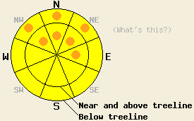
Increasing avalanche danger this morning will rise to widespread MODERATE danger with pockets of CONSIDERABLE danger forming today in near and above treeline areas on NW-N-NE-E aspects on slopes 35 degrees and steeper as wind slabs continue to grow in size and depth. Pockets of CONSIDERABLE danger are possible in below treeline areas below 7,500' as rain on snow keeps the possibility of loose wet snow avalanches ongoing, especially on NW-N-NE aspects on slopes 37 degrees and steeper. |
|
|
|
Snow and rain continue to fall over the forecast are this morning. Precipitation spread from north to south across the forecast area yesterday evening. Thus far new snow amounts above 7,700' range from 2 to 4 inches across the forecast area. This has come from 0.3 to 0.5 inches of snow water equivalent, making new snow density around 16%. Snow level began around 7,300' last night and has fallen to as low as 6,200' at times early this morning. Snow level is generally expected to hold between 6,500' and 7,300' for most of today. Snowfall is expected to continue today with up to an additional 4 inches possible above 7,000'. Ridgetop winds are moderate in speed out of the southwest this morning, Wind speeds are forecast to increase to strong to gale force today with ridgetop gusts 70 to 90 mph. Precipitation is expected to taper off tonight. Sunny skies, above freezing air temperatures, and moderate speed north winds are forecast for tomorrow.
Observations made around the forecast area over the past week have shown two major trends in snow melt and persistent weak layer stabilization. Significant melt has occurred on all aspects below 8,000' with areas of wet isothermal snowpack on E-SE-S-SW-W aspects below 7,800'. A surface layer of melt freeze snow of varied thickness existed to at least 9,500' on all aspects prior to the onset of precipitation yesterday. Old near crust facet layers that existed within the top 1 to 3 feet of the existing snowpack have shown significant rounding and strength gains over the past 10 days. Any areas of lingering instability associated with old near crust facet layers are isolated and limited to NW-N-NE aspects above 9,000'. (For detailed info on recent observations, click here)
Avalanche Problem #1: Wind Slabs
New snow and wind loading will create dense wind slabs in lee areas along ridgelines today. Slab depth could reach around 1 foot thick in the more heavily wind loaded areas on NW-N-NE-E aspects. On other aspects wind slabs 6 inches to 1 foot thick should be expected in lee areas where cross loading occurs. Human triggered slab avalanches are possible to likely today. Natural avalanche activity is possible.
Avalanche Problem #2: Loose Wet Avalanches
Snow levels will likely fluctuate a bit today with precipitation intensity, but rain will continue to fall on snow in areas below 7,000' to 7,500'. In these areas, free water drainage was been well established during periods of warm air temperatures and snowpack melt over the past week. The exception to this is on heavily shaded northerly aspects. In these areas, some cold snow unaffected by melt remained below the surface melt freeze layer prior to the onset of precipitation yesterday evening. As additional free water is added to the snowpack in the form of rain, wet snow avalanches could occur in steep terrain in low and mid elevation areas. Most loose wet avalanche activity that occurs today is expected as human triggered, but isolated natural loose wet avalanches are possible.
Tracking Persistent Slabs
Persistent slabs involving old near crust facet layers within the top 1 to 3 feet of the snowpack have been reduced to a lingering concern only in very isolated areas on NW-N-NE aspects above 9,000'. In very isolated areas the weak layer and overlying slab characteristics remain conducive to propagation following weak layer collapse. The amount of new snow loading and snow water equivalent associated with the current storm system is expected as insufficient to stress any remaining persistent weak layers to the point that the likelihood of natural or human triggered persistent slab avalanche occurrence rises above unlikely.
Increasing avalanche danger this morning will rise to widespread MODERATE danger with pockets of CONSIDERABLE danger forming today in near and above treeline areas on NW-N-NE-E aspects on slopes 35 degrees and steeper as wind slabs continue to grow in size and depth. Pockets of CONSIDERABLE danger are possible in below treeline areas below 7,500' as rain on snow keeps the possibility of loose wet snow avalanches ongoing, especially on NW-N-NE aspects on slopes 37 degrees and steeper.
| 0600 temperature: | 26 to 31 deg. F. |
| Max. temperature in the last 24 hours: | 34 to 45 deg. F. |
| Average wind direction during the last 24 hours: | Southwest |
| Average wind speed during the last 24 hours: | 19 mph |
| Maximum wind gust in the last 24 hours: | 51 mph |
| New snowfall in the last 24 hours: | 2 to 4 inches |
| Total snow depth: | 51 to 85 inches |
For 7000-8000 ft: |
|||
| Wednesday: | Wednesday Night: | Thursday: | |
| Weather: | Cloudy skies, becoming mostly cloudy. Snow likely this morning, possibly mixing briefly with rain. Scattered snow showers in the afternoon. | Mostly cloudy skies, becoming partly cloudy. Scattered snow showers in the evening. A slight chance of snow showers after midnight. | Sunny skies, becoming partly cloudy. |
| Temperatures: | 36 to 40 deg. F. | 20 to 25 deg. F. | 35 to 42 deg. F. |
| Wind direction: | SW | W | SW shifting to N |
| Wind speed: | 35 to 45 mph with gusts to 60 mph. Gusts increasing to 70 mph in the afternoon. | 40 to 45 mph with gusts to 65 mph, decreasing to 25 to 30 mph with gusts to 45 mph after midnight. | 20 to 25 mph with gusts to 40 mph. Gusts decreasing to 30 mph in the afternoon. |
| Expected snowfall: | Up to 4 in. | 0 to trace in. | O in. |
For 8000-9000 ft: |
|||
| Wednesday: | Wednesday Night: | Thursday: | |
| Weather: | Cloudy skies, becoming mostly cloudy. Snow likely. | Mostly cloudy skies, becoming partly cloudy. Scattered snow showers in the evening. A slight chance of snow showers after midnight. | Sunny skies, becoming partly cloudy. |
| Temperatures: | 30 to 34 deg. F. | 19 to 24 deg. F. | 36 to 42 deg. F. |
| Wind direction: | SW | W | W shifting to N |
| Wind speed: | 50 to 60 mph with gusts to 90 mph. | 55 to 60 mph with gusts to 90 mph, decreasing to 40 to 45 mph with gusts to 70 mph after midnight. | 35 to 40 mph with gusts to 60 mph, shifting and decreasing to 25 to 30 mph with gusts to 45 mph in the afternoon. |
| Expected snowfall: | Up to 4 in. | 0 to trace in. | O in. |


This website is owned and maintained by the non-profit arm of the Sierra Avalanche Center. Some of the content is updated by the USDA avalanche forecasters including the forecasts and some observational data. The USDA is not responsible for any advertising, fund-raising events/information, or sponsorship information, or other content not related to the forecasts and the data pertaining to the forecasts.

