In partnership with: 
|
March 22, 2013 at 7:00 am |
|
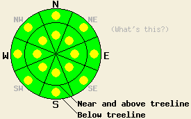
Both above and below treeline, pockets of MODERATE avalanche danger will exist on all aspects on slopes 35 degrees and steeper due to a combination of new and old wind slabs and wet snow instabilities formed by sunshine and daytime warming. |
|
|
|
The wind shifted to the northeast last night and started to increase due to a high pressure building over the area. These northeast winds should continue today and average between 20 and 30 mph above 8000 ft. These winds should begin to decrease tonight and continue decreasing tomorrow. Temperatures should remain cool today with daytime highs in the 30's and low 40's above 7000 ft. As the northerly flow decreases, temperatures should start to gradually warm back up tomorrow. The high pressure should also keep skies sunny and clear for the next few days.
Yesterday observations from Powderhouse Peak, Silver Peak, and Echo Summit all showed that the storm snow has started to form good bonds within itself and between itself and the old snow surfaces. On Silver Peak data and tests from a snowpit adjacent to a natural avalanche that occurred near the end of the storm on Wednesday indicated that the storm snow weakness that avalanche failed on was no longer active (video, photos, snowpit, and more info). Other observations and ski cuts on steep wind loaded N-NE aspects did not reveal any cracking or other signs of instability. On sun exposed E aspects in the Silver Peak area some wet loose snow avalanches did occur due yesterday's sunshine rapidly warming the new snow (photo, more info). On Powderhouse Peak above 8000 ft on the N-NE aspects, snowpit tests and general observations also did not find signs of lingering instability (video, photo, snowpit, more info). Below 8000 ft. the snow had become wet and sticky in this area by mid afternoon. In the Echo Summit area, N facing aspects below 8000 ft. still held wet snow below the new snow; however, tests and ski cuts on steep N facing slopes in this area did not reveal other signs of instability (more info). Some wet loose avalanches also occurred below 8000 ft. near exposed rocks on the E-SE-S aspects in the Echo Summit area, the Meiss Ridge area, and on Mt. Tallac yesterday.
Avalanche Problem #1: Loose Wet Avalanches
Wet loose avalanches may remain possible today on steep sun exposed E-SE-S-SW aspects due to the strong spring sunshine and above freezing temperatures. Slightly cooler temperatures today, stronger northerly winds, and the fact that the new snow has already experienced one day of warm temps and sunshine should all work to make the wet snow instabilities smaller and less widespread today. Roller balls, pinwheels, and wet loose point releases should comprise the majority of wet snow instabilities today. While wet slab avalanches should remain unlikely, they are not impossible on the most sun exposed E-SE-S aspects where cold dry snow still exists.
Avalanche Problem #2: Wind Slabs
Wind slabs 1 to 3 feet deep still exist on wind loaded near and above treeline NW-N-NE-E aspects. In many areas these slabs have now bonded to the snow below them and triggering these slabs has become unlikely. However, human triggering of these slabs may remain possible in isolated areas especially in complex or extreme terrain and in areas where the wind slabs exist on unsupported slopes. If the NE winds increase as forecasted, some new and human triggerable wind slabs may also form on the SW-W-NW aspects near ridgelines.
Both above and below treeline, pockets of MODERATE avalanche danger will exist on all aspects on slopes 35 degrees and steeper due to a combination of new and old wind slabs and wet snow instabilities formed by sunshine and daytime warming.
| 0600 temperature: | 18-26 deg. F. |
| Max. temperature in the last 24 hours: | 34-42 deg. F. |
| Average wind direction during the last 24 hours: | Southwest until midnight | Northeast since midnight |
| Average wind speed during the last 24 hours: | Before midnight: 10 mph | After midnight: 15-30 mph |
| Maximum wind gust in the last 24 hours: | 55 mph |
| New snowfall in the last 24 hours: | O inches |
| Total snow depth: | 54-88 inches |
For 7000-8000 ft: |
|||
| Friday: | Friday Night: | Saturday: | |
| Weather: | Sunny | Clear | Sunny |
| Temperatures: | 36-42 deg. F. | 14-21 deg. F. | 39-45 deg. F. |
| Wind direction: | Northeast | Northeast | Variable |
| Wind speed: | 10-15 mph with gusts to 25 mph | 10-15 mph | Light |
| Expected snowfall: | O in. | O in. | O in. |
For 8000-9000 ft: |
|||
| Friday: | Friday Night: | Saturday: | |
| Weather: | Sunny | Clear | Sunny |
| Temperatures: | 30-38 deg. F. | 16-23 deg. F. | 33-39 deg. F. |
| Wind direction: | Northeast | Northeast | North shifting to the south in the afternoon |
| Wind speed: | 20-30 mph with gusts to 45 mph | 15-25 mph with gusts to 40 mph | 20-25 mph with gusts to 35 mph |
| Expected snowfall: | O in. | O in. | O in. |


This website is owned and maintained by the non-profit arm of the Sierra Avalanche Center. Some of the content is updated by the USDA avalanche forecasters including the forecasts and some observational data. The USDA is not responsible for any advertising, fund-raising events/information, or sponsorship information, or other content not related to the forecasts and the data pertaining to the forecasts.

