


For 7000 ft. to 8000 ft.
| Friday | Friday Night | Saturday | |
|---|---|---|---|
| Weather: | Sunny skies, becoming partly cloudy. | Partly cloudy skies. | Partly cloudy skies. |
| Temperatures: | 50 to 57 deg. F. | 29 to 36 deg. F. | 51 to 57 deg. F. |
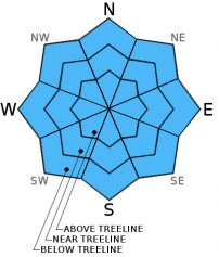
| Mid Slope Winds: | E | SW | SW |
| Wind Speed: | Light winds increasing to 10 to 15 mph in the afternoon. | 10 to 15 mph. | 20 to 30 mph with gusts to 35 mph. Gusts increasing to 45 mph in the afternoon. |
| Expected snowfall: | 0 | 0 | 0 |
For 8000 ft. to 9000 ft.
| Friday | Friday Night | Saturday | |
|---|---|---|---|
| Weather: | Sunny skies, becoming partly cloudy. | Partly cloudy skies. | Partly cloudy skies. |
| Temperatures: | 48 to 54 deg. F. | 30 to 37 deg. F. | 45 to 53 deg. F. |
| Ridge Top Winds: | E shifting to S | SW | SW |
| Wind Speed: | Light winds shifting and increasing to 10 to 15 mph in the afternoon. | 15 to 20 mph with gusts to 30 mph. | 30 to 35 mph with gusts to 50 mph, increasing to 40 to 45 mph with gusts to 65 mph in the afternoon. |
| Expected snowfall: | 0 | 0 | 0 |


