


For 7000 ft. to 8000 ft.
| Thursday | Thursday Night | Friday | |
|---|---|---|---|
| Weather: | Partly cloudy / mostly clear this morning with increasing clouds and isolated snow showers as the day progresses. | Partly cloudy with isolated snow showers in the evening becoming clear overnight | Sunny |
| Temperatures: | 29 to 35 deg. F. | 16 to 21 deg. F. | 44 to 49 deg. F. |
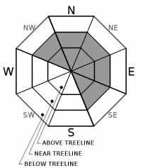
| Mid Slope Winds: | West | West | Variable |
| Wind Speed: | 15 to 20 mph with gusts to 40 mph | 10 to 15 mph with gusts to 35 mph in the evening becoming light overnight | 10 to 15 mph with gusts to 40 mph in the morning decreasing to 5 to 10 mph with gusts to 25 mph in the afternoon |
| Expected snowfall: | up to 1 | 0 | 0 |
For 8000 ft. to 9000 ft.
| Thursday | Thursday Night | Friday | |
|---|---|---|---|
| Weather: | Partly cloudy / mostly clear this morning with increasing clouds and isolated snow showers as the day progresses. | Partly cloudy with isolated snow showers in the evening becoming clear overnight | Sunny |
| Temperatures: | 24 to 30 deg. F. | 13 to 18 deg. F. | 39 to 45 deg. F. |
| Ridge Top Winds: | West | Northwest | Northeast |
| Wind Speed: | 20 to 30 mph with gusts to 60 mph decreasing to 40 mph in the afternoon | 20 to 30 mph with gusts to 35 mph increasing to 60 mph after midnight | 20 to 30 mph with gusts to 55 mph decreasing to 15 to 20 mph with gusts to 40 mph in the afternoon |
| Expected snowfall: | up to 1 | 0 | 0 |


