THIS AVALANCHE FORECAST EXPIRED ON December 18, 2020 @ 6:59 am
Avalanche Forecast published on December 17, 2020 @ 6:59 am
Issued by Andy Anderson - Tahoe National Forest - Sierra Avalanche Center

New wind and snow will add weight to an already unstable snowpack. Expect fragile slabs of wind drifted snow on wind-loaded slopes and unstable slabs of recent snow on old weak snow in more sheltered areas. This complicated mix of avalanche problems will result in dangerous conditions in the backcountry today. Large human triggered avalanches are likely. CONSIDERABLE avalanche danger exists at all elevations. Advanced route finding and decision making skills are required to avoid today's avalanche problems.

3. Considerable

?

Above Treeline
Dangerous avalanche conditions. Careful snowpack evaluation, cautious route-finding and conservative decision-making essential.

3. Considerable

?

Near Treeline
Dangerous avalanche conditions. Careful snowpack evaluation, cautious route-finding and conservative decision-making essential.

3. Considerable

?

Below Treeline
Dangerous avalanche conditions. Careful snowpack evaluation, cautious route-finding and conservative decision-making essential.
    Dangerous avalanche conditions. Careful snowpack evaluation, cautious route-finding and conservative decision-making essential.
Avalanche Problem 1: Persistent Slab
  • Type ?
  • Aspect/Elevation ?
  • Likelihood ?
    Certain
    Very Likely
    Likely
    Possible
    Unlikely
  • Size ?
    Historic
    Very Large
    Large
    Small

Every day this week, backcountry travelers have reported collapsing, whumfing, and unstable test results on the weak sugary snow buried on Dec. 11. New snow accumulating across the region will add more weight on top of this persistent weak layer. Since it had only just begun to adjust to the previous storm snow, this new load will likely overload the weak layer again. This weak buried facet layer exists on most near and below treeline W-NW-N-NE-E aspects. Observers have even found it in a few isolated areas above treeline. The additional weight of a person on the snowpack would likely provide enough of a trigger to break this layer and cause an avalanche today. These avalanches could break partway down a slope, propagate farther than expected, and people could trigger them remotely from below, above, to the side, or from any connected terrain. These avalanches would also have serious consequences as many obstacles still exist in the early season snowpack.

Persistent slabs represent one of the most difficult avalanche problems to manage. Sometimes cracking and whumpfing can provide clues to instability; sometimes triggering a large avalanche is the only clue to instability you see. Avoiding travel in avalanche terrain where persistent slabs might lurk is the best strategy for dealing with persistent slabs. Terrain less steep than 30 degrees that is not connected to steeper slopes can still provide enjoyable recreation. 

Avalanche Problem 2: Wind Slab
  • Type ?
  • Aspect/Elevation ?
  • Likelihood ?
    Certain
    Very Likely
    Likely
    Possible
    Unlikely
  • Size ?
    Historic
    Very Large
    Large
    Small

More snow and wind today will form slabs of drifted snow on leeward aspects in exposed areas. These wind slabs will be fragile today and human triggered wind slab avalanches will be likely on the most heavily wind-loaded slopes. In some areas, these wind slabs could build on slopes where the persistent weak layer mentioned above exists. In these cases, larger avalanches that could propagate much farther than expected and be remotely triggered could occur. Cornices that form along ridgelines could also break easily and provide triggers for avalanches on the slopes below. 

Newly developed cornices, wind pillows, and wind created surface textures can all help to identify which slopes may hold wind slabs. Signs of wind slabs instability include recent avalanches, cracking, or signs of denser snow over less dense snow. Managing multiple avalanche problems at all elevations will be required today. 

recent observations

*  The Dec 11 persistent weak layer was formed by the faceting process during our extended dry period from Nov 18 through Dec 11 and is now buried more than a foot below the snow surface in many areas. This buried faceted weak layer is widespread below treeline, near treeline, and is some case above treeline on W-NW-N-NE-E aspects. Observers reported more signs of instability including whumpfs and unstable test results in more locations yesterday. Some areas had more variable results.

* An avalanche that occurred on Monday on the north side of Castle Peak was also reported yesterday.

Weather and CURRENT CONDITIONS
weather summary

Snow started falling across the region around 2 am this morning. Since then between 2 and 4 inches of new snow has accumulated with another few inches expected through this morning. The area could see some intense bursts of snowfall in the next couple of hours. The NWS is calling for storm totals of 3 to 6 inches of snow in most places with the potential for a bit more in some places along the Sierra Crest. By midday snow showers should start to taper off as this cold front moves through the area. The forecast calls for decreasing winds, clearing skies, and colder temperatures across the region tonight and tomorrow. 

CONDITIONS ALONG THE SIERRA CREST BETWEEN 8200 FT. AND 9200 FT. IN THE LAST 24 HOURS
6am temperature: 20 to 28 deg. F.
Max. temperature: 37 to 43 deg. F.
Average ridgetop wind direction: SW
Average ridgetop wind speed: 25 to 30 mph
Maximum ridgetop wind gust: 85 mph
New snowfall: 2 to 4 inches
Total snow depth: 23 to 30 inches
Two-Day Mountain Weather Forecast Produced in partnership with the Reno NWS
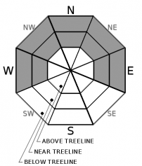
For 7000 ft. to 8000 ft.
Thursday Thursday Night Friday
Weather: Mostly cloudy. Snow in the morning, then chance of snow in the afternoon. Snow levels below 7000 feet. Chance of precipitation is 95%. Mostly cloudy then becoming partly cloudy. Snow levels below 7000 feet. Chance of precipitation is 5%. Partly cloudy then becoming sunny. Snow levels below 7000 feet. Chance of precipitation is 0%.
Temperatures: 29 to 34 deg. F. 14 to 20 deg. F. 33 to 38 deg. F.
Mid Slope Winds: West 15 to 20 mph. Gusts up to 45 mph decreasing to 30 mph in the afternoon. Light winds. Light winds.
Expected snowfall: 80% probability of 3 to 6 inches. 20% probability of 6 to 8 inches. | SWE = 0.20-0.45 inch. No accumulation. | SWE = none. No accumulation. | SWE = none.
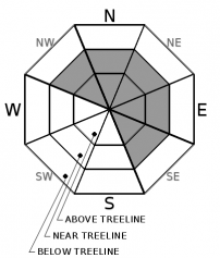
For 8000 ft. to 9000 ft.
Thursday Thursday Night Friday
Weather: Mostly cloudy. Snow in the morning, then chance of snow in the afternoon. Snow levels below 7000 feet. Chance of precipitation is 95%. Mostly cloudy then becoming partly cloudy. Snow levels below 7000 feet. Chance of precipitation is 5%. Partly cloudy then becoming sunny. Snow levels below 7000 feet. Chance of precipitation is 0%.
Temperatures: 25 to 30 deg. F. 12 to 17 deg. F. 29 to 35 deg. F.
Ridge Top Winds: Southwest 25 to 35 mph with gusts to 75 mph becoming west 15 to 25 mph with gusts to 45 mph in the afternoon. Northeast 15 to 25 mph with gusts to 40 mph. Southeast 15 to 25 mph. Gusts up to 40 mph increasing to 55 mph in the afternoon.
Expected snowfall: 80% probability of 3 to 6 inches. 20% probability of 6 to 9 inches. | SWE = 0.30-0.55 inch. No accumulation. | SWE = none. No accumulation. | SWE = none.
Disclaimer

This avalanche forecast is provided through a partnership between the Tahoe National Forest and the Sierra Avalanche Center. This forecast covers the Central Sierra Nevada Mountains between Yuba Pass on the north and Ebbetts Pass on the south. Click here for a map of the forecast area. This forecast applies only to backcountry areas outside established ski area boundaries. This forecast describes general avalanche conditions and local variations always occur. This forecast expires 24 hours after the posted time unless otherwise noted. The information in this forecast is provided by the USDA Forest Service who is solely responsible for its content.

For a recorded version of the avalanche forecast call (530) 587-3558 x258