In partnership with: 
|
January 9, 2009 at 7:45 am |
|
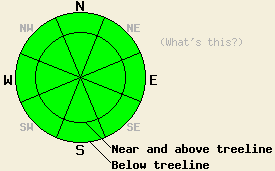
Avalanche danger is LOW for all elevations and aspects. Normal caution is advised. |
|
|
|
Moisture associated with the weather system that passed to the north of the forecast area yesterday tracked further south than expected. A short quick burst of snowfall occurred over the northern half of the forecast area during the early afternoon. New snow accumulation totaled less than one inch. Skies remained sunny with a few scattered clouds over the southern half of the forecast area yesterday. Ridgetop winds shifted to the east late yesterday afternoon as the weather system left the area and rapid clearing occurred. Ridgetop winds are expected to remain light to moderate in speed from the east today under sunny skies. An air temperature inversion is in place across the forecast area this morning.
Recent observations from the Bear Valley, Desolation Wilderness, West Shore Lake Tahoe, Donner Summit, and Mount Rose areas all indicate a generally stable snowpack at this time. Snow surface conditions consist mainly of melt-freeze snow and supportable wind affected snow. At higher elevations, a few isolated pockets of unconsolidated surface snow exist below treeline in wind protected areas.
Some melting of surface snow will occur today in sun exposed areas, with the exception of the highest peaks. Melting is also expected at lower elevations in shaded areas. Any wet snow instability that may occur is expected to be very small. This should not pose a significant threat to backcountry travelers. As always, use good travel habits to minimize risk.
| 0600 temperature: | 20 deg. F. |
| Max. temperature in the last 24 hours: | varied by location, 35 to 45 deg. F. |
| Average wind direction during the last 24 hours: | west shifting to east |
| Average wind speed during the last 24 hours: | 29 mph |
| Maximum wind gust in the last 24 hours: | 77 mph |
| New snowfall in the last 24 hours: | 0 to a trace inches |
| Total snow depth: | 62 inches |
For 7000-8000 ft: |
|||
| Friday: | Friday Night: | Saturday: | |
| Weather: | Sunny skies. | Clear skies. | Sunny skies. |
| Temperatures: | 32 to 39 deg. F. | 17 to 27 deg. F. | 40 to 47 deg. F. |
| Wind direction: | E | E | E |
| Wind speed: | 5 to 10 mph with gusts to 25 mph in the afternoon. | 10 to 15 mph with gusts to 25 mph. | Around 10 mph. |
| Expected snowfall: | O in. | O in. | O in. |
For 8000-9000 ft: |
|||
| Friday: | Friday Night: | Saturday: | |
| Weather: | Sunny skies. | Clear skies. | Sunny skies. |
| Temperatures: | 27 to 37 deg. F. | 23 to 33 deg. F. | 41 to 47 deg. F. |
| Wind direction: | E | E | NE |
| Wind speed: | 25 to 35 mph with gusts to 50 mph. | 20 to 30 mph with gusts to 50 mph. | 10 to 20 mph with gusts to 35 mph. |
| Expected snowfall: | O in. | O in. | O in. |


This website is owned and maintained by the non-profit arm of the Sierra Avalanche Center. Some of the content is updated by the USDA avalanche forecasters including the forecasts and some observational data. The USDA is not responsible for any advertising, fund-raising events/information, or sponsorship information, or other content not related to the forecasts and the data pertaining to the forecasts.

