In partnership with: 
|
January 12, 2009 at 7:56 am |
|
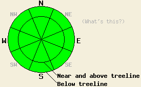
The avalanche danger is LOW for all elevations and aspects. Use normal caution. |
|
|
|
Sunny, warm, and windy weather will continue over the forecast area. Daytime highs should reach into the upper 40's and low 50's again today. Last night overnight lows dropped into the upper 20's and low 30's. They should do the same tonight. Cool east to northeast winds should continue today. These winds should be stronger during the day and start to decrease tonight. This sunny, dry, and breezy weather pattern should continue until the high pressure starts to move east later this week.
Observations near Carson Pass, on Castle Peak, on Mt. Judah, and in the Mt. Rose area continue to show a variety of wind affected snow, melt-freeze snow, supportable crusts, and breakable crusts on the surface in most areas. Only a few small pockets of unconsolidated snow still exist on higher elevation northerly, tree-covered aspects that are protected from wind and sun. Yesterday, some softening occurred on southerly aspects below 8800'. Unfortunately, snow cover on these aspects is limited, and large areas of dirt and rocks are still exposed. The surface snow that melted and softened yesterday refroze quickly by late afternoon. This refreeze should have continued last night due to radiational cooling and below freezing temperatures.
Snowpits continue to reveal pockets of depth hoar in some areas that had snow cover before the December storms. The strength and distribution of this weak layer varies greatly across the forecast area and even across a slope. Right now avalanche activity remains unlikely on this layer due to strong well-bonded snow on top of the depth hoar that should have enough strength to hold itself up. The current weather should allow this weak layer to gain some strength before the next storm cycle.
Today strong, cool northeast winds and the weak January sun will prevent the snow surface from softening and melting very much. These two factors combined with the prolonged melt-freeze cycle should keep wet snow avalanche activity unlikely today. On sun-exposed, southerly aspects below 8800' the top 1-2 inches of surface snow should soften due to daytime warming today. These surfaces will quickly refreeze as soon as they lose direct sun.
| 0600 temperature: | 29 deg. F. |
| Max. temperature in the last 24 hours: | 42 deg. F. |
| Average wind direction during the last 24 hours: | Northeast |
| Average wind speed during the last 24 hours: | 35-50 mph |
| Maximum wind gust in the last 24 hours: | 89 mph |
| New snowfall in the last 24 hours: | O inches |
| Total snow depth: | 60 inches |
For 7000-8000 ft: |
|||
| Monday: | Monday Night: | Tuesday: | |
| Weather: | Sunny | Clear | Sunny |
| Temperatures: | 46-53 deg. F. | 28-38 deg. F. | 50-57 deg. F. |
| Wind direction: | Northeast | East | East |
| Wind speed: | 15-25 mph with gusts to 35 mph | 10-20 mph with gusts to 30 mph | 10-15 mph with gusts to 35 mph |
| Expected snowfall: | O in. | O in. | O in. |
For 8000-9000 ft: |
|||
| Monday: | Monday Night: | Tuesday: | |
| Weather: | Sunny | Clear | Sunny |
| Temperatures: | 43-50 deg. F. | 30-40 deg. F. | 51-57 deg. F. |
| Wind direction: | Northeast | Northeast | North |
| Wind speed: | 30-40 mph with gusts to 70 mph decreasing to 20-30 mph with gusts to 50 mph in the afternoon | 15-25 mph with gusts to 40 mph | 15-25 mph with gusts to 40 mph |
| Expected snowfall: | O in. | O in. | O in. |


This website is owned and maintained by the non-profit arm of the Sierra Avalanche Center. Some of the content is updated by the USDA avalanche forecasters including the forecasts and some observational data. The USDA is not responsible for any advertising, fund-raising events/information, or sponsorship information, or other content not related to the forecasts and the data pertaining to the forecasts.

