In partnership with: 
|
January 13, 2009 at 7:51 am |
|
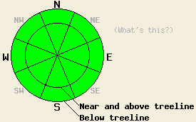
The avalanche danger is LOW for all elevations and aspects. Use normal caution. |
|
|
|
The high pressure ridge over the forecast area will continue to cause sunny, warm, and windy weather today. Remote sensors already indicate temperatures along the Sierra Crest in the high 30's to low 40's this morning. Daytime highs should reach into the upper 40's and low 50's by this afternoon. Overnight lows dropped below freezing, and they should do so again tonight. The easterly winds should start to decrease today as the high pressure starts to creep slowly east.
Yesterday observations near Carson Pass, near Castle Peak, and in the Mt. Rose area continue to show a variety of hard, wind-buffed snow, melt-freeze snow, supportable crusts, and breakable crusts on the surface in most areas. Even though temperatures did not reach the forecasted highs yesterday, the snow surface did soften on open, sun exposed, southerly aspects below 8800'. Unfortunately, these aspects also have the least amount of snow on them. Areas of dirt and rocks still exist on many open, southerly aspects. By late afternoon yesterday, the soft surface snow had started to refreeze. With last night's clear skies and below freezing temperatures, this refreeze should have continued.
Today the surface snow should soften again on open, sun-exposed, southerly aspects below 8800' due to daytime warming. These surfaces will quickly refreeze as soon as they lose direct sun. The cool northeast winds and the weak January sun combined with the prolonged melt-freeze cycle should keep wet snow avalanche activity unlikely today.
| 0600 temperature: | 35-38 deg. F. |
| Max. temperature in the last 24 hours: | 38-42 deg. F. |
| Average wind direction during the last 24 hours: | East northeast |
| Average wind speed during the last 24 hours: | 35-40 mph |
| Maximum wind gust in the last 24 hours: | 81 mph |
| New snowfall in the last 24 hours: | O inches |
| Total snow depth: | 60 inches |
For 7000-8000 ft: |
|||
| Tuesday: | Tuesday Night: | Wednesday: | |
| Weather: | Sunny | Clear | Sunny |
| Temperatures: | 46-56 deg. F. | 25-35 deg. F. | 46-56 deg. F. |
| Wind direction: | East | East | East |
| Wind speed: | 10-15 mph with gusts to 30 mph | 10-15 mph | 10-15 mph |
| Expected snowfall: | O in. | O in. | O in. |
For 8000-9000 ft: |
|||
| Tuesday: | Tuesday Night: | Wednesday: | |
| Weather: | Sunny | Clear | Sunny |
| Temperatures: | 42-52 deg. F. | 31-41 deg. F. | 42-53 deg. F. |
| Wind direction: | East | Northeast | Northeast |
| Wind speed: | 20-30 mph with gusts to 45 mph | 15-25 mph with gusts to 45 mph | 15-25 mph with gusts to 40 mph |
| Expected snowfall: | O in. | O in. | O in. |


This website is owned and maintained by the non-profit arm of the Sierra Avalanche Center. Some of the content is updated by the USDA avalanche forecasters including the forecasts and some observational data. The USDA is not responsible for any advertising, fund-raising events/information, or sponsorship information, or other content not related to the forecasts and the data pertaining to the forecasts.

