In partnership with: 
|
January 31, 2009 at 7:59 am |
|
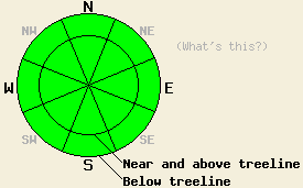
The avalanche danger is LOW for all elevations and aspects. Use normal caution when traveling in the backcountry. |
|
|
|
Today the forecast calls for highs in the mid 40's at all elevations. As a storm system moves across the northern US the northerly winds should increase across the forecast area this afternoon. This system should also push some colder temperatures into the forecast area this evening. These cooler temperatures and stronger winds should remain through Sunday before the high pressure ridge returns and increases the temperatures again on Monday.
Snowpit data from across the forecast area since the end of the last storm shows good bonding within layers in the recent snow and between the recent snow and the previous hard snow surfaces. In the Mt. Rose area, the Echo Summit area, and on Rubicon Peak, observers report the formation of faceted snow grains both on the surface and within the recent snow. Isolated patches of surface hoar have also formed in some areas. Both of these weak layers will not pose a threat to backcountry travelers until new snow falls on top of them. By the time the next storm reaches the forecast area the springlike weather may have destroyed these layers. Overall observations indicate that the snowpack is gaining some strength during this period of calm, mild weather. East winds have continued to affect the exposed N-NE-E aspects leaving a mix of hard, wind-scoured surfaces, crusts, and unconsolidated snow on these slopes. Warm temperatures and sunny skies have created breakable melt/freeze and sun crusts on the southerly aspects below 8800'. Several inches of soft, unconsolidated snow still remains on NW-N-NE-E aspects that are protected from the sun and wind.
Slab avalanche activity will remain unlikely but not impossible today. Cool northerly winds, below freezing temperatures overnight, the weak January sun, and prolonged gradual warming should prevent widespread wet snow instabilities from forming again today. Some small, isolated pinwheels and point-release sluffs may occur due to human triggering or daytime warming on sun exposed southerly aspects steeper than 37 degrees. While they should not entrain enough snow to bury a person, they could be large enough to push a person off-balance. If this happens in the wrong place like above a large cliff, it could have dangerous consequences. Be aware of the surroundings. Use caution and safe travel to minimize risks.
The avalanche danger is LOW for all elevations and aspects. Use normal caution when traveling in the backcountry.
| 0600 temperature: | 32 deg. F. |
| Max. temperature in the last 24 hours: | 44 deg. F. |
| Average wind direction during the last 24 hours: | East shifting to west overnight then back to east this morning |
| Average wind speed during the last 24 hours: | 17 mph |
| Maximum wind gust in the last 24 hours: | 53 mph |
| New snowfall in the last 24 hours: | O inches |
| Total snow depth: | 69 inches |
For 7000-8000 ft: |
|||
| Saturday: | Saturday Night: | Sunday: | |
| Weather: | Sunny | Clear | Sunny |
| Temperatures: | 40-47 deg. F. | 22-28 deg. F. | 37-44 deg. F. |
| Wind direction: | Northwest | North shifting to the west after midnight | North |
| Wind speed: | 10 mph with gusts to 25 mph in the afternoon | 10 mph with gusts to 25 mph | 10-15 mph with gusts to 30 mph increasing to gusts to 40 mph in the afternoon |
| Expected snowfall: | O in. | O in. | O in. |
For 8000-9000 ft: |
|||
| Saturday: | Saturday Night: | Sunday: | |
| Weather: | Sunny | Clear | Sunny |
| Temperatures: | 40-46 deg. F. | 19-26 deg. F. | 32-39 deg. F. |
| Wind direction: | Northwest | North | North |
| Wind speed: | 10-15 mph with gusts to 30 mph increasing to gusts to 40 mph this afternoon | 10-20 mph with gusts to 40 mph increasing to 20-30 mph with gusts to 50 mph after midnight | 20-30 mph with gusts to 55 mph decreasing to gusts to 40 mph in the afternoon |
| Expected snowfall: | O in. | O in. | O in. |


This website is owned and maintained by the non-profit arm of the Sierra Avalanche Center. Some of the content is updated by the USDA avalanche forecasters including the forecasts and some observational data. The USDA is not responsible for any advertising, fund-raising events/information, or sponsorship information, or other content not related to the forecasts and the data pertaining to the forecasts.

