In partnership with: 
|
March 11, 2009 at 6:46 am |
|
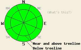
Avalanche danger is LOW for all elevations and aspects. A very isolated human triggered hard slab avalanche is unlikely but not impossible today above treeline. Normal caution is advised. |
|
|
|
High pressure is in place over the forecast area this morning. Plenty of sunshine with air temperatures warming into the upper 20s and 30s is expected today. Ridgetop winds shifted from NE to W overnight and remain light this morning. Ridgetop winds are expected to shift to SE and increase to moderate in speed this afternoon as a weather disturbance passes to the south of our area.
Yesterday, observations made on Silver Peak (North of Squaw Peak) and on Dick's Peak (Desolation Wilderness Area) both indicated a generally stable snowpack. Stability tests performed on Silver Peak at 8,000' on a N aspect 32 degree slope near treeline revealed moderate to hard force shears. This occurred within the upper foot of the snowpack on a slight density change at the bottom of the surface slab. Further tests indicated that fracture propagation was unlikely on this relative weak layer. On Dick's Peak, some isolated and inconsistent minor cracking was observed above treeline in recently wind loaded areas. In general, the hurricane force SW winds from March 7-8 created high density snow surfaces in all wind exposed areas near and above treeline. Areas of unconsolidated surface snow linger on wind sheltered N aspects below treeline. Surface crusts exist in most sun exposed areas.
Today, a stable snowpack will exist in the vast majority of areas. A very isolated human triggered hard slab avalanche is unlikely but not impossible today above treeline on a steep N-NE aspect. Any areas of hard slab that sound hollow when traversed over should be avoided. Use good travel habits to minimize risk.
Avalanche danger is LOW for all elevations and aspects. A very isolated human triggered hard slab avalanche is unlikely but not impossible today above treeline. Normal caution is advised.
| 0600 temperature: | 22 to 25 deg. F. |
| Max. temperature in the last 24 hours: | 35 to 40 deg. F. |
| Average wind direction during the last 24 hours: | NE shifting to W |
| Average wind speed during the last 24 hours: | 5 mph |
| Maximum wind gust in the last 24 hours: | 28 mph |
| New snowfall in the last 24 hours: | O inches |
| Total snow depth: | 148 inches |
For 7000-8000 ft: |
|||
| Wednesday: | Wednesday Night: | Thursday: | |
| Weather: | Partly cloudy skies. | Partly cloudy skies. | Partly cloudy skies with a slight chance of snow showers. |
| Temperatures: | 29 to 36 deg. F. | 15 to 23 deg. F. | 33 to 40 deg. F. |
| Wind direction: | W shifting to SE | E | E |
| Wind speed: | Light winds. | Around 10 mph. | Around 10 mph. |
| Expected snowfall: | O in. | O in. | 0 to trace in. |
For 8000-9000 ft: |
|||
| Wednesday: | Wednesday Night: | Thursday: | |
| Weather: | Partly cloudy skies. | Partly cloudy skies. | Partly cloudy skies with a slight chance of snow showers. |
| Temperatures: | 28 to 34 deg. F. | 14 to 21 deg. F. | 32 to 38 deg. F. |
| Wind direction: | W shifting to SE | E | E |
| Wind speed: | Increasing to 10 to 15 mph with gusts to 25 mph in the afternoon. | 10 to 15 mph | 10 to 15 mph with gusts to 25 mph. |
| Expected snowfall: | O in. | O in. | 0 to trace in. |


This website is owned and maintained by the non-profit arm of the Sierra Avalanche Center. Some of the content is updated by the USDA avalanche forecasters including the forecasts and some observational data. The USDA is not responsible for any advertising, fund-raising events/information, or sponsorship information, or other content not related to the forecasts and the data pertaining to the forecasts.

