In partnership with: 
|
December 28, 2009 at 8:02 am |
|
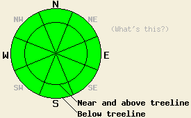
LOW avalanche danger exists at all elevations and on all aspects. LOW danger does not mean no danger. Even though avalanche activity is unlikely today, it is not impossible. Use normal caution when travelling in the backcountry. |
|
|
|
Yesterday, 2-4 inches of snow accumulated across the forecast area during the day. By yesterday afternoon most of the show showers had stopped, and the southwest winds started to decrease and shift to the east and southeast. The winds remain light out of the south-southeast this morning. A low pressure system off the west coast will keep cloudy skies and snow flurries over the forecast area today. A second low pressure system should start to impact the forecast area tomorrow afternoon. The forecast calls for cloud cover and southwest winds to increase. This second system should bring more snow to the area starting Tuesday night.
Yesterday observations from Mt. Judah showed some cracking near newly-formed cornices and in newly-formed wind-slabs. In the Mt. Rose backcountry (photo and video), a ski-cut triggered a small, soft-slab avalanche on a 35-degree, wind-loaded, NE test-slope. This soft-slab was about 35 ft wide and with a crown of 4-12 inches. Other less wind-loaded slopes nearby did not react to a skier's weight. No other avalanche activity was reported. This slide ran on a weakness within the new snow. Observations in both of these areas showed a variety of riding conditions. On exposed N-NE-E aspects the new snow fell on top of wind-scoured surfaces creating "dust-on-crust" conditions. On more sheltered northerly aspects the new snow landed on unconsolidated snow from the last storm. In the Mt Judah area a breakable crust existed under the new snow in some areas. Snowpits on sheltered slopes in these areas also showed that the persistent weak layer (Oct 19th facets) near the base of the snowpack is gaining strength. Recent observations from across the forecast area indicate that the strength and distribution of this layer remains variable. Most recent observations also indicate that the strong, well-consolidated snow above the facets makes failure of this layer due to human-triggering unlikely.
Avalanche concern #1:
Most of the wind-slabs that formed yesterday are small and shallow due to yesterday's limited snow accumulation. The light winds should keep them from growing today. These slabs should stabilize quickly. Dangerous avalanche activity resulting from failure of these wind slabs is unlikely today. However, a few small, isolated pockets of instability may still exist above treeline on the most heavily wind-loaded N-NE-E aspects steeper than 35 degrees.
Avalanche concern #2:
Deep-slab avalanche activity on sheltered NW-N-NE aspects below treeline above 8,000 ft. where old persistent weak layers exist remains unlikely but not impossible. In the unlikely event that avalanche activity does occur due to failure of this layer, the resulting avalanches will release without warning with crowns of 2-4 ft deep. These large avalanches would have dire consequences for those who triggered them. The uncertainty surrounding this layer's strength and distribution make stability evaluations on slopes with this layer unreliable and difficult.
LOW avalanche danger exists at all elevations and on all aspects. LOW danger does not mean no danger. Even though avalanche activity is unlikely today, it is not impossible. Use normal caution when travelling in the backcountry.
| 0600 temperature: | 20 deg. F. |
| Max. temperature in the last 24 hours: | 26 deg. F. |
| Average wind direction during the last 24 hours: | Southwest until 5 pm yesterday then shifting the the east and southeast overnight. |
| Average wind speed during the last 24 hours: | 17 mph until 5 pm yesterday then decreasing to 10 mph |
| Maximum wind gust in the last 24 hours: | 37 mph |
| New snowfall in the last 24 hours: | 2-4 inches |
| Total snow depth: | 34-55 inches |
For 7000-8000 ft: |
|||
| Monday: | Monday Night: | Tuesday: | |
| Weather: | Cloudy with a chance of snow showers. | Cloudy with a chance of snow. | Mostly cloudy in the morning. Cloudy with a chance of snow in the afternoon. |
| Temperatures: | 24-31 deg. F. | 13-20 deg. F. | 24-31 deg. F. |
| Wind direction: | South | Variable | Southwest |
| Wind speed: | 10 mph | Light | 10-20 mph with gusts to 30 mph |
| Expected snowfall: | trace to .5 in. | up to 1 in. | trace to .5 in. |
For 8000-9000 ft: |
|||
| Monday: | Monday Night: | Tuesday: | |
| Weather: | Cloudy with a chance of snow showers. | Cloudy with a chance of snow. | Mostly cloudy in the morning. Cloudy with a chance of snow in the afternoon. |
| Temperatures: | 18-25 deg. F. | 10-17 deg. F. | 20-28 deg. F. |
| Wind direction: | South | Southwest | West shifting to southwest in the afternoon |
| Wind speed: | 10-15 mph | 10-15 mph with gusts to 25 mph after midnight | 15-25 mph with gusts to 35 mph increasing to 25-35 mph with gusts to 55 mph in the afternoon |
| Expected snowfall: | trace to .5 in. | up to 2 in. | trace to .5 in. |


This website is owned and maintained by the non-profit arm of the Sierra Avalanche Center. Some of the content is updated by the USDA avalanche forecasters including the forecasts and some observational data. The USDA is not responsible for any advertising, fund-raising events/information, or sponsorship information, or other content not related to the forecasts and the data pertaining to the forecasts.

