In partnership with: 
|
January 10, 2010 at 8:00 am |
|
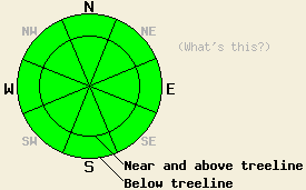
Avalanche danger is LOW for all elevations and aspects. Normal caution is advised. |
|
|
|
A break in the weather will bring party cloudy skies, light winds, and more above freezing air temperatures to the forecast area by this afternoon. A small amount of precipitation fell over the forecast area yesterday evening with around 0.1 inches of rain up to 8,300' to 9,200' depending on location. A trace to 1 inch of new snow is expected to have accumulated above 9,200'. Ridgetop winds have remained light out of the southwest for the past 24 hours. Winds are expected to remain light and shift to the south today. An air temperature inversion is in place this morning with fog and below freezing temperatures in many of the mountain valleys. Remote sensors in the 7,000' to 8,000' zone are reporting above freezing air temperatures in most locations this morning. A more significant storm system is expected to impact the forecast area on Tuesday.
A stable snowpack exists throughout the forecast area at this time. Observations from around the forecast area over the past two weeks have seen significant rounding and strengthening of the all portions of the snowpack in nearly all areas. When persistent crystal types such as facets exist, a few isolated areas of slower stabilization are expected. This was seen in observations made yesterday in Upper Ophir Creek (Mount Rose area) near treeline at 9,190' on a N aspect 28 degree slope where the October 19 facet layer persists in a well developed state (pit profile, photo, and videos). This has not been seen in other areas since mid to late December.
Avalanche concerns:
Avalanche activity occurring on the October 19 layer is highly unlikely at this time. With the persistence of faceted crystals in this layer in a few isolated areas, continued monitoring is needed to determine if future significant new loading from snow or rain may reawaken this deep slab instability. Snow surface conditions are in a melt freeze state on all aspects, especially below 9,100' throughout the forecast area. Significant wet snow instability is unlikely at this time.
| 0600 temperature: | 29 to 33 deg. F. |
| Max. temperature in the last 24 hours: | 43 to 45 deg. F. |
| Average wind direction during the last 24 hours: | Southwest |
| Average wind speed during the last 24 hours: | 20 mph |
| Maximum wind gust in the last 24 hours: | 31 mph |
| New snowfall in the last 24 hours: | O inches |
| Total snow depth: | 35 to 59 inches |
For 7000-8000 ft: |
|||
| Sunday: | Sunday Night: | Monday: | |
| Weather: | Mostly cloudy skies in the morning, becoming partly cloudy. | Mostly cloudy skies. | Mostly cloudy skies. |
| Temperatures: | 37 to 44 deg. F. | 22 to 29 deg. F. | 40 to 47 deg. F. |
| Wind direction: | S | S | S |
| Wind speed: | Light winds | Light winds increasing to around 10 mph after midnight. | Up to 10 mph in the morning. Winds increasing to 10 to 15 mph with gusts to 25 mph in the afternoon. |
| Expected snowfall: | O in. | O in. | O in. |
For 8000-9000 ft: |
|||
| Sunday: | Sunday Night: | Monday: | |
| Weather: | Mostly cloudy skies in the morning, becoming partly cloudy. | Mostly cloudy skies. | Mostly cloudy skies. |
| Temperatures: | 37 to 43 deg. F. | 22 to 29 deg. F. | 37 to 44 deg. F. |
| Wind direction: | S | S | SW |
| Wind speed: | Around 10 mph in the morning, becoming light. | Light winds increasing to around 10 mph after midnight. | 20 to 30 mph with gusts to 40 mph. Gusts increasing to 50 mph in the afternoon. |
| Expected snowfall: | O in. | O in. | O in. |


This website is owned and maintained by the non-profit arm of the Sierra Avalanche Center. Some of the content is updated by the USDA avalanche forecasters including the forecasts and some observational data. The USDA is not responsible for any advertising, fund-raising events/information, or sponsorship information, or other content not related to the forecasts and the data pertaining to the forecasts.

