In partnership with: 
|
February 20, 2010 at 7:57 am |
|
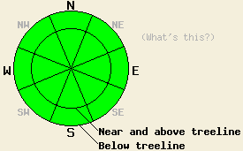
The avalanche danger will remain LOW for all elevations and aspects today. Expect the avalanche danger to increase over the 24 hours if the forecasted snow impacts the Central Sierra. |
|
|
|
The low-pressure off the west coast tracked farther south than originally predicted, and most of the snow and moisture went with it leaving only a trace to 1 inch of snow across the forecast area over the last 24 hours. A second low-pressure moving southwest from ID/MT should start to impact the forecast area this afternoon and should bring some snow to the area tonight and tomorrow. The forecast calls for 5-11 inches of accumulation by tomorrow afternoon above 7000'. This low-pressure should also bring colder temperatures to the region over the next 24 hrs. The winds associated with this system should shift to the west and remain moderate through tomorrow.
Yesterday observations on Mt. Judah indicated a mostly stable snowpack. The areas of melt-freeze snow had undergone a solid overnight refreeze and remained firm throughout the day. Some pockets of shallow, soft snow still remained on the sheltered northerly aspects. On most of the northerly slopes a breakable melt-freeze crust with a thin layer of weak, sugary snow beneath it existed up to 8000'. A layer of surface hoar also had formed on the open northerly aspects and remained intact as of 4pm yesterday all the way to the summit of Mt. Judah (photo). With less wind than normal forecasted, this layer could get buried and turn into a worrisome weak layer. Other observations this week point to a mostly stable snowpack with a variety of surface conditions across the forecast area.
Avalanche Concerns:
Continued refreezing of the melt-freeze snow, continued consolidation and settlement in the snowpack, and very little new snow in the last 24 hrs should keep any avalanche activity involving the current snowpack unlikely today. As the snow starts to accumulate over the weekend, new slabs will start to from on top a variety of old snow surfaces ranging from frozen crusts to surface hoar to soft, unconsolidated snow. Any of these old surfaces could act as weak layer. Expect the avalanche danger to increase as new snow accumulates over the next 24 hours. How much the danger increases will depend on how much new snow actually falls and how well it bonds to those old snow surfaces.
The avalanche danger will remain LOW for all elevations and aspects today. Expect the avalanche danger to increase over the 24 hours if the forecasted snow impacts the Central Sierra.
| 0600 temperature: | 20 deg. F. |
| Max. temperature in the last 24 hours: | 31 deg. F. |
| Average wind direction during the last 24 hours: | Southwest shifting to northeast last night |
| Average wind speed during the last 24 hours: | Southwest: 10 mph | Northeast: 0-5 mph mph |
| Maximum wind gust in the last 24 hours: | 35 mph |
| New snowfall in the last 24 hours: | 1 inches |
| Total snow depth: | 66-102 inches |
For 7000-8000 ft: |
|||
| Saturday: | Saturday Night: | Sunday: | |
| Weather: | Mostly cloudy with isolated snow showers in the morning. Snow showers should become slightly more widespread this afternoon. 30% chance of precipitation. | Cloudy with a 60% chance of snow showers. | 70% chance of snow. |
| Temperatures: | 29-36 deg. F. | 12-19 deg. F. | 23-30 deg. F. |
| Wind direction: | Southwest shifting to the west | West | West |
| Wind speed: | Light this morning increasing to 10 mph with gusts to 25 mph this afternoon | 10-15 mph with gusts to 30 mph | 10 mph with gusts to 25 mph |
| Expected snowfall: | trace in. | 2-4 in. | 3-6 in. |
For 8000-9000 ft: |
|||
| Saturday: | Saturday Night: | Sunday: | |
| Weather: | Mostly cloudy with isolated snow showers in the morning. Snow showers should become slightly more widespread this afternoon. 30% chance of precipitation. | Cloudy with a 60% chance of snow showers. | 70% chance of snow. |
| Temperatures: | 27-33 deg. F. | 11-17 deg. F. | 21-27 deg. F. |
| Wind direction: | Southwest shifting to the west | Southwest | West |
| Wind speed: | 10 mph with gusts to 30 mph | 10-20 mph with gusts to 40 mph | 10-15 mph with gusts to 45 mph decreasing to 35 mph in the afternoon |
| Expected snowfall: | trace in. | 2-4 in. | 3-7 in. |


This website is owned and maintained by the non-profit arm of the Sierra Avalanche Center. Some of the content is updated by the USDA avalanche forecasters including the forecasts and some observational data. The USDA is not responsible for any advertising, fund-raising events/information, or sponsorship information, or other content not related to the forecasts and the data pertaining to the forecasts.

