In partnership with: 
|
January 15, 2011 at 7:30 am |
|
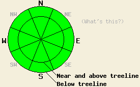
Avalanche danger is LOW for all elevations and aspects. Normal caution is advised. |
|
|
|
High pressure parked offshore will keep the storm track passing to the north of the forecast area for the next several days. Expect warm air temperatures and high clouds for most locations. A slight chance of showers exists tonight over the far northern portion of the forecast area. A strong air temperature inversion is in place this morning with above freezing air temperatures in the mid 30s to low 40s for areas above 6,500'. Ridgetop winds shifted to the northeast yesterday and remain moderate in speed this morning. Winds are expected to shift to the northwest to west today with light to moderate speed over the ridgetops.
Observations made yesterday revealed that the surface rain crust that formed on Thursday reaches to at least 8,700' in the Ebbetts Pass area. This rain crust was noted as up to 3 inches thick in the Donner Summit area (pit profile, video, more info) and less than one inch thick in the Bear Valley area (pit profile, more info). In areas where this rain crust exists, it is adding strength to the upper couple feet of the snowpack, keeping any instability to a minimum. In most areas this rain crust is breakable under the weight of a person. In a few areas it has been reported as supportable. We have yet to make or receive any observations from above the elevation of this newly formed rain crust.
Avalanche Concerns:
In areas above 9,000', slabs of recent storm snow may exist. Lingering instability in these areas is unlikely, but certainly not impossible given the lack post rain crust formation field data from the highest elevation areas. Warm air temperatures are expected to have allowed any areas of recent storm snow to settle and bond to itself and the old snow surface below. Any areas of lingering instability are expected to be small and limited to N-NE aspects at the highest elevations. Avalanche concerns for today in areas where the rain crust that formed on Thursday covers the snow surface are very minimal at best.
| 0600 temperature: | 34 to 42 deg. F. |
| Max. temperature in the last 24 hours: | 34 to 42 deg. F. |
| Average wind direction during the last 24 hours: | Northeast |
| Average wind speed during the last 24 hours: | 25 mph |
| Maximum wind gust in the last 24 hours: | 41 mph |
| New snowfall in the last 24 hours: | O inches |
| Total snow depth: | 67 to 97 inches |
For 7000-8000 ft: |
|||
| Saturday: | Saturday Night: | Sunday: | |
| Weather: | Variable high clouds. | Mostly cloudy skies with isolated showers in the north. | Mostly cloudy skies (high clouds). |
| Temperatures: | 45 to 52 deg. F. | 35 to 40 deg. F. | 47 to 53 deg. F. |
| Wind direction: | W to NW | W | W |
| Wind speed: | Around 10 mph in the morning. 10 to 15 mph with gusts to 25 mph in the afternoon. | 10 to 20 mph with gusts to 30 mph. | 10 to 20 mph with gusts to 30 mph. Winds descreasing to around 10 mph with gusts to 20 mph in the afternoon. |
| Expected snowfall: | O in. | O in. | O in. |
For 8000-9000 ft: |
|||
| Saturday: | Saturday Night: | Sunday: | |
| Weather: | Variable high clouds. | Mostly cloudy skies with isolated showers in the north. | Mostly cloudy skies (high clouds). |
| Temperatures: | 39 to 45 deg. F. | 33 to 38 deg. F. | 42 to 47 deg. F. |
| Wind direction: | W to NW | NW | NW |
| Wind speed: | 15 to 25 mph with gusts to 40 mph. | 20 to 30 mph with gusts to 35 mph in the evening. Gusts increasing to 50 mph overnight. | 20 to 30 mph with gusts to 60 mph in the morning. Winds decreasing to 15 to 20 mph with gusts to 40 mph. |
| Expected snowfall: | O in. | O in. | O in. |


This website is owned and maintained by the non-profit arm of the Sierra Avalanche Center. Some of the content is updated by the USDA avalanche forecasters including the forecasts and some observational data. The USDA is not responsible for any advertising, fund-raising events/information, or sponsorship information, or other content not related to the forecasts and the data pertaining to the forecasts.

