In partnership with: 
|
February 7, 2011 at 7:32 am |
|
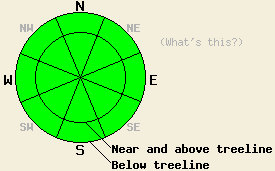
Avalanche danger is LOW for all elevations and aspects. Normal caution is advised. |
|
|
|
A brief change in the weather is in store for the next couple of days. A cold front is expected to pass from north to south through the forecast area this afternoon and evening. Cloud cover and wind speeds will increase today ahead of the approaching cold front. Ridgetop winds shifted from east to west overnight in response to the approaching cold front. Winds speeds are in the light to moderate range this morning but are forecast to increase to strong to gale force later today. An air temperature inversion is in place this morning with below freezing air temperatures near the mountain valley floors and above freezing air temperatures in most other locations. Maximum daytime air temperatures on Tuesday are expected to be around 20 degrees colder than today. A slight chance of upslope snow showers are possible Tuesday with little to no accumulation.
Observations made yesterday on Incline Lake Peak (Mount Rose area) matched well with other recent observations from around the forecast area. On the northerly aspects, cold unconsolidated snow remained in wind protected areas while NE-E aspects above treeline were heavily wind scoured. On southerly aspects storm snow from Jan 30 has assimilated well with previous melt-freeze snow in this area. An isolated and very minor skier triggered wet loose snow surface sluff was observed at 1pm on an open SSE aspect at 9,000'. This sluff was small, slow moving, and was not a significant hazard to backcountry travel (photo, more info). No evidence of unstable wind slabs on northerly aspects were observed in this area.
Avalanche concerns:
Avalanche concerns for today are few. Some melting of surface snow will occur today on southerly aspects, especially at lower elevations. However, increasing cloud cover and increasing west winds will greatly reduce the amount incoming long wave solar radiation and will increase the convective cooling on the snow surface on southerly aspects. This will reduce the amount of snow surface melting as compaired to the past two days. As a result, wet snow instability is not expected today.
Concern for winds slabs that formed over the past week is decreasing as time passes and the snowpack has more and more time to stabilize. Cross loaded NW-N aspects where the bonds between the slab and the snow below have been slower to stabilize have remained the areas of concern. In the vast majority of locations observed, these slabs were too small and disconnected to provide a significant hazard to backcountry travelers. Areas where it is reasonable to think that a human triggered avalanche is anything beyond unlikely are becoming increasingly few and far between.
| 0600 temperature: | 31 to 37 deg. F. |
| Max. temperature in the last 24 hours: | 41 to 46 deg. F. |
| Average wind direction during the last 24 hours: | East shifting to west |
| Average wind speed during the last 24 hours: | 30 mph |
| Maximum wind gust in the last 24 hours: | 71 mph |
| New snowfall in the last 24 hours: | O inches |
| Total snow depth: | 59 to 86 inches |
For 7000-8000 ft: |
|||
| Monday: | Monday Night: | Tuesday: | |
| Weather: | Mostly cloudy skies. | Partly cloudy skies. | Partly cloudy skies. |
| Temperatures: | 42 to 49 deg. F. | 12 to 19 deg. F. | 23 to 30 deg. F. |
| Wind direction: | W | W | NE |
| Wind speed: | 10 to 15 mph with gusts to 35 mph. Gusts increasing to 50 mph in the afternoon. | 10 to 20 mph with gusts to 55 mph. Gusts decreasing to 45 mph after midnight. | 10 to 15 mph with gusts to 35 mph. |
| Expected snowfall: | O in. | O in. | O in. |
For 8000-9000 ft: |
|||
| Monday: | Monday Night: | Tuesday: | |
| Weather: | Mostly cloudy skies. | Partly cloudy skies. | Partly cloudy skies with a slight chance of snow showers. |
| Temperatures: | 36 to 43 deg. F. | 10 to 17 deg. F. | 18 to 25 deg. F. |
| Wind direction: | W | NW shifting to N | NE |
| Wind speed: | 30 to 40 mph with gusts to 55 mph. Winds increasing to 35 to 50 mph with gusts to 70 mph in the afternoon. | 35 to 50 mph with gusts to 65 mph. Winds decreasing to 30 to 40 mph with gusts to 55 mph after midnight. | 25 to 40 mph with gusts to 55 mph. |
| Expected snowfall: | O in. | O in. | 0 to trace in. |


This website is owned and maintained by the non-profit arm of the Sierra Avalanche Center. Some of the content is updated by the USDA avalanche forecasters including the forecasts and some observational data. The USDA is not responsible for any advertising, fund-raising events/information, or sponsorship information, or other content not related to the forecasts and the data pertaining to the forecasts.

