In partnership with: 
|
February 9, 2011 at 7:56 am |
|
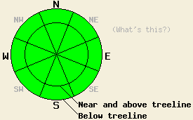
The avalanche danger remains LOW for all elevations and aspects. Please use normal caution while traveling in the backcountry. |
|
|
|
The forecast calls for a mostly sunny but cold day today with daytime highs only forecasted to reach into the mid 20's above 7000 ft. The east winds should continue today as well. By this evening these winds should start to decrease as a high pressure ridge builds over the forecast area. This ridge should allow temperatures to start warming back up over the next few days.
A mix of surface crusts, wind scoured surfaces, and some areas of softer snow comprises the snow surface across the forecast area. On Echo Peak yesterday, the N-NE aspects held a thin, breakable crust, while mostly firm melt-freeze conditions existed on the more sun exposed aspects. Some shallow (about 1 inch), short-lived softening did occur on S-SW aspects by mid afternoon. Farther north in Ward Canyon (photos and video) and on Lincoln Ridge strong winds had scoured the exposed N-NE-E aspects near and above treeline leaving behind firm crusts. The solar aspects in these areas held firm melt-freeze crusts that showed no signs of softening due to more widespread, longer-lasting cloud cover. On the more sheltered N aspects in these areas, about 3-6 inches of softer snow remained. On Lincoln Ridge a thin, breakable crust similar to the ones on Echo Peak existed up to 7400 ft on the N-NE-E aspects. Stability tests and general observations in all three of these areas showed a mostly stable snowpack.
Avalanche Concerns:
Avalanche activity will remain unlikely today. The snowpack continues to gain strength and shows very few if any signs of lingering instabilities. Due to the lack of snow available for transport, no new wind loading has occurred for several days even though several strong wind events have happened. With temperatures forecasted to remain well below freezing today, not enough melting will occur for wet snow instabilities to form. Any instabilities that do exist in the forecast area should remain extremely isolated. Even though avalanches remain unlikely, they are not impossible. Continue to evaluate slopes carefully before committing to them and travel with caution in the backcountry.
The avalanche danger remains LOW for all elevations and aspects. Please use normal caution while traveling in the backcountry.
| 0600 temperature: | 11-13 deg. F. |
| Max. temperature in the last 24 hours: | 15-22 deg. F. |
| Average wind direction during the last 24 hours: | East |
| Average wind speed during the last 24 hours: | 35-45 mph |
| Maximum wind gust in the last 24 hours: | 82 mph |
| New snowfall in the last 24 hours: | O inches |
| Total snow depth: | 59-86 inches |
For 7000-8000 ft: |
|||
| Wednesday: | Wednesday Night: | Thursday: | |
| Weather: | Sunny | Clear | Sunny |
| Temperatures: | 24-31 deg. F. | 14-22 deg. F. | 35-42 deg. F. |
| Wind direction: | East | East | East |
| Wind speed: | 10 mph with gusts to 30 mph | 10-15 mph with gusts to 30 mph | 10 mph with gusts to 25 mph becoming light in the afternoon |
| Expected snowfall: | O in. | O in. | O in. |
For 8000-9000 ft: |
|||
| Wednesday: | Wednesday Night: | Thursday: | |
| Weather: | Sunny | Clear | Sunny |
| Temperatures: | 20-27 deg. F. | 20-26 deg. F. | 31-38 deg. F. |
| Wind direction: | East | East | East |
| Wind speed: | 20-30 mph with gusts to 50 mph decreasing to 40 mph in the afternoon | 20-30 mph with gusts to 40 mph decreasing to 15-20 mph with gusts to 30 mph after midnight | 10-15 mph with gusts to 25 mph |
| Expected snowfall: | O in. | O in. | O in. |


This website is owned and maintained by the non-profit arm of the Sierra Avalanche Center. Some of the content is updated by the USDA avalanche forecasters including the forecasts and some observational data. The USDA is not responsible for any advertising, fund-raising events/information, or sponsorship information, or other content not related to the forecasts and the data pertaining to the forecasts.

