In partnership with: 
|
February 12, 2011 at 7:37 am |
|
Avalanche danger remains LOW on all elevations and aspects. Normal caution is advised. |
|
|
|
High pressure remains in place over the forecast area this weekend. A weather system passing to the north caused ridgetop winds to shift from east to west overnight. Wind speeds are moderate this morning. Increasing southwest winds are expected to continue through the weekend. An air temperature inversion is in place this morning with above freezing air temperatures in most locations above the mountain valley floors. A fair bit of warming is expected today with most locations above 7,000' warming into the upper 30s to upper 40s. Just past this weekend a well advertised storm system is expected to impact the area.
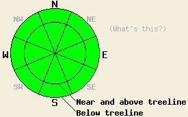
Recent observations from around the forecast area show a mostly stable snowpack with a mix of melt-freeze conditions, wind scoured surfaces, breakable crusts, and some isolated patches of softer snow. The vast majority of daily melt freeze is focused on sun-exposed SE-S-SW aspects. The exposed N-NE-E aspects near and above treeline hold firm, uneven, wind-scoured surfaces in nearly all areas. Isolated patches of softer snow only remain on the sheltered upper elevation N aspects below treeline. Stability tests and hand pits continue to show a strengthening trend in the snowpack. These tests and observations have shown that the facets below the old crust in the upper portion of the snowpack on northerly aspects have undergone the process of rounding and are gaining strength.
Avalanche concerns:
A solid overnight refreeze under clear skies and radiational cooling occurred last night. Avalanche concerns for today are limited to small human triggered wet loose snow sluffs that may occur during the afternoon hours on steep SE-S-SW aspects. Any wet snow avalanches that occur today are only expected to pose a significant threat to backcountry travelers if secondary terrain hazards are involved such as terrain traps or cliff areas that would greatly increase the consequences of being pushed around by a wet loose snow sluff. Despite increasing southwest winds, very little to no snow is available for wind transport making the formation of any new wind slabs very unlikely.
Avalanche danger remains LOW on all elevations and aspects. Normal caution is advised.
| 0600 temperature: | 35 to 37 deg. F. |
| Max. temperature in the last 24 hours: | 39 to 47 deg. F. |
| Average wind direction during the last 24 hours: | East shifting to west |
| Average wind speed during the last 24 hours: | 25 mph |
| Maximum wind gust in the last 24 hours: | 42 mph |
| New snowfall in the last 24 hours: | O inches |
| Total snow depth: | 58 to 84 inches |
For 7000-8000 ft: |
|||
| Saturday: | Saturday Night: | Sunday: | |
| Weather: | Sunny skies. | Partly cloudy skies. | Sunny skies in the morning, becoming partly cloudy. |
| Temperatures: | 42 to 50 deg. F. | 26 to 36 deg. F. | 44 to 50 deg. F. |
| Wind direction: | SW | SW | SW |
| Wind speed: | Around 10 mph with gusts to 25 mph in the morning. Winds increasing to 10 to 25 mph with gusts to 35 mph in the afternoon. | 10 to 20 mph with gusts to 35 mph. | 10 to 20 mph with gusts to 40 mph. Gusts decreasing to 30 mph in the afternoon. |
| Expected snowfall: | O in. | O in. | O in. |
For 8000-9000 ft: |
|||
| Saturday: | Saturday Night: | Sunday: | |
| Weather: | Sunny skies. | Partly cloudy skies. | Sunny skies in the morning, becoming partly cloudy. |
| Temperatures: | 35 to 42 deg. F. | 30 to 36 deg. F. | 35 to 43 deg. F. |
| Wind direction: | SW | SW | SW |
| Wind speed: | 15 to 20 mph with gusts to 30 mph. Winds increasing to 30 to 45 mph with gusts to 65 mph in the afternoon. | 30 to 45 mph with gusts to 60 mph. | 20 to 30 mph with gusts to 50 mph. |
| Expected snowfall: | O in. | O in. | O in. |


This website is owned and maintained by the non-profit arm of the Sierra Avalanche Center. Some of the content is updated by the USDA avalanche forecasters including the forecasts and some observational data. The USDA is not responsible for any advertising, fund-raising events/information, or sponsorship information, or other content not related to the forecasts and the data pertaining to the forecasts.

