In partnership with: 
|
December 6, 2011 at 7:38 am |
|
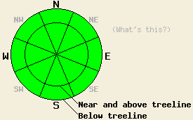
Avalanche danger is LOW for all elevations and aspects. Normal caution is advised. A human triggered avalanche is unlikely, but far from impossible above 8,000' on steep NW-N-NE-E aspects. |
|
|
|
Sunny skies with a bit a of a warm up is expected today. Moderate speed east to northeast winds from yesterday have decreased overnight. Light winds are expected for today. An air temperature inversion is already warming the upper elevations this morning, with remote sensors around 8,500' reporting air temperatures in the mid 20s to low 30s. Maximum daytime highs are forecast for the mid 30s to around 40 deg today for areas below 9,000'. Similar conditions are expected for Wednesday.
Observations made yesterday on Castle Peak (Donner Pass area) continue to show a trend of decreasing snowpack instability across the forecast area (pit profile, more info). A few key factors have combined to put the persistently weak November 18 facet layer to sleep for a while. Recent east winds have scoured significant amounts of snow off of N-NE-E aspects in near and above treeline areas. Some areas have received moderate scouring while other avalanche start zones have been stripped of snow down to bare ground (more info). The second factor is continued faceting and weakening of the overlying slab. Instability that was observed during the second half of November from the combination of the weak facet layer under a slab of storm snow has decreased. Faceting and weakening of the overlying slab has made it too weak to sustain significant propagation of fractures within the snowpack. Where it was not removed by wind, the Nov 18 facet layer remains weak where is sits on NW-N-NE-E aspects above 8,000'. The change in structure of the overlying slab has decreased the likelihood of slab avalanche activity for now. Not a significant change in the weak layer. The third factor is anchoring. This is a contributing factor in areas where the November 18 facet layer is capped by a strong hard slab. The strength of the slab attached to rocks, trees, and stumps is keeping the snowpack from failing despite the presence of a significant weak layer underneath.
Avalanche Concerns: Persistent slabs
Natural and human triggered avalanche activity in unlikely at this time. Any lingering areas of instability have become increasingly isolated. Most areas either have a slab without the proper characteristics for propagation, sufficient anchoring, or have had most or all of the snowpack removed by wind. Exercise caution when dealing with steep poorly anchored slopes above 8,000' either above or below treeline on NW-N-NE-E aspects. Slopes with unanchored hard slabs overlying the Nov 18 facet layer remain suspect. Beware of any hollow sounds underneath a hard slab. Any remaining areas of instability to be found will exist within surrounding areas of stable snow.
Avalanche danger is LOW for all elevations and aspects. Normal caution is advised. A human triggered avalanche is unlikely, but far from impossible above 8,000' on steep NW-N-NE-E aspects.
| 0600 temperature: | 24 to 31 deg. F. |
| Max. temperature in the last 24 hours: | 24 to 31 deg. F. |
| Average wind direction during the last 24 hours: | East northeast |
| Average wind speed during the last 24 hours: | 28 mph |
| Maximum wind gust in the last 24 hours: | 56 mph |
| New snowfall in the last 24 hours: | O inches |
| Total snow depth: | 6 to 20 inches |
For 7000-8000 ft: |
|||
| Tuesday: | Tuesday Night: | Wednesday: | |
| Weather: | Sunny skies. | Clear skies. | Sunny skies. |
| Temperatures: | 34 to 39 deg. F. | 21 to 27 deg. F. | 39 to 44 deg. F. |
| Wind direction: | NE shifting to E | E | E |
| Wind speed: | Up to 10 mph in the morning, becoming light. | Up to 10 mph. | Up to 10 mph in the morning, becoming light. |
| Expected snowfall: | O in. | O in. | O in. |
For 8000-9000 ft: |
|||
| Tuesday: | Tuesday Night: | Wednesday: | |
| Weather: | Sunny skies. | Clear skies. | Sunny skies. |
| Temperatures: | 35 to 40 deg. F. | 20 to 27 deg. F. | 36 to 41 deg. F. |
| Wind direction: | NE shifting to E | E | E |
| Wind speed: | 10 to 20 mph decreasing to around 10 mph in the afternoon. | 10 to 15 mph. | Around 10 mph. |
| Expected snowfall: | O in. | O in. | O in. |


This website is owned and maintained by the non-profit arm of the Sierra Avalanche Center. Some of the content is updated by the USDA avalanche forecasters including the forecasts and some observational data. The USDA is not responsible for any advertising, fund-raising events/information, or sponsorship information, or other content not related to the forecasts and the data pertaining to the forecasts.

