In partnership with: 
|
December 8, 2011 at 7:02 am |
|
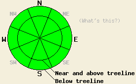
LOW avalanche danger exists at all elevations and on all aspects. Use normal caution when traveling in the backcountry. Human triggered avalanches remain unlikely, but not impossible above 8,000' on steep NW-N-NE-E aspects. |
|
|
|
A low pressure system passing through the Pacific Northwest has pushed some thin high clouds over the region. These clouds helped keep temperatures slightly warmer overnight and prevented a strong inversion from forming. As this system moves farther away today, the thin cloud cover should give way to sunny skies and daytime highs in the upper 30's and possibly low 40's above 7000 ft. The NE winds should continue and should decrease overnight before shifting to the southeast tomorrow. Expect warmer temperatures over the forecast area tomorrow as the high pressure ridge over the region once again dominates the weather.
Yesterday, observations on Mt. Lola revealed a wide variety of snow conditions ranging from thin breakable crusts to warm wet snow, wind scoured ice, and soft "recycled" powder. Surface conditions depended on aspect, elevation, and exposure. Consistent "recycled" powder conditions existed on the shaded and sheltered northerly aspects above 7500 ft. in this area. Snow depths in these sheltered areas above 7500 ft. ranged from 10-20 inches. Above treeline on open N-NE-E aspects, the recent NE winds had scoured most of this season's snow away leaving behind the hard icy snow left over from last season (photo). On all other aspects (W-SW-S-SE), snow coverage remains mostly non-existent with bare ground exposed at all elevations in most places. Snowpit data and general observations showed that faceting continues to weaken every layer in the snowpack from the ice layer at the bottom to the patches of hard slab on the top. This process has caused the upper layers of the snowpack to lose enough strength that they no longer represent slab layers in this area. Observations have shown similar conditions across most of the forecast area.
Avalanche Concerns: Persistent slabs
Avalanche activity remains unlikely but not impossible today mainly as a result of three things. First, the strong N-NE-E winds have scoured snow away from the exposed N-NE-E facing starting zones removing both the slab and the weak layer from many of these slopes. Second, continued faceting has weakened the snow above the persistent weak layers so much that a slab no longer exists on top of the weak layer in most places. Third, anchors poking through the shallow snowpack disrupt the weak layer and hold the snowpack in place in many areas. Even though these three things have significantly reduced the size and distribution of areas where instability exists in the snowpack, they have not eliminated the instability completely. As the snowpack continues to change, it will do so sporadically leaving patches of instability scattered amongst areas of more stable snow. Steep poorly anchored slopes above 8,000 ft. either above or below treeline on NW-N-NE-E aspects still warrant extra caution.
LOW avalanche danger exists at all elevations and on all aspects. Use normal caution when traveling in the backcountry. Human triggered avalanches remain unlikely, but not impossible above 8,000' on steep NW-N-NE-E aspects.
| 0600 temperature: | 27 deg. F. |
| Max. temperature in the last 24 hours: | 37-42 deg. F. |
| Average wind direction during the last 24 hours: | East and northeast |
| Average wind speed during the last 24 hours: | 20 mph |
| Maximum wind gust in the last 24 hours: | 40 mph |
| New snowfall in the last 24 hours: | O inches |
| Total snow depth: | 6-20 inches |
For 7000-8000 ft: |
|||
| Thursday: | Thursday Night: | Friday: | |
| Weather: | Thin high clouds during the morning becoming sunny this afternoon | Clear | Sunny |
| Temperatures: | 37-43 deg. F. | 21-28 deg. F. | 39-44 deg. F. |
| Wind direction: | Northeast | East | Southeast |
| Wind speed: | 10-15 mph with gusts to 30 mph | around 10 mph | around 10 mph |
| Expected snowfall: | O in. | O in. | O in. |
For 8000-9000 ft: |
|||
| Thursday: | Thursday Night: | Friday: | |
| Weather: | Thin high clouds during the morning becoming sunny this afternoon | Clear | Sunny |
| Temperatures: | 30-37 deg. F. | 19-26 deg. F. | 32-42 deg. F. |
| Wind direction: | Northeast | East | Southeast |
| Wind speed: | 15-25 mph with gusts to 35 mph | 10-20 mph with gusts to 35 mph | 10-15 mph with gusts to 25 mph |
| Expected snowfall: | O in. | O in. | O in. |


This website is owned and maintained by the non-profit arm of the Sierra Avalanche Center. Some of the content is updated by the USDA avalanche forecasters including the forecasts and some observational data. The USDA is not responsible for any advertising, fund-raising events/information, or sponsorship information, or other content not related to the forecasts and the data pertaining to the forecasts.

