In partnership with: 
|
January 27, 2012 at 7:35 am |
|
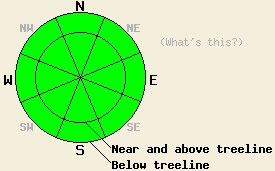
Avalanche danger is LOW for all elevations and aspects. Normal caution is advised. |
|
|
|
High pressure is building over the forecast area. Cloud cover has decreased overnight in the vast majority of locations. Up slope flow may hold some residual cloud cover over the southeast portion of the forecast area with snow flurries possible for a few hours this morning. Air temperatures have dropped well below freezing across the area. Remote sensors are reporting air temperatures in the teens and 20s across the region this morning. Ridgetop winds have shifted to the east and are moderate in speed. Sunny skies with maximum daytime air temperatures in the 20s and 30s are forecast today for areas above 7,000'. Light to moderate east winds are expected to continue through tomorrow morning. Continued sunny skies, light winds, and a few degrees of additional warming are expected for Saturday.
Observations made yesterday on Andesite Ridge (Donner Summit area) revealed more rainfall than forecast and snow level above the highest elevation traveled of 8,200'. Around 6 inches (15cm) of rain saturated wet snow existed on the snow surface. Below that was the recent storm snow that had become moist to wet during the warming of the past several days since the end of the storm cycle. Very small skier triggered wet loose snow avalanches up to 3 feet wide occurred on steep NE aspect test slopes. Failure would initiate at the base of the rain saturated layer. In many instances, the moving snow would entrain more snow from the deeper moist to wet storm snow (photos, video, more info). Runnels were also observed in some areas, indicating that good drainage of the snowpack had been established. Several hours of light drizzle were reported yesterday on Hwy 4 at Bear Valley as well. Snow level yesterday is estimated to have been somewhere around 9,000' to 9,500' across the forecast area.
Recent observations from around the forecast area have shown a well defined trend of strengthening and stabilization of the snowpack since the end of that last storm cycle. The various density inversions that once existed within the storm snow have settled out and become stable. A rain crust exists at the base of the storm snow in areas below 9,500'. Very strong snow above this crust is expected to keep the snowpack stable and supportable above any remaining basal weak layers at this time. Above 9,500' all of the recent accumulated snow sits on the ground surface as these areas were heavily wind scoured and melted prior to the recent snowfall.
Avalanche Concerns:
Avalanche concerns at this time are few. Clearing skies combined with below freezing air temperatures are expected to have allowed for a good refreeze of wet surface snow that existed yesterday. Any significant snow surface melting that occurs today is expected mainly on lower elevation SE-S-SW aspects. Signs of instability are expected to remain limited to human triggered roller ball activity in areas where surface crusts are fully melted today. All recently collected and received snowpack data indicates that slab avalanche activity is unlikely at this time.
| 0600 temperature: | 22 to 27 deg. F. |
| Max. temperature in the last 24 hours: | 33 to 37 deg. F. |
| Average wind direction during the last 24 hours: | Southwest shifting to east. |
| Average wind speed during the last 24 hours: | 32 mph |
| Maximum wind gust in the last 24 hours: | 50 mph |
| New snowfall in the last 24 hours: | O inches |
| Total snow depth: | 20 to 39 inches |
For 7000-8000 ft: |
|||
| Friday: | Friday Night: | Saturday: | |
| Weather: | Partly cloudy skies in the morning, becoming sunny. | Clear skies. | Sunny skies. |
| Temperatures: | 28 to 35 deg. F. | 22 to 30 deg. F. | 36 to 43 deg. F. |
| Wind direction: | E | E | E |
| Wind speed: | 15 to 25 mph with gusts to 35 mph. | 15 to 20 mph with gusts to 30 mph. | 15 to 20 mph with gusts to 30 mph in the morning, becoming light.. |
| Expected snowfall: | O in. | O in. | O in. |
For 8000-9000 ft: |
|||
| Friday: | Friday Night: | Saturday: | |
| Weather: | Partly cloudy skies in the morning, then clearing. Scattered snow flurries south of Lake Tahoe. | Clear skies. | Sunny skies. |
| Temperatures: | 25 to 32 deg. F. | 25 to 35 deg. F. | 34 to 43 deg. F. |
| Wind direction: | E | E | E |
| Wind speed: | 30 to 35 mph with gusts to 45 mph, decreasing to 20 to 25 mph with gusts to 35 mph in the afternoon. | 10 to 15 mph with gusts to 35 mph. | 10 to 15 mph with gusts to 25 mph in the morning, becoming light. |
| Expected snowfall: | 0 to trace in. | O in. | O in. |


This website is owned and maintained by the non-profit arm of the Sierra Avalanche Center. Some of the content is updated by the USDA avalanche forecasters including the forecasts and some observational data. The USDA is not responsible for any advertising, fund-raising events/information, or sponsorship information, or other content not related to the forecasts and the data pertaining to the forecasts.

