In partnership with: 
|
February 9, 2012 at 7:41 am |
|
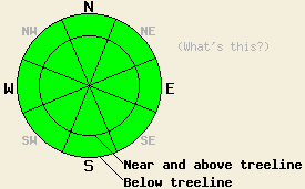
Avalanche danger remains LOW for all elevations and aspects. Normal caution is advised. |
|
|
|
The high pressure ridge over the forecast area will provide sunny skies and well above freezing air temperatures across the region today. Remote sensors are reporting air temperatures this morning in the 20s and 30s across the forecast area. Winds shifted from northeast to southwest last night, which is mixing out air temperature inversions this morning in some but not all areas. Maximum daytime air temperatures are forecast to reach the 40s and 50s today for areas above 7,000'. Light to moderate winds are expected for today. As the ridge of high pressure breaks down, increasing cloud cover will occur tomorrow with slightly cooler air temperatures than today at the upper elevations, but warmer on the valley floors. Winds are forecast to increase to moderate to strong in speed ahead of the first of several weather systems expected to impact the forecast area beginning this weekend.
Observations made yesterday on Castle Peak (Donner Summit area) continued to show a trend of a stable snowpack (photo, pit profile, more info). Air temperatures exceeded forecast expectations by 5 to 10 degrees, creating more wet snow on SE-S-SW aspects than anticipated. At 12:30 pm, around one inch of wet snow existed on southerly aspects in the area between 7,700' and 8,300'. This wet snow sat on top of a very supportable melt freeze layer that extended to the base of the snowpack in most locations. The trace of new snow in this area from February 7 was rapidly assimilated into the wet snow on southerly aspects. No evidence of wet snow instability was observed as of 1 pm. Observations on NW-N aspects in the area revealed similar conditions to other locations within the forecast area with the lower and middle portions of the snowpack remaining strong and well anchored. Near surface faceting was not nearly as well developed within the top 1 foot of the snowpack in this area as has been observed in other locations in recent days. In general across the forecast area, the surface or near surface rain crust that formed after the January 26 rain event continues become increasingly brittle on northerly aspects. Faceted snow exists below this crust, but no significant slabs exist on top of this crust/facet combo. N-NE-E aspects at and below treeline hold a few inches of soft snow from the Feb 1 and 7 snowfall events. Above treeline areas had generally been scoured down to the rain crust by NE winds prior to the Feb 7 snowfall.
Today's Avalanche Concerns:
Several inches of wet snow will form today on SE-S-SW aspects at nearly all elevations. Melting all the way through the supportable melt freeze layer is expected to occur only in areas where the snowpack is around one foot deep or less and near exposed rocks and bushes. Isolated human triggered roller ball activity may occur today, however areas of significant wet snow instability are not expected. On NW-N-NE aspects, no significant changes in the snowpack are expected to occur today from what has been observed over the past week. Natural and human triggered avalanche activity remains unlikely today on all aspects and at all elevations.
Avalanche danger remains LOW for all elevations and aspects. Normal caution is advised.
| 0600 temperature: | 34 to 37 deg. F. |
| Max. temperature in the last 24 hours: | 41 to 45 deg. F. |
| Average wind direction during the last 24 hours: | Northeast shifting to southwest |
| Average wind speed during the last 24 hours: | 14 mph |
| Maximum wind gust in the last 24 hours: | 27 mph |
| New snowfall in the last 24 hours: | O inches |
| Total snow depth: | 20 to 36 inches |
For 7000-8000 ft: |
|||
| Thursday: | Thursday Night: | Friday: | |
| Weather: | Sunny skies. | Clear skies. | Sunny skies, becoming partly cloudy. |
| Temperatures: | 46 to 54 deg. F. | 25 to 31 deg. F. | 41 to 49 deg. F. |
| Wind direction: | S to SW | SW | SW |
| Wind speed: | Light winds | Light winds becoming 15 to 20 mph with gusts to 35 mph after midnight. | 15 to 25 mph with gusts to 40 mph. |
| Expected snowfall: | O in. | O in. | O in. |
For 8000-9000 ft: |
|||
| Thursday: | Thursday Night: | Friday: | |
| Weather: | Sunny skies. | Clear skies. | Sunny skies, becoming partly cloudy. |
| Temperatures: | 40 to 50 deg. F. | 28 to 38 deg. F. | 35 to 45 deg. F. |
| Wind direction: | S to SW | SW | SW |
| Wind speed: | 10 to 15 mph with gusts to 30 mph. | Light winds becoming 15 to 25 mph with gusts to 45 mph after midnight. | 25 to 35 mph with gusts to 60 mph. |
| Expected snowfall: | O in. | O in. | O in. |


This website is owned and maintained by the non-profit arm of the Sierra Avalanche Center. Some of the content is updated by the USDA avalanche forecasters including the forecasts and some observational data. The USDA is not responsible for any advertising, fund-raising events/information, or sponsorship information, or other content not related to the forecasts and the data pertaining to the forecasts.

