In partnership with: 
|
February 24, 2012 at 8:00 am |
|
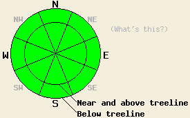
The avalanche danger remains LOW for all elevations and aspects. LOW danger does not mean no danger. Continue to use normal caution when traveling in the backcountry. |
|
|
|
Remote sensors across the forecast area indicate that temperatures stayed at or above freezing above 7000 ft last night. The high pressure ridge over the region should allow the warm temperatures to continue today with daytime highs in the mid to upper 40's above 7000 ft. Skies should also remain clear and sunny due to this ridge. As this ridge departs the area later today, the southwest winds should begin to increase ahead of the low pressure that should move into the region tonight. This low pressure should bring some clouds, strong southwest winds, a slight chance of snow showers, and much colder temperatures back to the forecast area. Tonight's lows could fall into the teens, and tomorrow's highs should only reach into the low 30's. Even though some snow showers may occur tonight, the forecast does not call for any significant accumulation. By tomorrow the clouds should begin to dissipate and the southwest winds should shift towards the northwest and decease.
A mix of wind scoured surfaces, breakable crusts, and melt-freeze conditions existed on Castle Peak yesterday (photos, pit profile, more info). On the sheltered NE-N-NW aspects, a breakable crust sat on top of softer snow. On the more exposed E-NE-N aspects, a firm and supportable wind scoured snow surface remained. Underneath these surface features, the persistent crust/facet combination existed near the base of the recent snow. Snowpit data and tests indicated that breaking this layer continues to become more difficult. This data also showed that once this layer does break the resulting fracture does not travel very far through the weak layer (pit profile and photo). On the more sun-exposed SE-S-SW-W aspects, one to three inches of soft, wet melt-freeze snow existed on the surface by noon. This wet corn snow sat on top of a thick and supportable layer of frozen melt-freeze snow. Some very small skier triggered pinwheels about six inches in diameter did occur on a steep SW aspect around 3 pm. Other than that no signs of wet snow instabilities were observed.
Today's Primary Avalanche Concern: Wet snow
Daytime highs near 50 degrees and sunny skies will allow more melting to occur in the snowpack today. This melting should allow some wet snow instabilities to form on the steep sun-exposed SE-S-SW facing slopes especially near exposed rocks, cliffs, trees, and bushes that can absorb more of the sun's heat. The facts that the snowpack has already been through several days of melt freeze cycles, that clear skies should have allowed a decent overnight refreeze last night, and that the sun remains a few weeks away from reaching its spring strength should all work together to limit the wet snow instabilities that do form. Isolated roller balls, pinwheels, and small wet loose snow avalanches should comprise most of these instabilities today. Even though these instabilities should remain small, they could push someone off balance or into an area that could have higher consequences like over a cliff, into a gully or creek, or some other terrain trap that could magnify the consequences of even a small slide.
Today's Secondary Avalanche Concern: Persistent Slabs
Observations over the last several days have indicated that the persistent weak layer made up of faceted snow and crusts at the base of the recent new snow has gone dormant. As this layer has adjusted to the weight of the recent snow above it, triggering avalanches has become more unlikely on near or below treeline NW-N-NE aspects. Unlikely does not mean impossible, and persistent weak layers like this one warrant extra caution. This weak layer has not gone away. It could re-awaken when more snow arrives. Continue to use caution and exercise good travel habits in order to minimize risk.
The avalanche danger remains LOW for all elevations and aspects. LOW danger does not mean no danger. Continue to use normal caution when traveling in the backcountry.
| 0600 temperature: | 30-38 deg. F. |
| Max. temperature in the last 24 hours: | 34-44 deg. F. |
| Average wind direction during the last 24 hours: | East Northeast |
| Average wind speed during the last 24 hours: | 25 mph |
| Maximum wind gust in the last 24 hours: | 42 mph |
| New snowfall in the last 24 hours: | O inches |
| Total snow depth: | 23-33 inches |
For 7000-8000 ft: |
|||
| Friday: | Friday Night: | Saturday: | |
| Weather: | Sunny | Partly cloudy with a slight chance of snow showers after midnight | Partly cloudy |
| Temperatures: | 40-47 deg. F. | 16-23 deg. F. | 30-36 deg. F. |
| Wind direction: | Southwest | Southwest | West shifting to the northwest |
| Wind speed: | 20-25 mph with gusts to 35 mph in the afternoon | 35-40 mph with gusts to 60 mph increasing to 45-55 mph with gusts to 85 mph after midnight | 45-55 mph with gusts to 85 mph decreasing to 30-35 mph with gusts to 50 mph in the afternoon |
| Expected snowfall: | O in. | Trace to 0 in. | O in. |
For 8000-9000 ft: |
|||
| Friday: | Friday Night: | Saturday: | |
| Weather: | Sunny | Partly cloudy with a slight chance of snow showers after midnight | Partly cloudy |
| Temperatures: | 38-45 deg. F. | 14-21 deg. F. | 26-32 deg. F. |
| Wind direction: | Southwest | Southwest | West shifting to the northwest in the afternoon |
| Wind speed: | 20-30 mph with gusts to 45 mph in the afternoon | 40-50 mph with gusts to 75 mph increasing to 55-65 mph with gusts to 95 mph after midnight | 55-65 mph with gusts to 95 mph decreasing to 40-50 mph with gusts to 75 mph in the afternoon |
| Expected snowfall: | O in. | Trace to 0 in. | O in. |


This website is owned and maintained by the non-profit arm of the Sierra Avalanche Center. Some of the content is updated by the USDA avalanche forecasters including the forecasts and some observational data. The USDA is not responsible for any advertising, fund-raising events/information, or sponsorship information, or other content not related to the forecasts and the data pertaining to the forecasts.

