In partnership with: 
|
March 8, 2012 at 8:00 am |
|
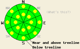
Pockets of MODERATE avalanche danger exist on all aspects on slopes 35 degrees and steeper both above and below treeline due to ongoing deep slab instability and daytime warming. Even though they seem to be growing more difficult to trigger, large destructive human-triggered avalanches remain possible today in some areas. |
|
|
|
Sunny, dry, spring-like weather should prevail over the forecast area due to a high pressure ridge over the region. This morning temperatures have already started climbing with most remote sensors above 7500 feet showing temperatures in the upper 20's and low 30's. These temperatures also represent the maximum temperatures during the last 24 hours. The forecast calls for daytime highs in the upper 30's to mid 40's in the mountains today. Tomorrow's highs should warm another 10 degrees above today's. Below 7500 ft temperatures remain cooler due to colder air pooling at the lower elevations this morning. The east winds should continue to decrease today. By this evening the winds should become light and variable at all elevations. Tomorrow a light southwest wind could pick up over the ridgetops.
The persistent weak layer comprised of old crusts and weak sugary snow (facets) still exists near the base of the snow that fell at the end of February and the beginning of March. Observations across the forecast area have shown that this problematic layer remains weak and variable. Along Meiss Ridge (more info, photos, video) and on Rubicon Peak (more info, snowpit, video) yesterday, snowpit data showed more consistent failures along this layer than in other areas. On Rubicon four out five Extended Column Tests indicated that once this layer breaks, fractures can travel along this weakness (video of one of these tests). On Meiss Ridge another test (video) showed similar results. In both of these areas, the tests suggest that this weakness is getting more difficult to trigger, but if it breaks it could still produce large avalanches. Ski cuts on test slopes in these areas did not produce failures on this layer. On Rubicon, on Meiss Ridge, and on Becker Peak the NE winds had scoured the upper elevation exposed N-NE-E aspects leaving behind a firm wind scoured snow surface. Some skier-triggered cracking did occur on small shallow wind slabs on the SW aspects on Meiss Ridge and NNE aspects on Becker Peak (photo more info). None of these wind slabs had grown large enough to pose a serious threat to backcountry travelers.
Today's Primary Avalanche Concern: Persistent Deep Slabs
Breaking the persistent weak layer and triggering avalanches on this layer seems to have become more difficult. However, due to the way that these kind of layers stabilize, areas of stability and areas of instability could exist within a few feet of each other on the same slope. In areas where this layer exists, where it remains weak, and where the right trigger gets applied to the slope in the right spot, large human-triggered deep slab avalanches will remain possible. Pockets of terrain both above and below treeline on NW-N-NE aspects represent the most likely areas where this layer both exists and remains weak. Areas near exposed rock outcrops and cliffs, steep unsupported slopes, and slopes with trigger points represent locations where triggering a deep slab avalanche would be easier. Caution and conservative decision making remain prudent due to the variability of this layer and the consequences of its failure. Digging into the snowpack will reveal whether or not this layer exists. The difference between the snow in this layer and the snow above it remains very easy to see and feel.
Today's Secondary Avalanche Concern: Warming Instabilities
The strong spring sunshine, daytime highs in the 40's, new snow on the sun-exposed aspects due to wind-loading from the NE winds, and decreased winds will all combine to allow melting to occur in the snowpack today. This melting could produce some warming instabilities on sun-exposed SE-S-SW-W aspects today. While most of these instabilities should manifest as roller balls, pin wheels, and small wet loose snow slides that occur near rocks or trees, some larger point release slides and small human-triggered slab avalanches may become possible on the most sun-exposed slopes. The recently wind-loaded SW-S-SE aspects that have more new snow on them represent the most likely places for these larger wet snow instabilities.
Pockets of MODERATE avalanche danger exist on all aspects on slopes 35 degrees and steeper both above and below treeline due to ongoing deep slab instability and daytime warming. Even though they seem to be growing more difficult to trigger, large destructive human-triggered avalanches remain possible today in some areas.
| 0600 temperature: | 24-34 deg. F. |
| Max. temperature in the last 24 hours: | 28-34 deg. F. |
| Average wind direction during the last 24 hours: | Northeast |
| Average wind speed during the last 24 hours: | 30-40 mph |
| Maximum wind gust in the last 24 hours: | 81 mph |
| New snowfall in the last 24 hours: | O inches |
| Total snow depth: | 32-51 inches |
For 7000-8000 ft: |
|||
| Thursday: | Thursday Night: | Friday: | |
| Weather: | Sunny | Clear | Sunny |
| Temperatures: | 39-46 deg. F. | 20-28 deg. F. | 46-53 deg. F. |
| Wind direction: | East | Variable | Variable |
| Wind speed: | 15-20 mph with gusts to 30 mph decreasing in the afternoon | Light | Light |
| Expected snowfall: | O in. | O in. | O in. |
For 8000-9000 ft: |
|||
| Thursday: | Thursday Night: | Friday: | |
| Weather: | Sunny | Clear | Sunny |
| Temperatures: | 37-44 deg. F. | 28-34 deg. F. | 47-53 deg. F. |
| Wind direction: | East | Variable | Southwest |
| Wind speed: | 15-20 mph with gusts to 35 mph decreasing in the afternoon | Light | 10-15 mph with gusts to 25 mph in the afternoon |
| Expected snowfall: | O in. | O in. | O in. |


This website is owned and maintained by the non-profit arm of the Sierra Avalanche Center. Some of the content is updated by the USDA avalanche forecasters including the forecasts and some observational data. The USDA is not responsible for any advertising, fund-raising events/information, or sponsorship information, or other content not related to the forecasts and the data pertaining to the forecasts.

