In partnership with: 
|
March 24, 2012 at 7:00 am |
|
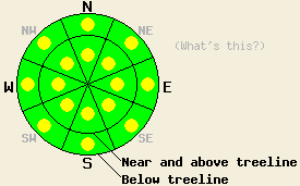
Pockets of MODERATE avalanche danger exist both above and below treeline on NW-N-NE aspects on slopes 35 degrees and steeper due to ongoing persistent deep slab instability and some new shallow wind slabs. Large destructive human triggered deep slab avalanches remain possible in these areas. For all other areas, avalanche danger is generally LOW with isolated pockets of MODERATE danger below 8,500' on slopes 37 degrees and steeper due to wet snow instability. |
|
|
|
A low pressure system moving along the CA coast should cause an increase in the south winds and cloud cover today. The winds could average in the 50's along the Sierra ridge lines with gusts as high as 90 mph. This system should also push some warmer air into the region with daytime highs above 7000 ft in the upper 30's to mid 40's. Most of the precipitation associated with this system should remain on the west side of the Sierra tonight and tomorrow. Some snow showers could occur on the Sierra Crest tonight and tomorrow. The best chances for precipitation exist in the mountains south of Echo Summit where 3-6 inches of snow could fall Sunday and Sunday night.
Yesterday observations on Jakes Peak (snowpit, video) and on Castle Peak (photos, video) showed one to four inches of new snow on top of a mix of breakable crusts on the northerly aspects and frozen melt-freeze snow on the upper elevation southerly aspects. Underneath these frozen crusts a layer of wet unfrozen snow still remained. In the most heavily wind-loaded areas near ridge lines some minor cracking occurred in the shallow (three to six inch deep) wind slabs. On Castle Peak some of these wind slabs failed and produced small shallow avalanches (photos). In most areas the persistent weak layer of crusts and weak sugary snow (facets) remains buried five to eight feet down in the snowpack. On Jake's Peak tests on this deeply buried layer still indicated that it remains weak and that fractures can easily travel through this layer if it breaks (video, snowpit).
Today's Primary Avalanche Concern: Wind Slabs
The small wind slabs that formed yesterday could remain fragile today. These shallow slabs should only exist on the most heavily wind loaded N-NE-E aspects in isolated areas in some near and above treeline terrain. Even though human triggering of these slabs should remain possible today, they should not entrain enough snow to bury a person due to their shallowness. These small slides could knock a person off balance or push them into a terrain trap that could magnify the consequences of a small slide.
Today's Secondary Avalanche Concern: Wet Snow Instabilities
As temperatures climb well above freezing today, some warming instabilities could form on some slopes. In most places increased cloud cover combined with several days of melt freeze cycles this week should prevent large wet snow instabilities from forming. Some small wet snow instabilities like roller balls, pinwheels, and wet loose avalanches could occur today on any steep slopes especially near trees, rocks, cliffs and other exposed objects that may warm up faster than the snowpack. The sun-exposed SE-S-SW aspects will hold the best potential for these wet snow instabilities. However, the increased cloud cover could allow warming to occur on all aspects. If more sun and higher than forecast temperatures occur today wet snow instabilities could become larger and more widespread.
Today's Third Avalanche Concern: Persistent Deep Slabs
Transmitting enough force through the snowpack to trigger a deep slab avalanche has become increasingly difficult due to the depth of the weak layer and the strength of the slab above it. However, if this layer does break, tests indicate that large destructive avalanches with serious consequences could still result. These kind of avalanches will remain possible today on NW-N-NE aspects at all elevations. Areas near exposed rock outcrops and cliffs, steep unsupported slopes, complex terrain features, and slopes with trigger points represent some locations where the persistent weak layer could remain closer to the surface allowing for the possibility that people on the surface could initiate a fracture. That fracture could then propagate out into much deeper parts of the snowpack. Larger triggers like large cornice failures or other avalanches could also produce these deep slab avalanches today.
Pockets of MODERATE avalanche danger exist both above and below treeline on NW-N-NE aspects on slopes 35 degrees and steeper due to ongoing persistent deep slab instability and some new shallow wind slabs. Large destructive human triggered deep slab avalanches remain possible in these areas. For all other areas, avalanche danger is generally LOW with isolated pockets of MODERATE danger below 8,500' on slopes 37 degrees and steeper due to wet snow instability.
| 0600 temperature: | 24-31 deg. F. |
| Max. temperature in the last 24 hours: | 29-38 deg. F. |
| Average wind direction during the last 24 hours: | Southwest |
| Average wind speed during the last 24 hours: | 30-35 mph |
| Maximum wind gust in the last 24 hours: | 63 mph |
| New snowfall in the last 24 hours: | O inches |
| Total snow depth: | 41-79 inches |
For 7000-8000 ft: |
|||
| Saturday: | Saturday Night: | Sunday: | |
| Weather: | Mostly cloudy with isolated snow showers in the afternoon | Mostly cloudy with a chance of snow showers | Cloudy with snow in the morning becoming snow showers in the afternoon |
| Temperatures: | 39-47 deg. F. | 21-28 deg. F. | 32-38 deg. F. |
| Wind direction: | South | South | South shifting to the southwest in the afternoon |
| Wind speed: | 20-30 mph with gusts to 50 mph | 20-25 mph with gusts to 45 mph | 15-20 mph with gusts to 30 mph |
| Expected snowfall: | O in. | up to 1 in. | up to 2 in. |
For 8000-9000 ft: |
|||
| Saturday: | Saturday Night: | Sunday: | |
| Weather: | Mostly cloudy with isolated snow showers in the afternoon | Mostly cloudy with a chance of snow showers | Cloudy with snow in the morning becoming snow showers in the afternoon |
| Temperatures: | 35-41 deg. F. | 18-25 deg. F. | 27-33 deg. F. |
| Wind direction: | South | South | South becoming southwest in the afternoon |
| Wind speed: | 55-65 mph with gusts to 90 mph | 50-60 mph with gusts to 90 mph decreasing to 80 mph after midnight | 40-45 mph with gusts to 65 mph decreasing to 25-30 mph with gusts to 45 mph in the afternoon |
| Expected snowfall: | O in. | up to 1 in. | up to 2 in. |


This website is owned and maintained by the non-profit arm of the Sierra Avalanche Center. Some of the content is updated by the USDA avalanche forecasters including the forecasts and some observational data. The USDA is not responsible for any advertising, fund-raising events/information, or sponsorship information, or other content not related to the forecasts and the data pertaining to the forecasts.

