In partnership with: 
|
April 22, 2012 at 6:30 am |
|
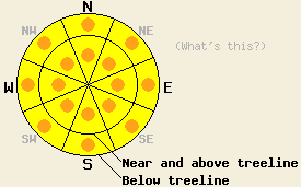
Widespread MODERATE avalanche danger will form quickly today on all aspects at all elevations on slopes 35 degrees and steeper in response to daytime warming. Pockets of CONSIDERABLE danger may form this afternoon on slopes 37 degrees and steeper. The vast majority of instability that occurs today is likely to be human triggered, but an isolated natural avalanche event is possible. |
|
|
|
As the heat wave continues, maximum daytime air temperatures today are once again forecast at 15 to 20 degrees above average for this time of year. This morning is the seventh morning in a row with air temperatures remaining above freezing overnight. Remote sensors are reporting air temperatures above 8,000' mainly in the upper 40s this morning across the forecast area, similar to yesterday morning. Maximum daytime air temperatures above 7,000' are forecast to reach the upper 50s to near 70 degrees again today. Ridgetop winds are out of the south to southwest this morning and are light in speed. Light winds are expected to last through most of this morning with moderate speed gusts by this afternoon. The start of a slow cooling trend will begin tomorrow with a chance of afternoon thunderstorms once again entering the forecast.
Observations made yesterday on Tamarack Peak (Mount Rose area) revealed that a snow surface refreeze had again occurred the night before. Radiational cooling created snow surface refreeze of the top 6 inches of the snowpack overnight with a minimum air temperature from the nearby Slide Mt. remote sensor of 41 deg F. At 10am, NE aspects remained supportable between 9,200' and 9,900' with 1 to 2 inches of wet snow on the surface over supportable melt freeze crust. At the same time on nearby S aspects, the top 45 cm of the snowpack was wet with full melt of the overnight refreeze and unsupportable conditions. At 11 am on E aspects at 9,700', the overnight refreeze was almost fully melted with ski cuts producing roller balls to 2 feet in diameter on test slopes steeper than 35 degrees. At 11:30am areas below 9,000' were unsupportable on all aspects in all but the most shaded areas (more info). A report was received from Woodchuck Basin (Bear Valley area) of natural roller ball activity occurring off of rocks during either the mid day or afternoon hours (photo, more info).
Clear skies are expected to have once again allowed for some amount of snow surface refreeze to have occurred last night in many locations despite above freezing air temperatures in all areas. Air temperatures rivialing those of yesterday and clear skies this morning will quickly melt the refreeze that occurred last night. Areas of wet snow instability will form quickly today on all aspects and at all elevations. Roller balls, wet loose snow avalanches, and wet slab avalanches all remain possible.
The vast majority of avalanche activity that occurs today is likely to be human triggered, but an isolated natural avalanche event is possible. Wet snow avalanches are much more difficult to accurately predict than dry snow avalanches. Uncertainty surrounding the precise timing of wet snow avalanches makes conservative decision making a prudent choice under these conditions. Surface instabilities such as roller balls and pinwheels or simple observations such as stepping off of one's skis, snowboard, or snowmobile and sinking up to boot-top depth or more in wet snow can indicate potential instability on a slope.
Other things to think about: The Persistent Weak Layer
Due to the depth of the persistent weak layer and the strength of the snow above it, triggering a deep slab avalanche on NW-N-NE aspects remains unlikely. At this time data indicates collapsing this layer would require an extremely large trigger or significant weakening of the snowpack. Spring melting could eventually cause enough snowpack weakening for a deep wet slab avalanche cycle to occur. Even though data indicates conditions that could create this scenario have not yet arrived, they keep getting closer as more and more melting occurs each day and free water percolates deeper into the snowpack.
Widespread MODERATE avalanche danger will form quickly today on all aspects at all elevations on slopes 35 degrees and steeper in response to daytime warming. Pockets of CONSIDERABLE danger may form this afternoon on slopes 37 degrees and steeper. The vast majority of instability that occurs today is likely to be human triggered, but an isolated natural avalanche event is possible.
| 0600 temperature: | 39 to 49 deg. F. |
| Max. temperature in the last 24 hours: | 56 to 63 deg. F. |
| Average wind direction during the last 24 hours: | South - Southwest |
| Average wind speed during the last 24 hours: | 15 mph |
| Maximum wind gust in the last 24 hours: | 25 mph |
| New snowfall in the last 24 hours: | O inches |
| Total snow depth: | 28 to 79 inches |
For 7000-8000 ft: |
|||
| Sunday: | Sunday Night: | Monday: | |
| Weather: | Sunny skies. | Clear skies. | Partly cloudy skies becoming mostly cloudy. Scattered thunderstorms in the afternoon. |
| Temperatures: | 63 to 69 deg. F. | 39 to 46 deg. F. | 59 to 65 deg. F. |
| Wind direction: | S | SW | S |
| Wind speed: | 10 to 20 mph with gusts 25 to 30 mph. | 15 to 25 mph with gusts to 35 mph. | 15 to 25 mph with gusts to 35 mph. |
| Expected snowfall: | O in. | O in. | O in. |
For 8000-9000 ft: |
|||
| Sunday: | Sunday Night: | Monday: | |
| Weather: | Sunny skies. | Clear skies. | Partly cloudy skies becoming mostly cloudy. Scattered thunderstorms in the afternoon. |
| Temperatures: | 58 to 63 deg. F. | 42 to 49 deg. F. | 54 to 59 deg. F. |
| Wind direction: | S | SW | S |
| Wind speed: | 15 to 20 mph with gusts to 30 mph. | 20 to 30 mph with gusts to 45 mph. | 20 to 30 mph with gusts to 45 mph. |
| Expected snowfall: | O in. | O in. | O in. |


This website is owned and maintained by the non-profit arm of the Sierra Avalanche Center. Some of the content is updated by the USDA avalanche forecasters including the forecasts and some observational data. The USDA is not responsible for any advertising, fund-raising events/information, or sponsorship information, or other content not related to the forecasts and the data pertaining to the forecasts.

